
Multiple tornadic supercells have developed just east of the immediate D/FW Metroplex. We’ve had confirmed tornadoes just north of Rockwall and Fate with a second near Canton over the last hour. Multiple storms continue to exhibit strong low-level rotation. This trend should continue for the next several hours as storms continue making their way toward Northeast Texas and portions of East Texas. Confirmed tornado now just north of Terrell at the time of this writing.
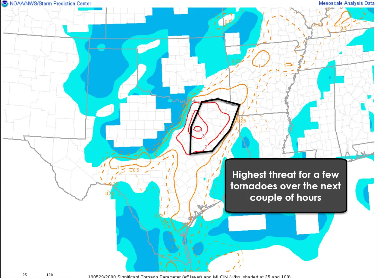
Composite indices indicate we have a relative maximum of ingredients to support tornadic activity just east of the metroplex (as proven). That should continue to slowly move east/northeast over the next several hours. That trend indicates we could be dealing with a tornado threat for several more hours as storms make their way into Northeast Texas and portions of East Texas. A tornado watch continues through 8 PM. Storms back west from Sherman to Mineral Wells to ranger should be behind an outflow boundary – and thus not prove to be much of a tornado threat. We’ll have to watch for some localized flash flooding and perhaps some hail.
Remain weather aware this afternoon and evening. The highest threat of tornadoes will be with discrete supercells that are out by themselves – ahead of the main line of storms farther west. Linear storms could produce localized damaging winds and heavy rainfall. Flash flooding is a concern given saturated soil conditions. We’ll be doing live severe weather coverage as needed on our social media channels – and you can keep tabs on the storms with our free HD interactive weather radar here.


0 Comments