
A dangerous situation is developing this evening and overnight for the Coastal Plains and Southeast Texas. I won’t rehash the forecast I just published moments ago (which can be read here). However, the Weather Prediction Center just upgraded portions of Southeast Texas and the Coastal Plains to a high risk of flash flooding tonight. That’s the highest risk level possible and they don’t get issued unless confidence is high in the potential for significant/life-threatening flooding.
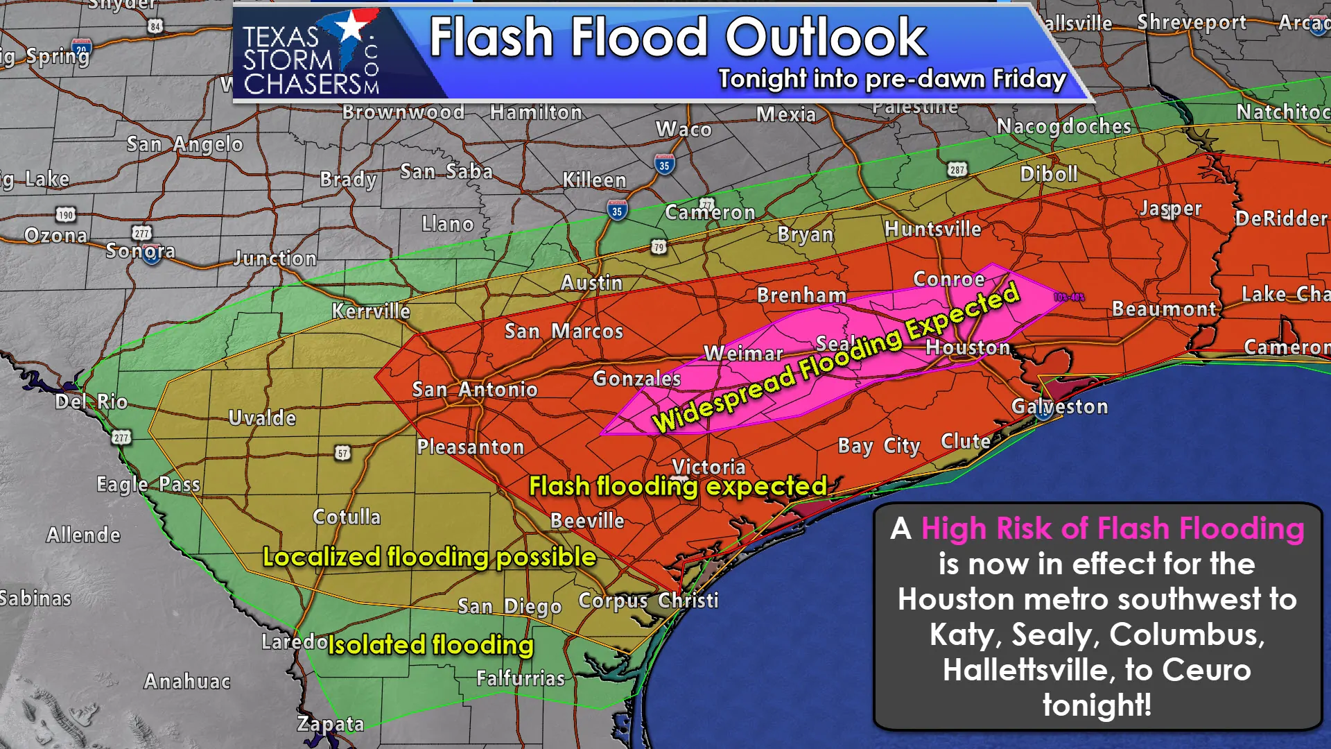
Heavy rainfall is already underway in parts of Harris County where multiple locations have received nearly 2 inches of rain in the past 30 minutes. New storms firing back west in the Edwards Plateau will grow in both coverage and intensity as they move east toward the Coastal Bend and Coastal Plains later tonight. We note that the storms in Southeast Texas may not move much this evening, but continue dropping very heavy rainfall. Due to saturated soil conditions from recent rains, it will not take much to cause new flash flooding.
In addition, rainfall rates are approaching 4 inches per hour under the heaviest storms. That’ll cause flooding to rapidly ensure regardless of how wet it has been recently. Stay weather aware and we’ll do our best to keep providing hourly updates here on the blog with nowcast/short-term forecast information. Severe storms with large hail and damaging winds are also possible. Not everyone will see heavy rain or severe weather tonight. There will be more heavy rain in the days to come.


0 Comments