
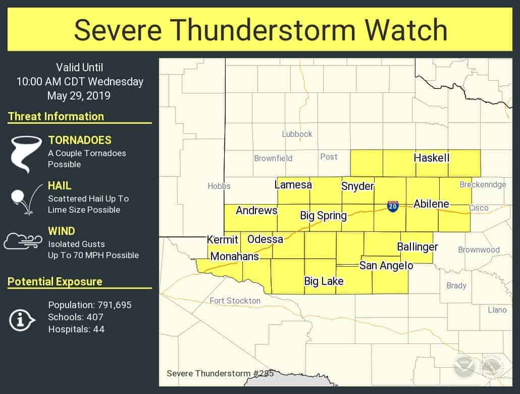
A severe thunderstorm watch has been issued for the eastern Permian Basin, portions of the Concho Valley, and a large chunk of the Big Country. This watch goes all the way to 10 AM this morning. Kermit, Andrews, Odessa, Midland, Big Lake, Big Spring, Snyder, San Angelo, Ballinger, Abilene, and Haskell are a few towns included. The primary threat with the most intense storms through sunrise will be large hail. However, there may be an uptick in damaging wind and isolated tornado potential near and after sunrise.
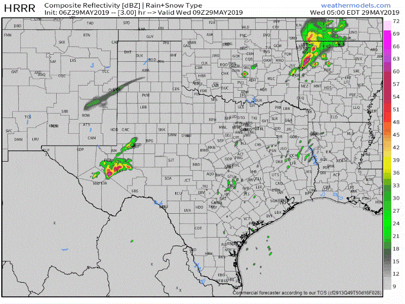
Simulated weather model radar from 4 AM until 12 PM today. Keep in mind this is only a simulation.
Thunderstorms are already developing at the time of this writing from Odessa northeast up Interstate 20 to Big Spring. We’ll see an uptick in thunderstorm coverage and intensity through 4 AM. Eventually, storms may grow upscale into a cluster or small squall line. That activity will move northeast into the Big Country and eventually toward Texoma and North Texas after sunrise. Some storms will likely be severe with large hail. The threat for localized damaging winds and isolated tornadoes will increase toward and after sunrise. Isolated flash flooding is also a threat given saturated soil conditions. That’ll take us through mid-morning, thereafter the risk of severe weather will continue through much of the day. That’s something we’ll discuss in far more detail in our usual Texas weather roundup around 6 AM.


0 Comments