
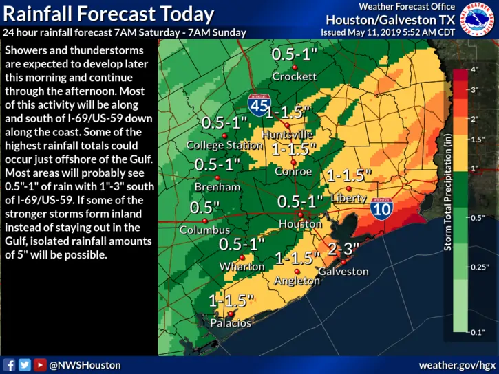
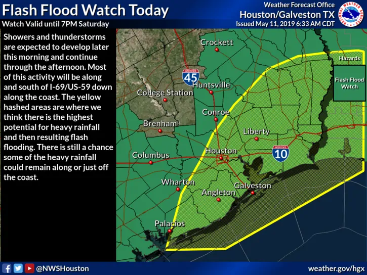
The Storm Prediction Center has placed a Slight Risk (Level 2) for the development of strong to severe storms once again across parts of southeast Texas. Timing will be after noon and through the afternoon and early evening hours before all activity shifts east into Louisiana. While we won’t be looking at much of a tornado threat across southeast Texas today, storms that develop by early afternoon will have the potential to become severe with a damaging wind, hail, frequent lightning and heavy rainfall threat. At the moment, the current prediction for a majority of the rainfall expected this afternoon will be along and south of the I-10 corridor…with the heaviest rainfall totals residing along and south of the US-69/US-59 corridor and along the immediate coastal zones. Of course this will only exacerbate ongoing flooding across the region, so if you don’t have to be out and about today, please stay off the roads and delay errands and travel until floodwaters have receded. A Flash Flood Watch remains in effect across all of southeast Texas until 7pm, but may be cancelled early if the activity shifts east faster than currently anticipated.
Elsewhere across the state, parts of central, north central and northeast Texas will continue to deal with nuisance rainfall through the morning hours until this activity shifts east and away from the region by early afternoon. No severe weather is expected this morning across these regions other than occasional thunder, brief heavy rainfall and perhaps some small hail.
Parts of far west Texas and southeast New Mexico will see some chances for isolated thunderstorms later this afternoon, but the risk of severe weather will remain low. Better chances for rainfall return to this region of western Texas on Sunday into Monday.


0 Comments