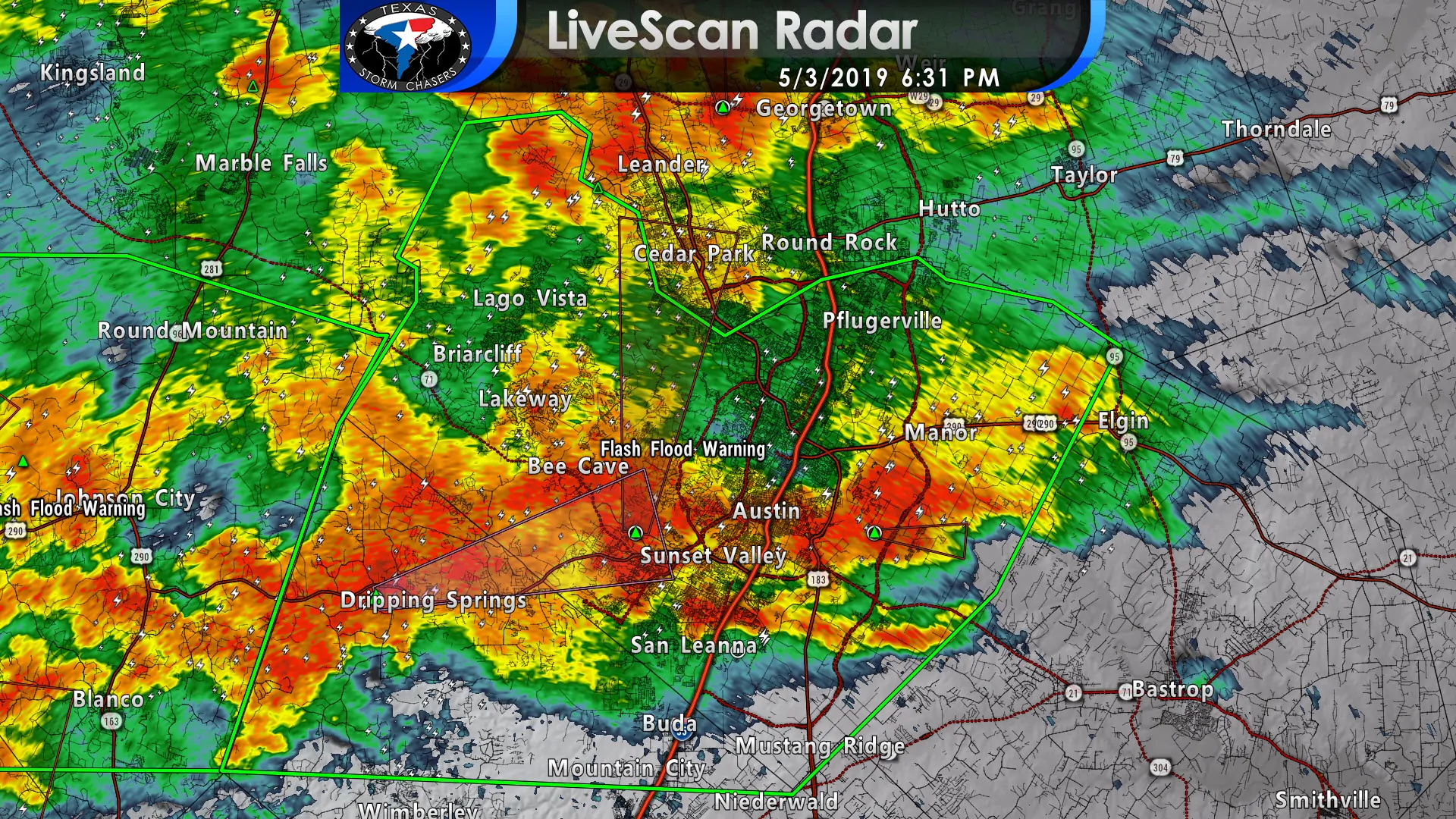
Flash Flooding is quickly becoming a concern for the Austin metro and surrounding cities. One to two inches of rainfall has fallen over the last hour in portions of Hays and Travis counties. Additional strong to severe thunderstorms are moving in from the west and south. Storms themselves aren’t moving much and have back-building – or moving over the same areas. This will allow for multi-inch rainfall amounts over the next 1 to 2 hours. Expect flooding to become more widespread by 7 to 7:30 PM.
Flash Flood Warning
National Weather Service Austin/San Antonio TX
626 PM CDT Fri May 3 2019
The National Weather Service in Austin San Antonio has issued a
* Flash Flood Warning for…
Central Hays County in south central Texas…
Travis County in south central Texas…
* Until 930 PM CDT.
* At 626 PM CDT, Doppler radar indicated thunderstorms producing
heavy rain across the warned area. Between 1 and 2 inches of
rainfall is occurring. Isolated pockets up to 4 inches are
possible.
* Some locations that will experience flooding include…
Austin, Round Rock, Cedar Park, Pflugerville, Kyle, Buda, Elgin,
Dripping Springs, Tanglewood Forest, Austin Bergstrom Int Airport,
Windemere, Anderson Mill, Leander, Lakeway, Manor, Lago Vista, Bee
Cave, West Lake Hills, Hudson Bend and The Hills.
PRECAUTIONARY/PREPAREDNESS ACTIONS…
Turn around, don’t drown when encountering flooded roads. Most flood
deaths occur in vehicles.
Excessive runoff from heavy rainfall will cause flooding of small
creeks and streams, urban areas, highways, streets, and underpasses
as well as other drainage areas and low lying spots.


0 Comments