
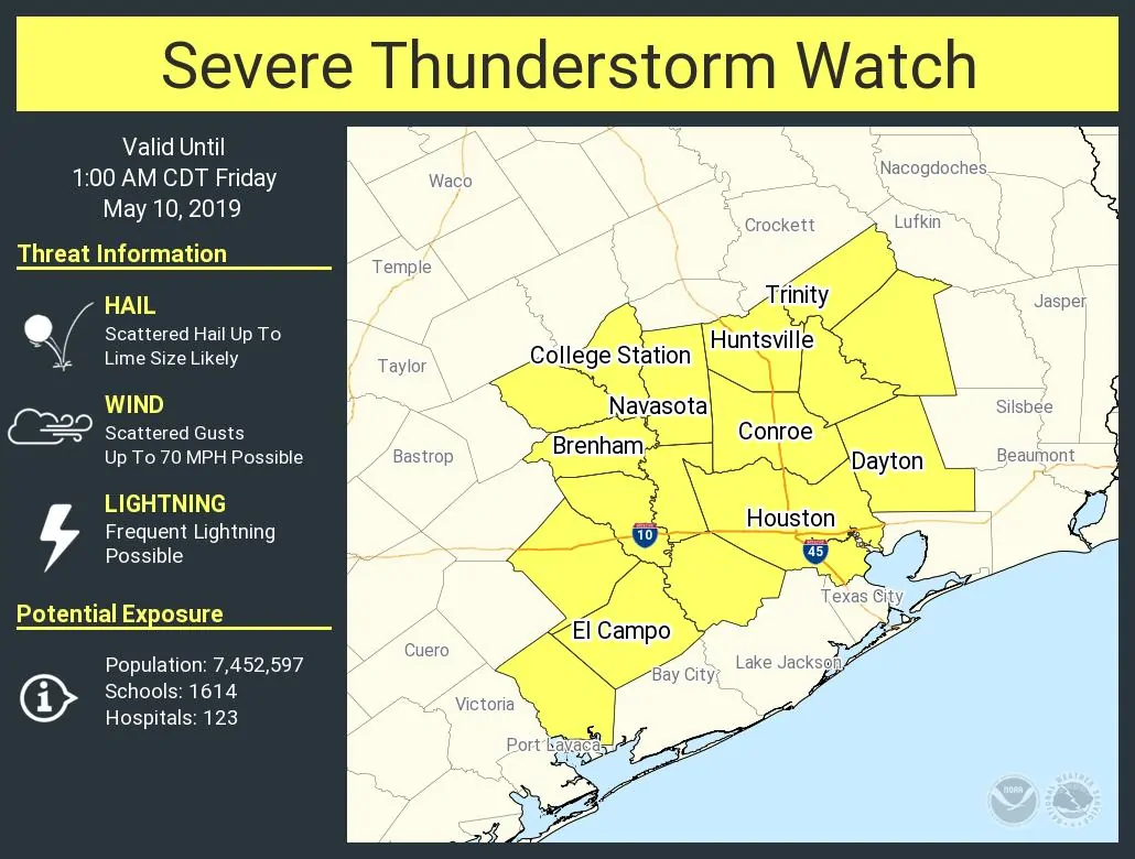
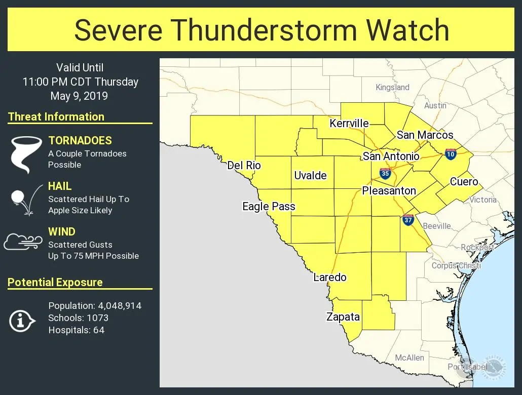
A severe thunderstorm watch is now in effect for the Brazos Valley and much of Southeast Texas through late tonight. This is in addition to the watch already in place for much of South-Central Texas, South Texas, the Edwards Plateau, and a portion of Central Texas. The strongest storms in both regions could produce very large hail and localized damaging wind gusts. However, the most widespread impact will likely be from flooding rainfall. Storms this evening will expand in coverage and intensity.
Those storms will be slow-moving and perhaps stall at some point. Hourly rainfall rates under the heaviest storms could exceed 4 inches. That means we could see 4 to 10 inches of rain in localized areas within a period of a couple of hours tonight. Given the saturated soil conditions and flash flooding earlier this week, there is an increased threat of significant flash flooding. If those heavy storms stall out on area river basins or reservoirs the situation will only become that much worse.
Now I’m well aware that most folks in Southeast Texas know about the flooding threat tonight through Sunday. However, that does not mean everyone is going to get a boatload of rain or that everyone is going to have to deal with severe storms. This isn’t Harvey and we’re not talking about widespread 20 to 60 inches of rain. We’re also not talking about a quick downpour that’s over in an hour.
We will likely have to deal with some fairly serious flash flooding on a local scale at times in the coming days. We’ll have to deal with multiple ‘flood waves’ moving down multiple basins into next week. Stay weather aware and keep an eye on the radar.
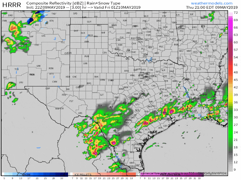
Simulated weather model radar this evening through the morning hours Friday .
Heavy thunderstorms will continue into the evening hours across the Coastal Bend, Coastal Plains, and Southeast Texas. Storms in the Edwards Plateau could organize into a cluster or squall line this evening. If that upscale growth occurs we could see a damaging straight-line wind threat develop as those storms make their way east toward the coast. It looks like Southeast Texas and the Coastal Plains will see a break from the heavy rain by the Friday morning rush. However, flooding will likely be an issue in some locations with low-water crossings closed.


0 Comments