
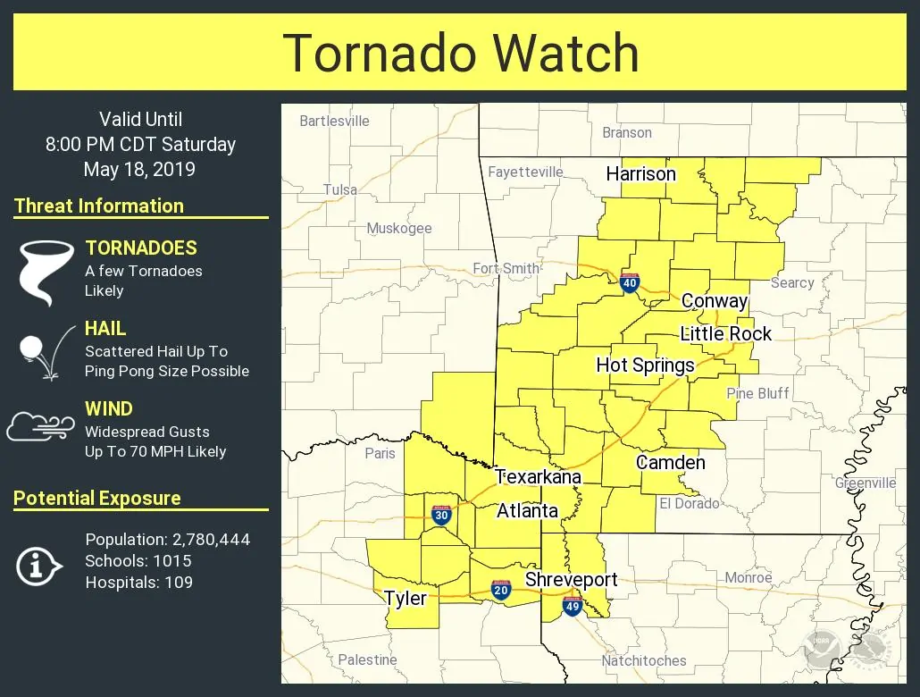
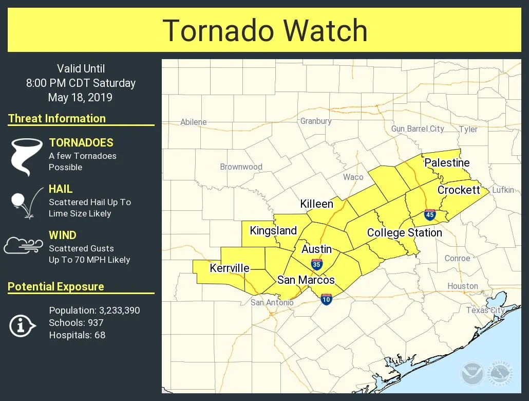
Tornado watches are now in effect for North Texas (east of the squall line), Northeast Texas, Central Texas, the Brazos Valley, and I expect one will be issued for East Texas at some point later this afternoon. The strongest storms this afternoon could produce all modes of severe weather – including large hail, damaging straight-line winds, and tornadoes. There is an enhanced tornado threat with any discrete thunderstorms this afternoon across the aforementioned regions. Tornadoes may also occur within the squall line if we see any embedded supercelluar modes develop. Keep in mind that with saturated soils it won’t take more than 35-40 MPH winds to uproot trees in East Texas and the Brazos Valley.
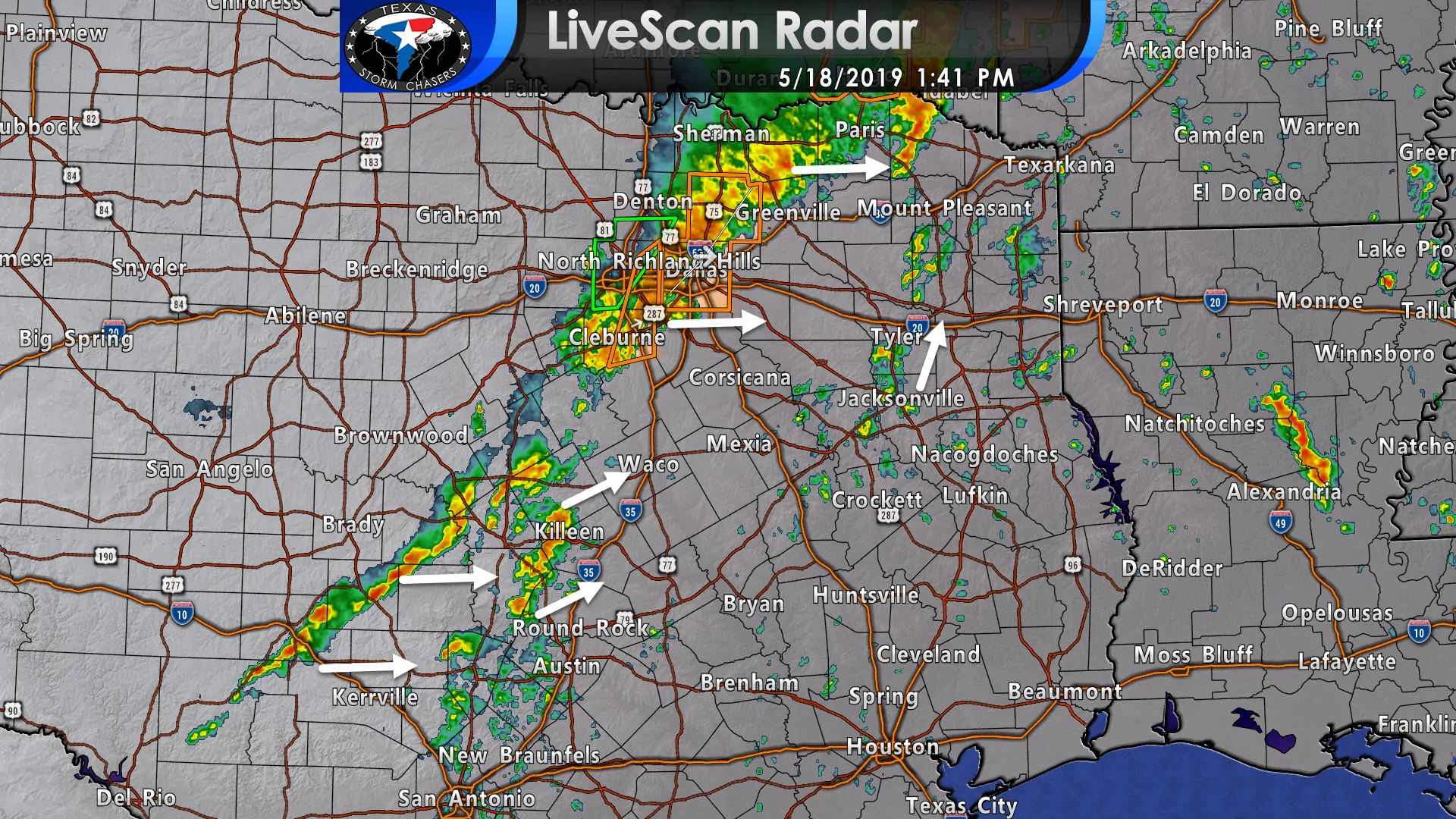
The line of thunderstorms will continue making their way east into Northeast Texas and toward East Texas this afternoon and into the early evening. Breaks in the clouds ahead of the line have allowed the atmosphere to become quite unstable. We’re also watching new thunderstorms develop farther south in Central Texas and the Hill Country. Those storms could also become more organized as they continue moving east/northeast over the next hour. Showers are firing up in East Texas – a sign of increasing upper-level lift and a weakening cap. If a few of those are able to become supercelluar (a question, not a guarantee) they would need to be watched very closely.
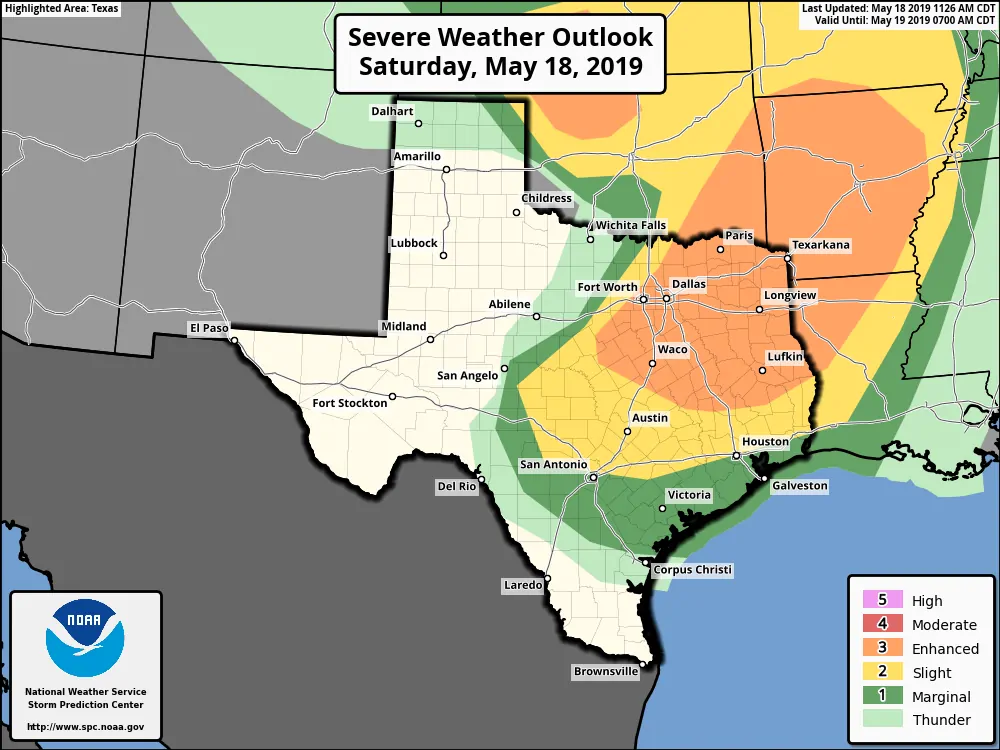
The severe weather outlook for this afternoon and evening. While those in a higher risk level have a higher chance of severe weather, if you’re in any risk level, you should pay attention to your radar app today.
Wind shear values, including in the lower levels in the atmosphere, are supportive of rotating thunderstorms and the potential for tornadoes. We’ve already had several tornadoes this morning when these storms were in the Big Country and Concho Valley. Conditions will continue to support a tornado threat as storms make their way east this afternoon. Again, any discrete supercell thunderstorms that develop could have an enhanced tornado threat. That does include the potential of a strong, longer-lived tornado.
Storms are also producing heavy rainfall. While they’re generally moving at a decent clip, they could drop a quick one to two inches of rain (especially in the squall line that’s impacting the D/FW metroplex at the time of this posting). Saturated soils won’t be able to absorb much rain, so all that will run-off and cause rapid rises on creeks, streams, and rivers. Flash flooding may occur.


0 Comments