
My apologies for not having a blog out yesterday. The last week and a half have literally been waking up, get on the road within 30 minutes, drive 13-16 hours, sleep and repeat. Combine that with a not so pleasant illness over the past three days and let’s just say I haven’t been the happiest camper. With that in mind along with an alarm set for a few hours from now, I’m going to try and keep this short and to the point.
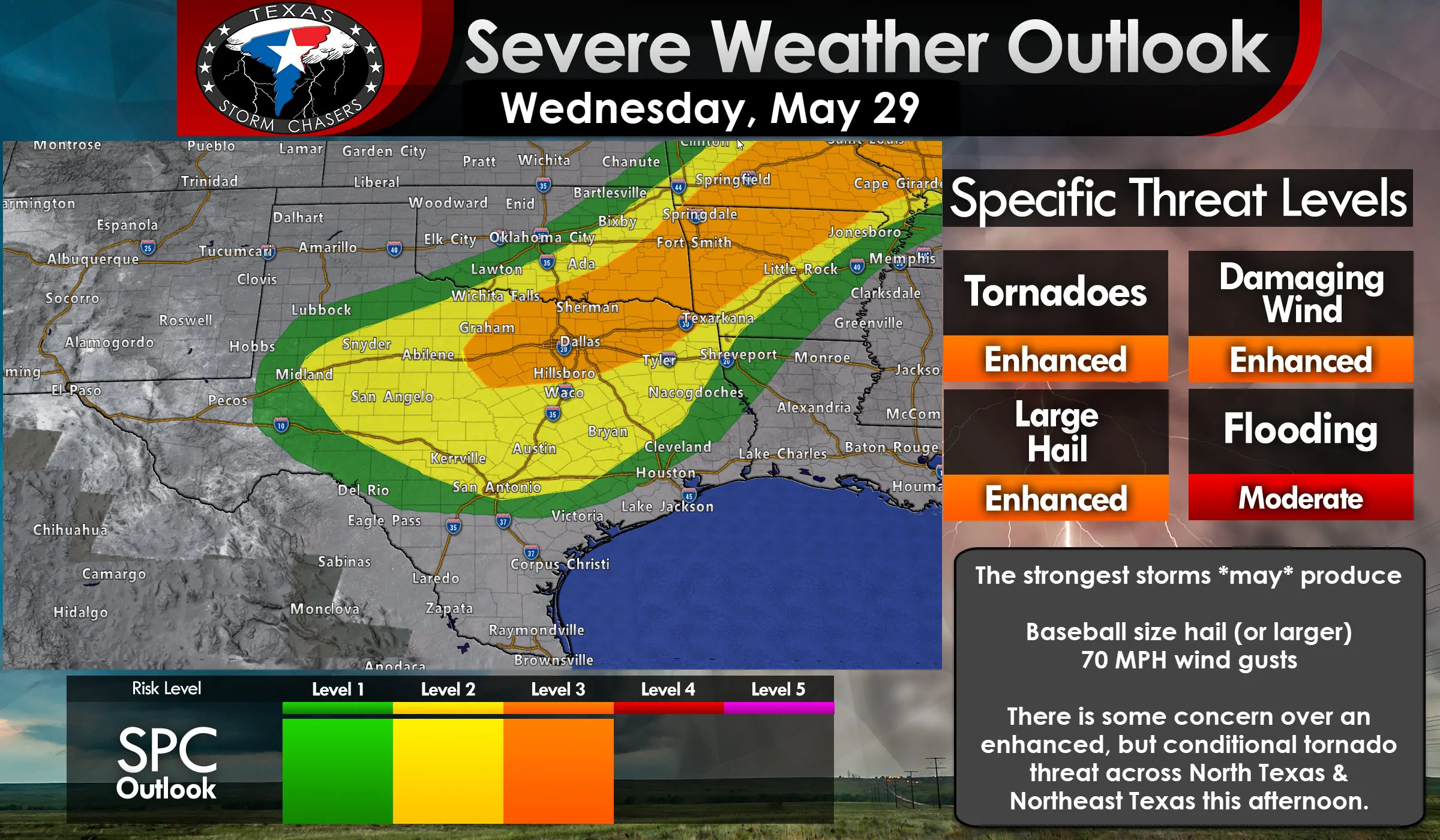
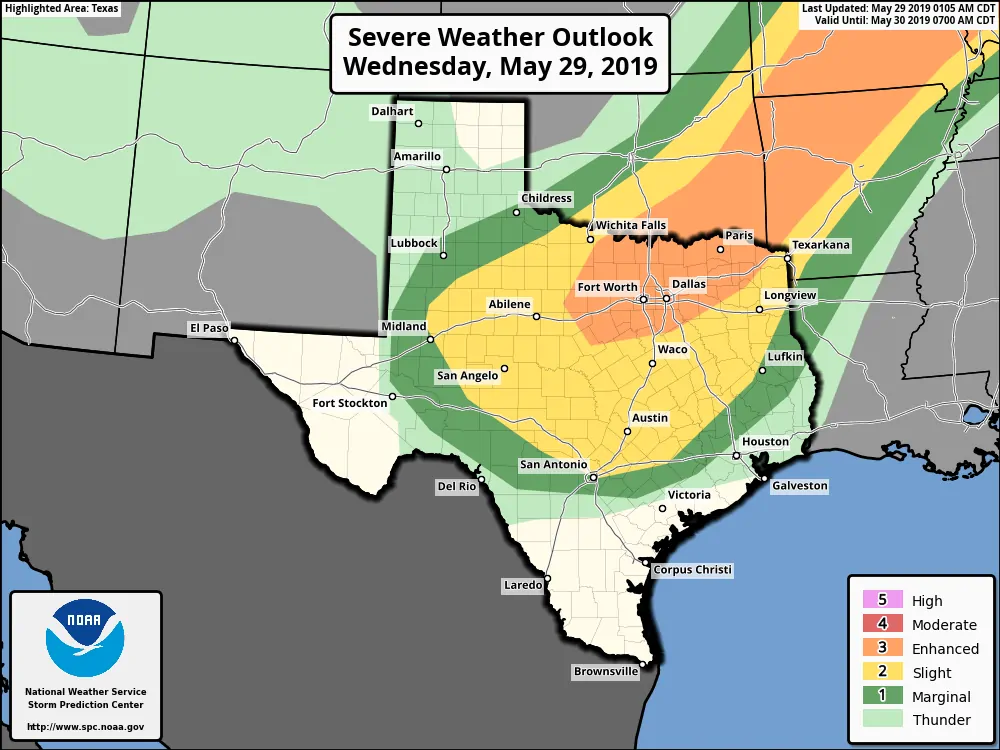
We have a level 3 risk of severe weather in place today across most of North Texas, Texoma, and Northeast Texas. This enhanced risk includes the threat of all modes of severe weather. That means very large hail, damaging winds, some tornado threat, and flash flooding will be possible with the strongest storms today. That does not mean all storms will be severe nor will all storms try and drop a tornado in your neighborhood. This is for the potential of severe weather, not a guarantee nor an ‘everyone is doomed’ message. A level 3 risk means a 30% chance of severe weather occurring within 25 miles of any given point (such as your home).
The standard level 2 risk includes the Big Country, Concho Valley, Hill Country, Central Texas, Brazos Valley, and parts of East Texas today. That risk this morning will be for storms moving east out of the Permian Basin and Big Country toward Texoma and North Texas. Storms later tonight will move south into portions of Central Texas and the Brazos Valley. We’ll chat about that below. This standard level 2 risk has a 15% chance of severe weather occurring within 25 miles of any given point (such as a home or business).
You can always view the latest severe weather outlooks on our severe weather dashboard here.
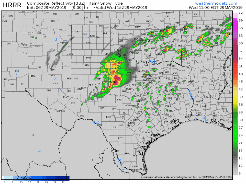
HRRR Simulated weather radar from late this morning through midnight tonight. Keep in mind that this is only one weather model and that we’ll probably see changes throughout the day. You can click on this image for a full-screen version.
Storms should be ongoing this morning across the eastern Permian Basin into the Big Country. The HRRR model assumes most of those storms will make their way into Texoma and Oklahoma by the early afternoon. However, new storms are expected to fire upon the southern periphery of the previous storms. Those storms – wherever they fire up – could become supercelluar this afternoon as they move east/northeast. There is some concern that some of those storms could become tornadic as they move across North Texas and into Northeast Texas this afternoon. Tornadoes are not guaranteed nor is the risk as high as the hail/wind threat. However, it is something to watch. Very large hail is a good bet with any intense storms today as we’re going to have plenty of instability to support hail growth.
Eventually, we should see storms grow upscale – or at least try and become more ‘clustered’ or linear toward the late afternoon and early evening hours. That will increase the threat of localized damaging wind gusts along with brief tornadoes and some hail. Saturated soil conditions mean it won’t take too much rain to cause new flash flooding. That threat will be highest across Texoma and Northeast Texas south to the D/FW Metroplex.
Assuming I’m chasing today (which I probably will be) this may be my only blog update for this event. Remember to have multiple sources to receive severe weather information today. There are excellent radio, television, and digital means to receive weather coverage. Follow your local National Weather Service and keep tabs on the storms with our free HD interactive weather radar here.


0 Comments