
No organized severe weather threats are expected in Texas over the next several days. This respite will end later this week. Across a broad region of the Plains from Texas north to Kansas, the most active period of severe weather potential in several years is expected to begin on Friday. That’s not to say the impact or severity will be noteworthy, but in terms of consecutive daily chances, we’re shaping up for a very active period.
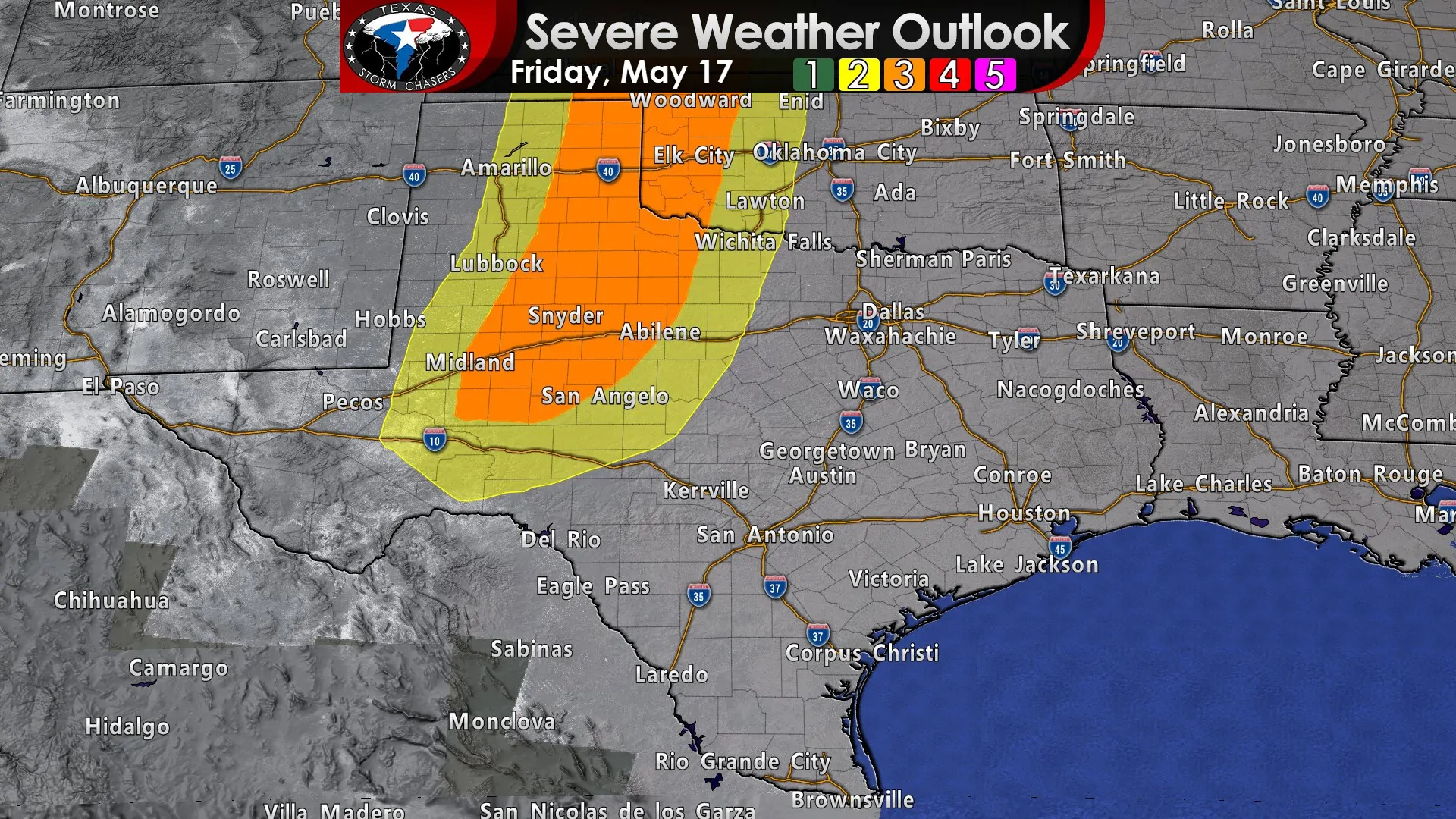
Friday’s severe weather outlook from the Storm Prediction Center. Click this image for a full-screen version.
We’ll start off talking about Friday. We already have an enhanced level 3 risk of severe weather in place east of the dryline across the eastern Texas Panhandle, Northwest Texas, West Texas, the western Big Country, into the eastern Permian Basin. That enhanced risk means a 30% chance of severe weather within 25 miles of any given point (such as your house or business). Those are high probabilities for four days away. Scattered supercell development should occur by the late afternoon hours. Those storms will be capable of producing all modes of severe weather. With time a line of severe storms should organize and move east. How far east those storms make it Friday night into Saturday morning will dictate how much we ‘reload’ by Saturday afternoon.
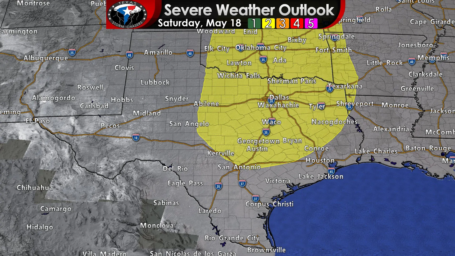
Saturday’s severe weather outlook from the Storm Prediction Center. Click this image for a full-screen version.
A broad level 2 risk of severe weather is in place for Saturday across Northwest Texas, the Big Country, Hill Country, Central Texas, Brazos Valley, North Texas, Texoma, Northeast Texas, and East Texas. The squall line early Saturday will play a big role in how the afternoon hours play out. If the line of storms ends up making a mess Saturday morning the severe weather threat Saturday afternoon may not be particularly widespread. However, if we don’t have a line of storms overturn the atmosphere Saturday morning, the afternoon hours could feature a fairly substantial severe weather threat – including all modes of severe weather. It is five days away so this is an early heads up. We’ll be able to get far more specific on Saturday’s severe weather threat once we get within two or three days.
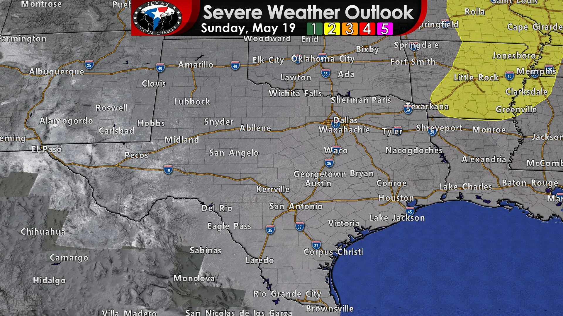
Sunday’s severe weather outlook from the Storm Prediction Center. Click this image for a full-screen version.
Sunday should be a ‘down’ day as we’ll be in-between storm systems. We’ll have to watch the Arklatex and points east/northeast in case we have to deal with the ‘tail-end’ of any storm threat.
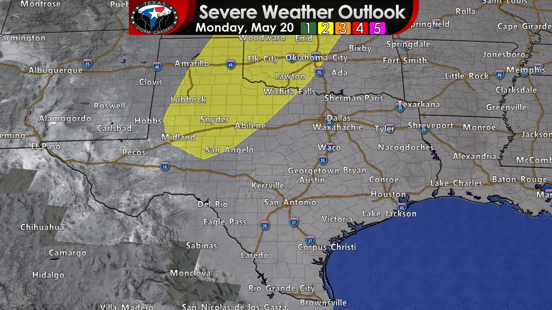
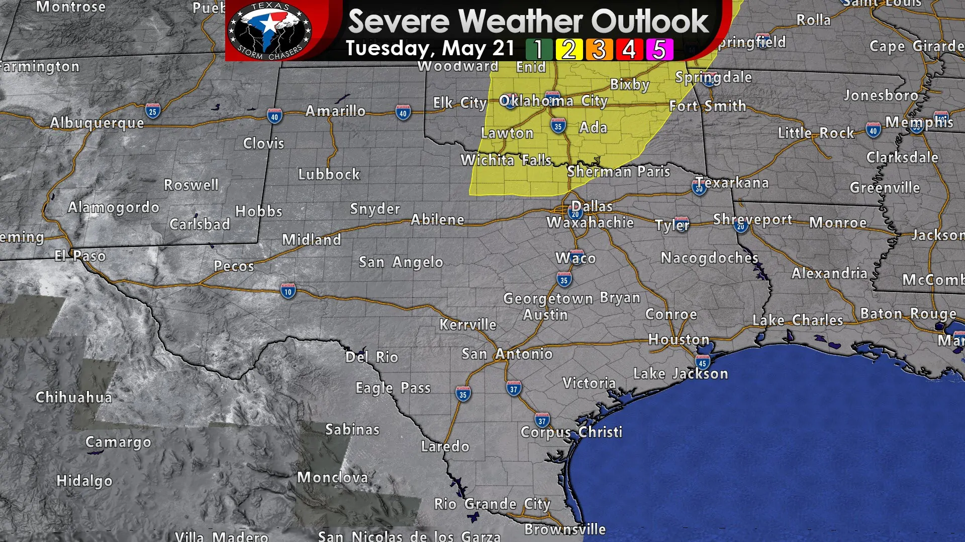
Monday and Tuesday (perhaps beyond) will bring a return of severe weather potential to the Southern Plains of the United States. While quite rare, the Storm Prediction Center has already highlighted risks for Day 7 and Day 8 of their severe weather outlook. For those weather nerds who are interested in such statistics – this morning’s severe weather outlook was the first once in the 5+ year history that SPC has included a risk on every day of their 4-8 day outlook. That itself indicates we (as in storm chasers) are going to be busy. Some of those threats will likely impact portions of Texas too. We will have to watch the hydrology aspects too since it won’t take much rain to cause additional flooding.
This post is more of a heads up to indicate that even though we’re quiet for most of this week – we’re going to be extremely active beginning Friday, moving into Saturday, and again on Monday, Tuesday, and probably Wednesday of next week. That does not mean each day will feature mile-wide tornadoes, bowling-ball size hail, or Daenerys riding down on a dragon. However, this is May and unlike last year, this year we will have to deal with a continued above-average severe weather season. Those with outdoor or travel plans should stay aware. We’ll be here to bring you the latest forecasts and awesome storm chasing content.


0 Comments