
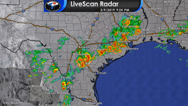
Numerous thunderstorms are underway from nor Corrigan and Silsbee far East Texas southwest over the Houston metro southwest down Highway 59 to Rosenberg to El Campo to the north of Victoria to near Kenedy to Three Rivers and George West. Additional thunderstorms have developed in eastern Mexico. Those storms will move east into the Edwards Plateau into South Texas by 11 PM near Laredo to Zapata. Severe storms are expected to continue through the evening hours with a threat of very large hail and localized damaging wind gusts. We haven’t heard too much about high winds this evening, but hail has certainly been an issue. Tennis-ball to softball size hail has been common with the storms in far East Texas and in Southeast Texas this evening. Most storms are slowly moving east to northeast. Each individual storm may have some deviant motion depending on factors such as outflow boundaries.
I would not be surprised if the storms in South Texas begin to organize into a cluster or small squall line. If that upscale growth occurs we could see storms begin moving more quickly to the east along with an uptick in damaging straight-line wind potential.
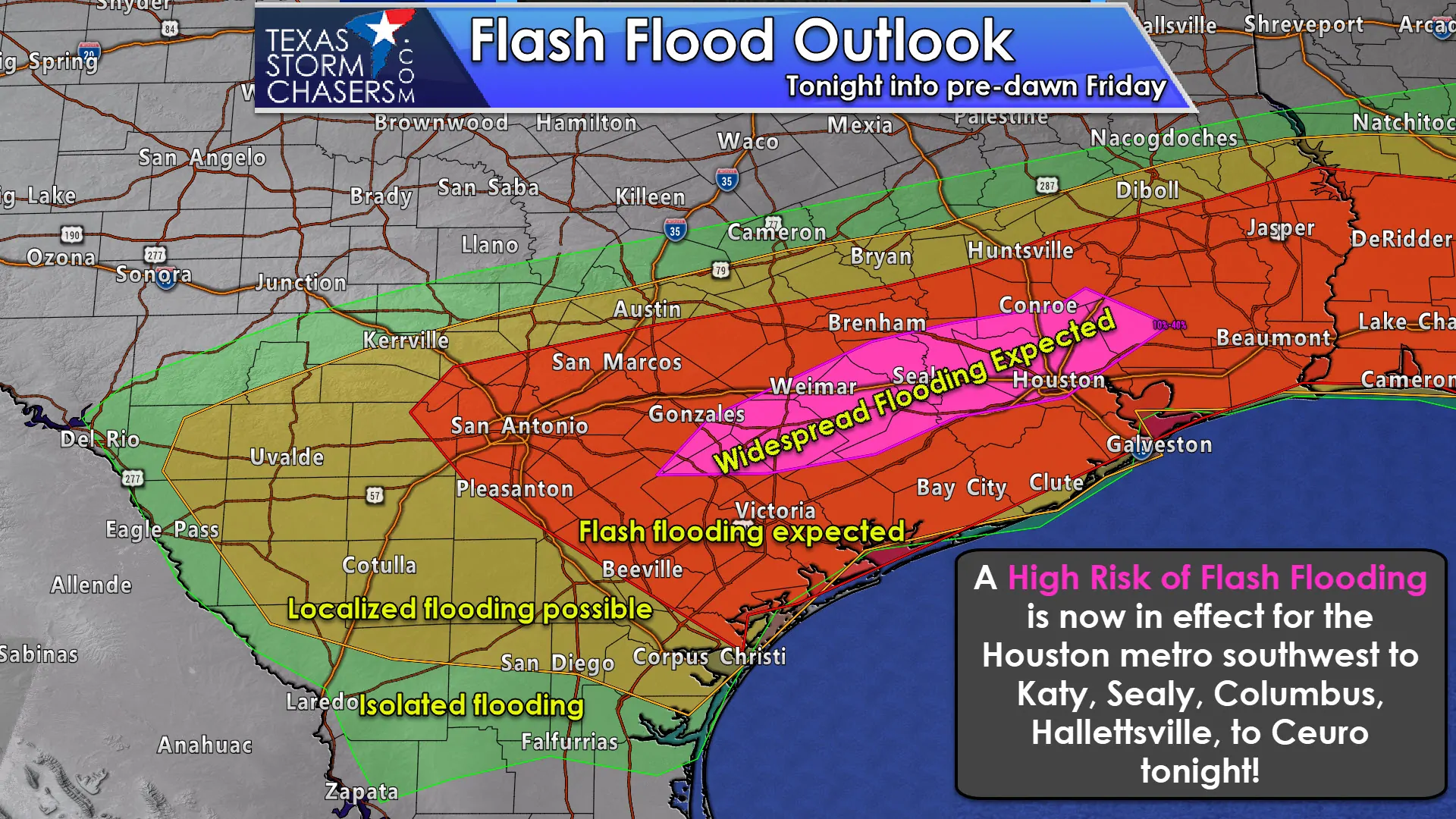
What will be the most widespread issue this evening is the threat of flooding rainfall. While the storms in Southeast Texas have been mean hailers, they’ve also been producing rain totals of 2 to 5 inches per hour. The threat of flash flooding is high tonight in the Coastal Plains and Southeast Texas. Multiple creeks in Harris County are now over their banks and roadways are under water. We anticipate those issues will expand southwest down Highway 59 and into the southern part of the Houston metro in the coming hours as new storms fire up. Remember, some locations received over ten inches of rain earlier this week. They can’t handle new rainfall and all that rain will run off into the already overflowing drainage systems.
Just in – a new flash flood warning for most of the Houston metro:
Flash Flood Warning
National Weather Service Houston/Galveston TX
932 PM CDT Thu May 9 2019
The National Weather Service in League City has issued a
* Flash Flood Warning for…
Northwestern Galveston County in southeastern Texas…
Central Fort Bend County in southeastern Texas…
Southern Montgomery County in southeastern Texas…
Harris County in southeastern Texas…
* Until 1230 AM CDT.
* At 930 PM CDT, Doppler radar indicated thunderstorms producing
heavy rain across the warned area. Flash flooding is ongoing
across parts of the area. Some of these cells will be moving over
the Kingwood area and Fort Bend County that saw copious amounts of
rain a few days ago.
* Some locations that will experience flooding include…
Pasadena, northeastern Pearland, Sugar Land, northwestern Baytown,
Missouri City, northern Friendswood, Deer Park, Rosenberg,
Stafford, South Houston, Bellaire, Humble, West University Place,
Katy, Richmond, Galena Park, Tomball, Jacinto City, Webster and
Jersey Village.
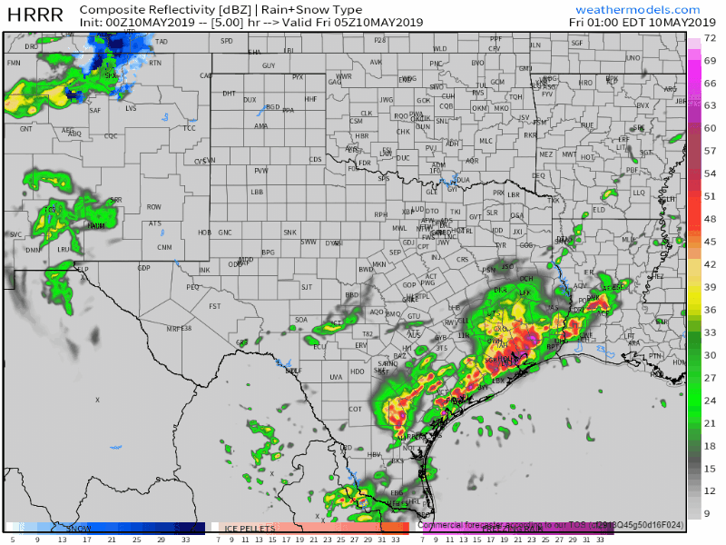
Thunderstorm intensity should start to decrease late tonight across the Coastal Plains and Southeast Texas as storms slowly move south out into the Gulf of Mexico. Several hours of light to moderate rainfall will continue behind the storms, but these 2-5″ per hour rainfall amounts will end. This is only round one with more rain expected on Friday, Saturday, and Sunday across East Texas, Southeast Texas, the Coastal Plains, and South Texas. Rains that fall now will only make it easier for future rains in the coming days to cause new flooding – even if those rains are light.


0 Comments