
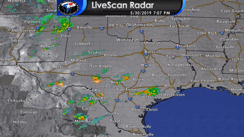
Isolated severe thunderstorms continue to slowly move east across the southern Trans-Pecos eastward into the northern Edwards Plateau and southern Hil Country. The strongest storms may continue producing very large hail. We have more summer-like storms impacting parts of the Coastal Plains – where flash flooding is the primary concern. Finally, storms developing in northern Mexico may move east into the southern Edwards Plateau in the coming hours with an associated severe weather threat. You can keep tabs on the storms with our free HD interactive weather radar here or in our free mobile app.
The strongest storms this evening may continue to produce very large hail up to the size of baseballs. Localized damaging wind gusts up to 70 MPH and a brief tornado cannot be ruled out. We’ll have to watch those storms coming in from Mexico in case they grow upscale into a small cluster. That would briefly increase the damaging wind threat. All storms are producing heavy rain, so be mindful of that if you’re in an area that has issues with low-water crossings.


0 Comments