
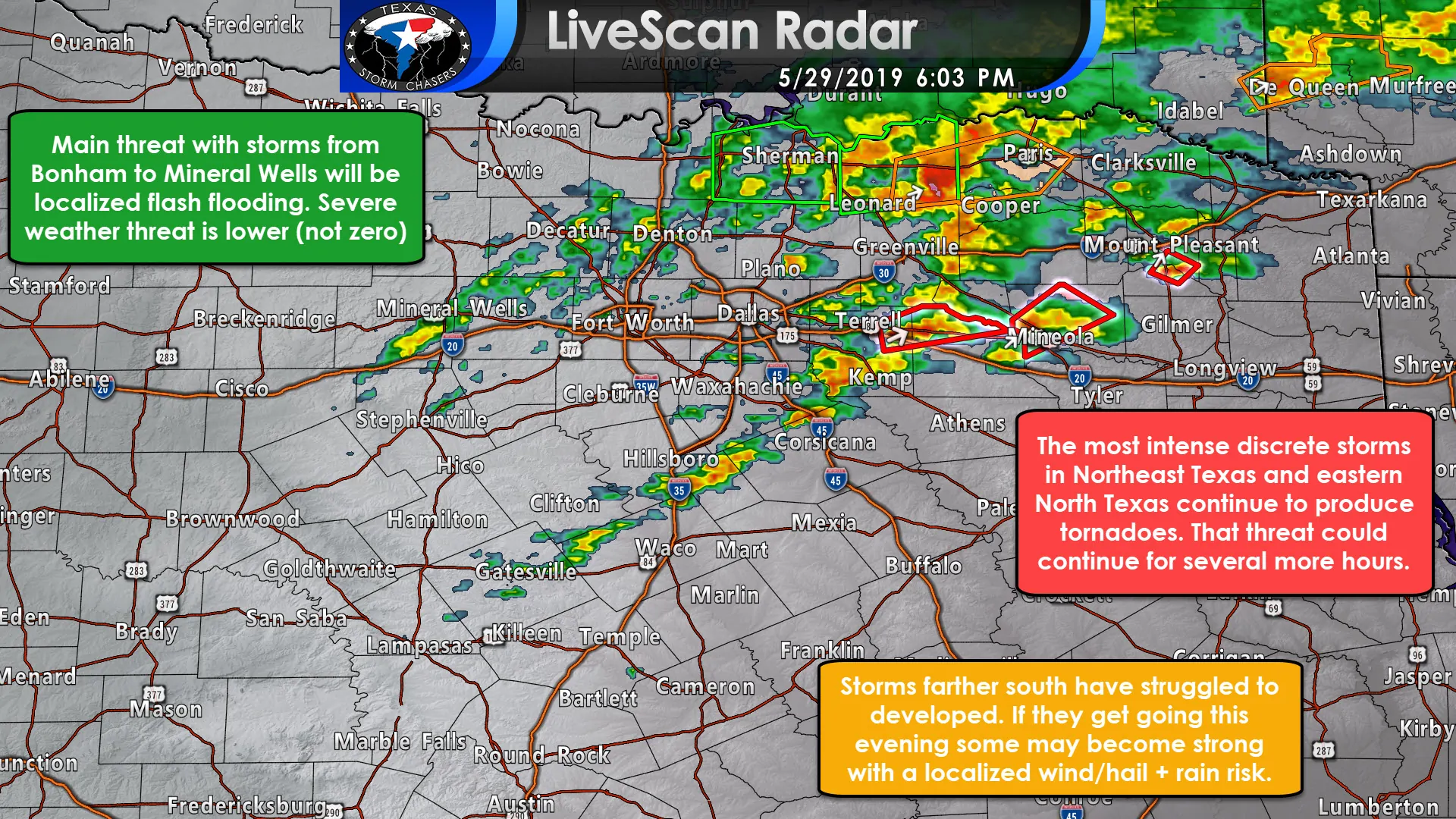
Tornadic thunderstorms continue to impact portions of East Texas and Northeast Texas. Conditions remain favorable for the development of tornadoes with the most intense supercells. Additional storms have developed from Terrell to Rice – and those are showing increasing rotation as they move east/northeast. Round #1 and Round #2 continue to have severe storms farther east/northeast.
Conditions will remain favorable through at least 8 PM for tornadoes. However, we should start to see a downtick in the tornado risk as storms begin growing upscale into a squall line and/or become undercut by outflow moving in from the west. We should also see low-level wind fields also start becoming weaker as the better dynamics aloft start moving away. Again, that still looks to be a few hours away.
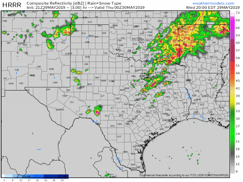
Simulated weather model radar through the overnight hours. Again, this is just meant to give a general timing guideline. Don’t use it to forecast specific ‘is this one storm going to hit the blade of grass in my back yard’ scenarios.
The threat for severe storms is lower farther south later tonight. While we may see some storms, their tornado risk should be much lower. I can’t rule out some hail and gusty winds given the fact it is late May – with the ‘juice’ that accompanies this time of year. Localized flooding will be a threat given saturated soils. Those in eastern North Texas and Northeast Texas should remain weather aware this evening and be ready to act if severe weather warnings are issued.
You can track the storms in your area (or wherever) using our free HD interactive weather radar here.


0 Comments