
After getting to enjoy several days of downtime we’ll be moving back into an unsettled weather pattern for most of the upcoming work week. Unlike the last few events where severe storms were the primary concern, we’ll be looking at both the threat for strong to severe storms along with hydrological impacts from heavy rainfall. After last Wednesday’s forecast bust I learned that some guidelines need to be shared with most of our forecast posts.
- The threat of (insert weather type) weather does not mean it is guaranteed.
- A threat of severe weather in your area is not a guarantee you’ll personally be impacted. The same goes for winter weather, flooding, and just about every summer afternoon when popup storms are expected.
- This is Texas in the spring. We deal with severe weather chances on a regular basis. Not all severe weather setups automatically result in violent tornadoes, bowling ball size hail, and 200 MPH wind gusts.
- A forecast will change. That’s why you check back for forecast updates.
- I’m still looking for the elephants.
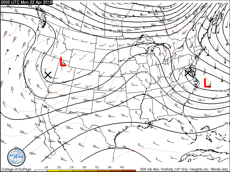
Upper-level winds last evening – showing our upcoming storm system sitting in the Western United States. It’ll sag south some today and on Tuesday, but generally not move too much. It’ll finally get into gear and start moving east on Wednesday – and move out on Thursday.
Now that I got those off my chest let’s dive into the forecast for the next several days. Our main weather maker in the upper-levels will be a slow-moving storm system in the Southwestern United States. As that system sits out there it’ll shove upper-level pieces of energy our way through at least Thursday. It’ll start moving east by Wednesday, and will hopefully be moving out on Thursday – giving us a break from precipitation chances for Friday. At the surface, we’ll have a cool front (boundary) that will slowly move south today, tomorrow and Wednesday. Severe storm chances will mainly be near and south of that boundary, but we’ll see widespread rain and storms to the north of it with a heavier rain threat.
I’ll leave it to your preferred smart-phone weather app to give you specific rain chances for your location. However, we’re expecting a gully washer this week – and not in the regions we’re accustomed to seeing it. In fact, the highest rain totals are currently forecast across West Texas, the Permian Basin, eastward through Northwest Texas, the Big Country, Concho Valley, Hill Country, into North and Central Texas. Those rain totals should average between 2 and 4 inches by the time we get to Thursday. Locally higher amounts are possible. The lightest rain totals will be across South Texas and Deep South Texas.
Locations that typically experience flooding after heavy rain will probably start filling up tomorrow and continue that way through Thursday. Rivers and lakes will start responding by Thursday and those rises will flow downstream this weekend into next week.
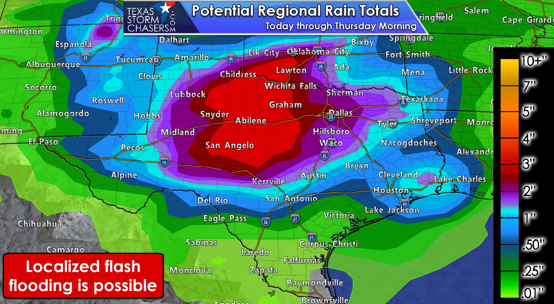
Click image for full-screen version
Localized flooding will be possible on Monday and Tuesday across the western half of Texas. We could see an increase in flooding potential by Wednesday as heavier rains continue and soils become more saturated. This does not appear to be a significant flash flood event at this time, but of course, we’ll be keeping an eye on it. Remember that there is a big difference in getting 4 inches of rain over 2-3 days versus 4 inches of rain in 1-3 hours. It beats having last year’s drought though.
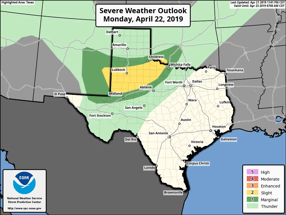
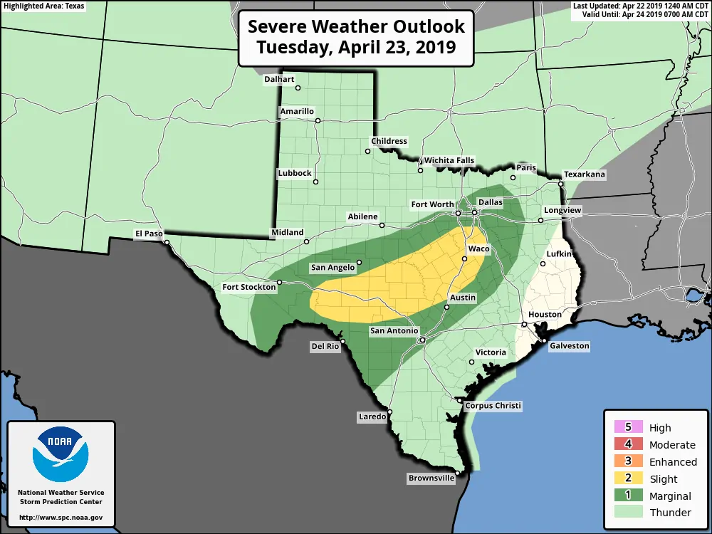
Severe Weather Chances Today, Tuesday, and Wednesday
We have the standard level 2 risk of severe weather today through Wednesday in the proximity of that cool front. As stated previously it’ll be moving south over the next several days. The highest chance for severe storms will be near and south of that front, although some storms may be strong to the north of the front too. We’ll share each day’s outlook summary graphic followed by regional maps. Each graphic can be clicked/tapped for a full-screen version.
Today (Monday)
Tomorrow (Tuesday)
Wednesday
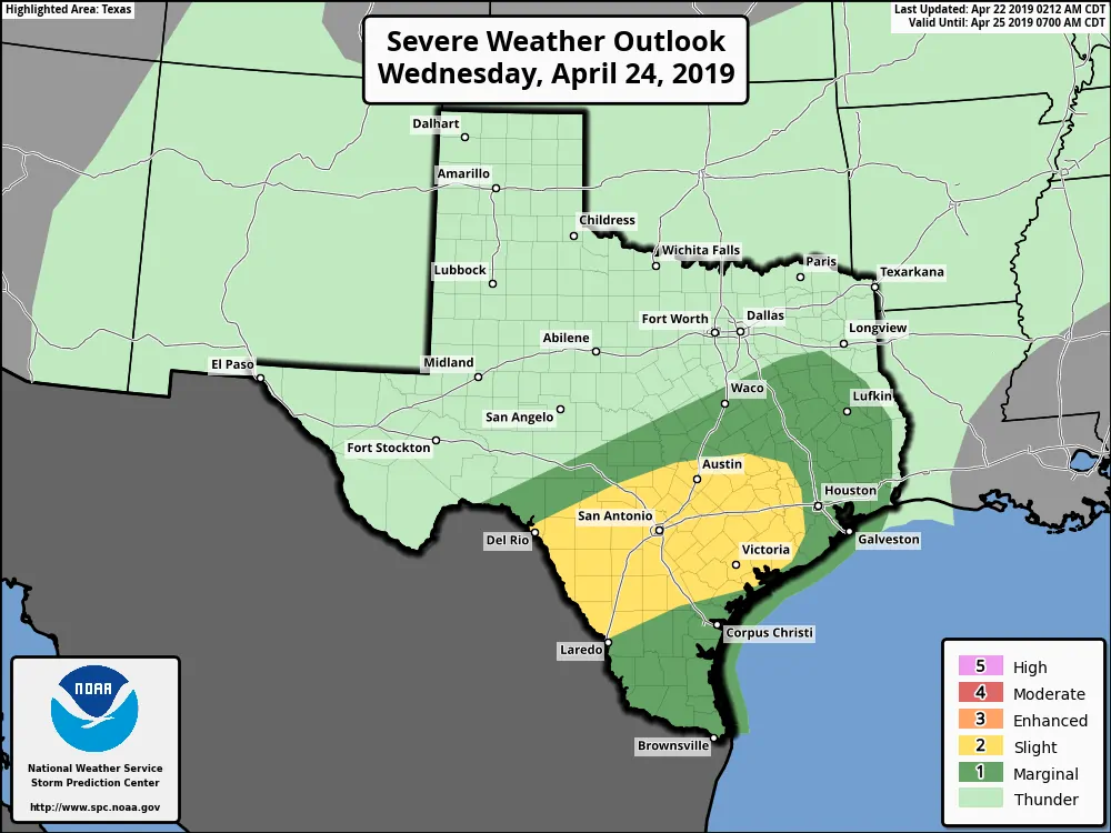
The strongest storms all three days may be capable of producing quarter to golfball size hail and localized wind gusts over 70 MPH. The tornado threat is very low for all three days, but we can’t rule out an isolated/brief tornado. Severe storms would be most likely (relatively) during the afternoon and evening hours. If we see any storm complexes develop those could continue on into the night with a risk of strong to locally damaging winds. Some storms north of the cool front could produce small to marginally severe hail.
We’ll talk later today about the severe weather threat in Western Texas this evening. Depending on how far that cool front makes it the threat may end up being more south into the Permian Basin extending northeast into Northwest Texas tonight (as a complex of storms moves northeast while slowly weakening). The next three days aren’t really chasing material with modest wind shear values and an environment more supportive of heavy rain versus visually-impressive storm structure. We’ll likely have some severe weather issues at varying points in the coming days, but this system is going to be more of a rain-maker versus a hailer.


0 Comments