
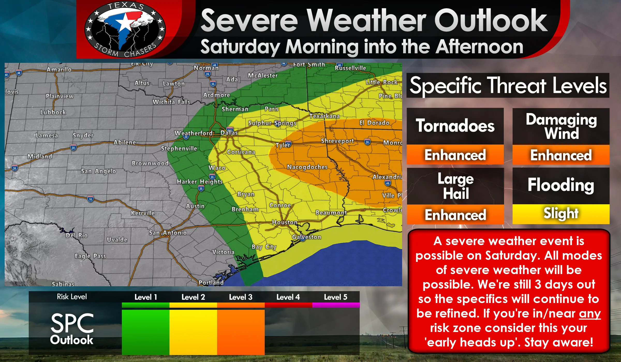
We’re going to be dealing with two threats of severe weather late Friday night and into the day on Saturday. The first threat will be for those north of a warm front, where surface temperatures are cooler but instability values aloft still existent. Hail will be possible with stronger storms in that environment. Along and south of a warm front is where we’ll have surface-based storms. Those storms will be able to tap into strong low-level wind shear and potentially produce all modes of severe weather. We’re still 2 days away and need to lock in some answers before we can become more specific on the exact threat levels and who may end up dealing with a higher risk of significant severe. Let’s talk about it!
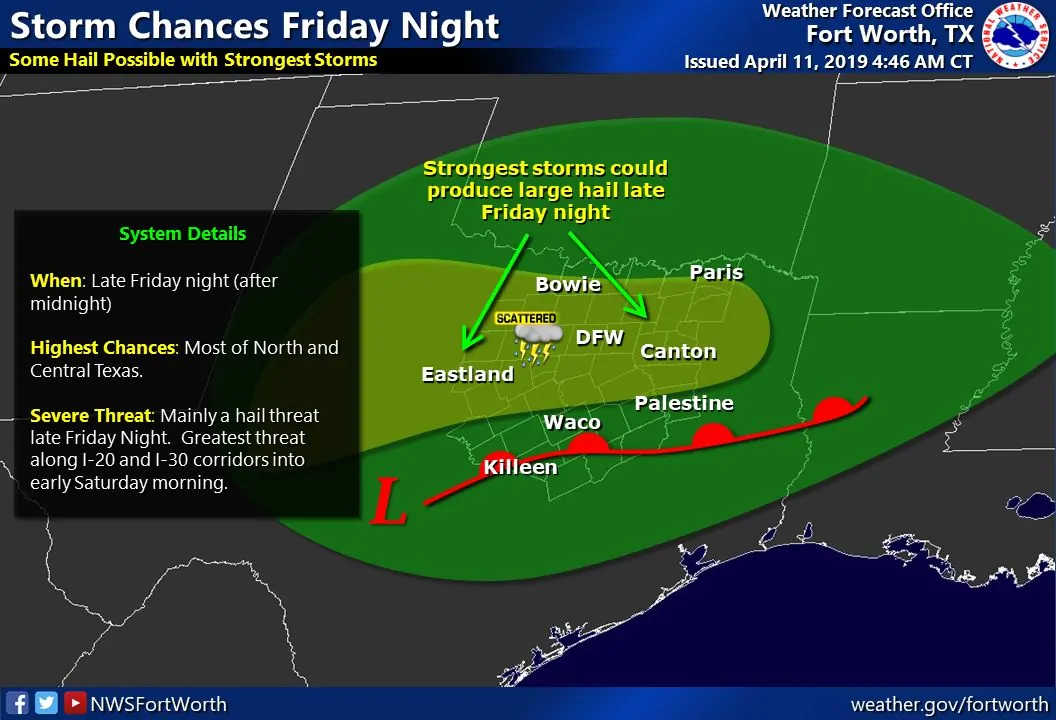
Scattered thunderstorms could be underway by midnight Saturday across the eastern Permian Basin northeastward into the Big Country and Northwest Texas. Storms will generally move off to the northeast and could contain hail. Thunderstorm coverage will increase before sunrise on Saturday across the aforementioned regions eastward into North Texas and Northeast Texas. Again, the strongest storms could be capable of producing hail. All of that activity will be north of the warm front and elevated above a stable layer of cool air near the surface.
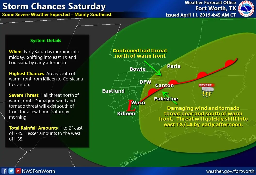
As we move past sunrise and toward the mid-morning hours a surface low pressure will move into Central Texas. Southeasterly winds to the east/southeast of that low will push a warm front north to near Interstate 20 in East Texas. Conditions south of the front will be warm, humid, and generally unstable with potent wind shear values in place. The primary questions are 1) when will thunderstorms develop in that airmass and 2) will we have a semi-discrete supercelluar mode or more of a squall line/cluster. Regardless, all modes of severe weather will be possible in East Texas – where the highest risk of severe weather seems to be at this point. Strong to severe storms may still be possible across Southeast Texas on Saturday, but questions over thunderstorm coverage and the cap need to be answered.
Weather model data has been a bit slower with the system’s progression over the last day. That means the threat could begin a bit farther west (compared to yesterday’s data) and that it may linger in East Texas until the middle to late afternoon before moving east into Lousiana. We’ll be able to get more specific on timing, threat levels for each hazard, and the highest risk zones tomorrow.


0 Comments