

The Storm Prediction Center has issued a new severe thunderstorm watch until 9 AM (although it’ll end to the western sooner than that). This watch includes Northeast Texas, East Texas, and the Brazos Valley, Brenham, College Station, Conroe, Lufkin, Jasper, Nacogdoches, Jacksonville, Tyler, and Texarkana. We note that this does not include Southeast Texas or the Coastal Plains. If storms ongoing across the Brazos Valley were to turn farther southeast or expand southward we’d likely see a watch expanded. Damaging straight-line winds of 60 to 70 MPH are expected with the most potent storms in the squall line. Brief tornadoes, some hail, and flooding are also threats.
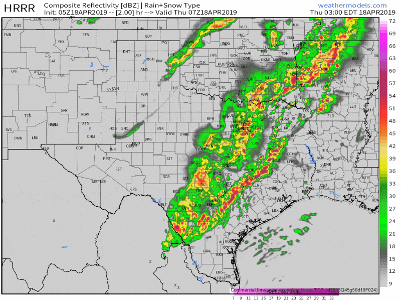
05Z HRRR Simulated weather radar from 2 AM CT to 3 PM CT today. This is a model simulation, but we generally expect a line of storms to continue moving east this morning. You can click on the graphic for a full-screen version.
A line of storms extends from Paris to Ennis to Mexia to Hearne to Caldwell to Giddings to Luling to Pleasanton to Cotulla. This line is moving east at 40 to 50 MPH. A storm with a history of damaging winds will move into B/CS in the next 15-30 minutes. We’re also watching storms with high winds around Mexia. Most storms this morning are not severe, but are producing lots of lightning, gusty winds, and heavy rainfall. Those storms that do become severe could have damaging straight-line winds and perhaps a few brief tornadoes. That threat will be highest across the Brazos Valley into East Texas for the next few hours. I think we will have to watch far Southeast Texas later this morning as storms may regain some ‘oomph’. Luckily, big hail doesn’t seem to be in the cards with these morning storms. Undoubtedly someone will complain that they didn’t get their softball size hail served up on a platter, but tough cookies.


0 Comments