
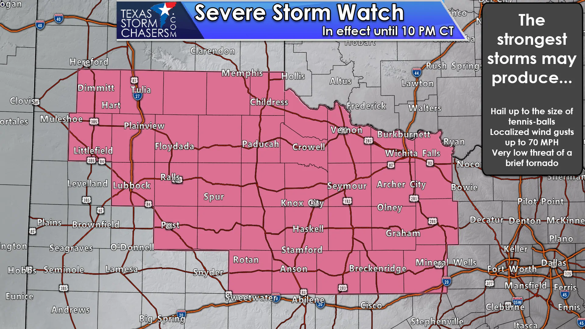
A severe thunderstorm watch is in effect through the mid-evening for a good portion of West Texas, Northwest Texas, into the northern Big Country. Lubbock, Post, Plainview, Tulia, Childress, Haskell, Wichita Falls, Graham, and Mineral Wells are a few towns included. The strongest storms this afternoon may produce very large hail up to the size of tennis-balls and localized damaging wind gusts of 60 to 70 MPH. A brief tornado cannot be ruled out.
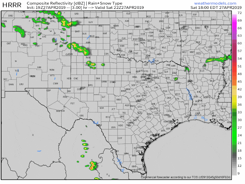
Simulated weather radar this afternoon and evening. Click the image for a full-screen version.
Our first thunderstorms of the afternoon have developed across the western Texas Panhandle from near Romero southeast to Hereford to Plainview to Crosbyton. Most storms are moving southeast at 30 to 35 MPH. Intensification is anticipated with these storms and we should have a few of them becoming severe by 5 PM. Semi-discrete supercells will continue through the early evening. Those storms will make their way into West-central Texas and into Northwest Texas. Additional storms may develop around 8-9PM across Northwest Texas. A small complex of thunderstorms will organize and move southeast into western North Texas late this evening. The strongest storms in that complex may be capable of producing damaging straight-line winds, hail, and heavy rainfall. Storms will be weakening as they approach Interstate 35 in North Texas around or after midnight.
Here’s the full watch text from the Storm Prediction Center…
Severe Thunderstorm Watch Number 107
NWS Storm Prediction Center Norman OK
350 PM CDT Sat Apr 27 2019
The NWS Storm Prediction Center has issued a
* Severe Thunderstorm Watch for portions of
West and Northwest Texas
* Effective this Saturday afternoon and evening from 350 PM until
1000 PM CDT.
* Primary threats include…
Scattered large hail likely with isolated very large hail events
to 2.5 inches in diameter possible
Scattered damaging wind gusts to 70 mph possible
A tornado or two possible
SUMMARY…Thunderstorms are expected to develop and become severe
across the watch area this afternoon and evening. The strongest
cells will pose a risk of large hail and damaging wind gusts.


0 Comments