
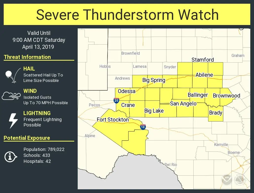
The National Weather Service has issued a severe thunderstorm watch for a majority of the Big Country and Concho Valley. This watch goes until 9 AM. Fort Stockton, Midland, Odessa, San Angelo, Brownwood, and Abilene are a few towns included. The strongest storms this morning may produce very large hail up to the size of tennis-balls and localized wind gusts over 70 MPH. Any storms that develop south of a warm front (generally south of an Ozona to Junction line) could also become tornadic, but that’ll be handled by a separate tornado watch if it becomes more likely.
URGENT - IMMEDIATE BROADCAST REQUESTED
   Severe Thunderstorm Watch Number 48
   NWS Storm Prediction Center Norman OK
   130 AM CDT Sat Apr 13 2019

   The NWS Storm Prediction Center has issued a

   * Severe Thunderstorm Watch for portions of
     West-central and southwest Texas

   * Effective this Saturday morning from 130 AM until 900 AM CDT.

   * Primary threats include...
     Scattered large hail and isolated very large hail events to 2
       inches in diameter possible
     Isolated damaging wind gusts to 70 mph possible

   SUMMARY...Thunderstorms should increase in coverage and intensity
   across the area through the remainder of the pre-dawn hours, as both
   moisture and lift strengthen near a surface low and north of a warm
   front.  Hail is the main threat, though sporadic damaging gusts may
   penetrate to the surface.


0 Comments