
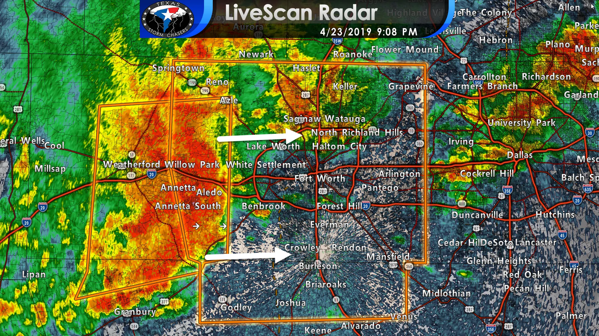
A severe thunderstorm extends from just west of Azle to Aledo to Cresson. This storm is capable of producing wind gusts of 60 to 70 MPH, dime to nickel size hail and very heavy rainfall. This storm is showing impressive velocity returns – indicating a high likelihood of damaging straight-line winds. Heavy rainfall will also produce isolated flash flooding. It would be advisable to move away from west-facing windows as this storm arrives. I cannot rule out a brief, weak tornado. Tune to local television media or our social media channels for updates.
Severe Thunderstorm Warning
National Weather Service Fort Worth TX
906 PM CDT Tue Apr 23 2019
The National Weather Service in Fort Worth has issued a
* Severe Thunderstorm Warning for…
Northern Johnson County in north central Texas…
Eastern Parker County in north central Texas…
Tarrant County in north central Texas…
* Until 1000 PM CDT.
* At 906 PM CDT, a cluster of severe thunderstorms was located from
near Springtown to Willow Park to Aledo , moving east at 35 mph.
HAZARD…65 mph wind gusts and penny size hail.
SOURCE…Radar indicated.
IMPACT…Expect damage to roofs, siding, and trees.
* Locations impacted include…
Fort Worth, Arlington, Grand Prairie, Mansfield, Euless, Bedford,
Grapevine, Haltom City, Keller, Hurst, Burleson, Southlake,
Weatherford, Watauga, Colleyville, Benbrook, Saginaw, White
Settlement, Crowley and Forest Hill.
PRECAUTIONARY/PREPAREDNESS ACTIONS…
For your protection get inside a sturdy structure and stay away from
windows.
Heavy rainfall is occurring with this storm, and may lead to flash
flooding. Do not drive your vehicle through flooded roadways.


0 Comments