
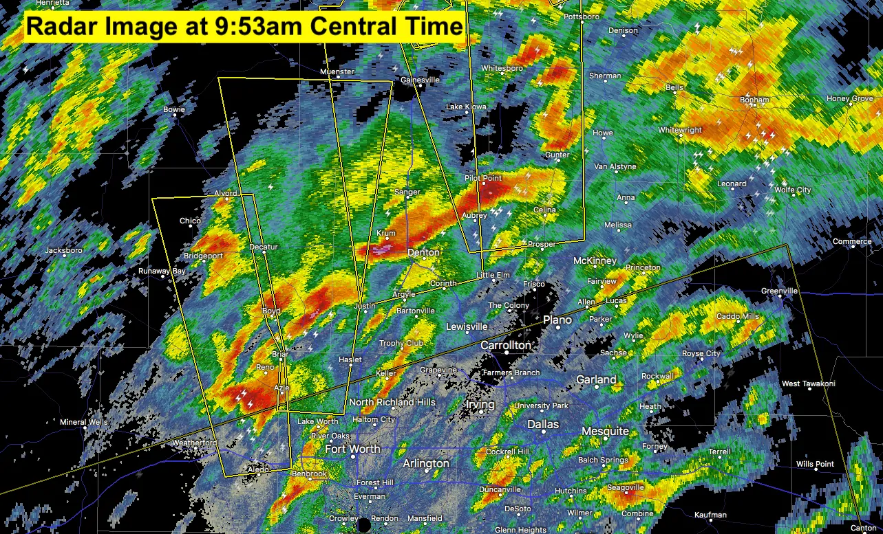
Just a real quick update on the severe weather issues this morning. Let’s begin with North Central Texas where we currently have four (4) severe warned storms ongoing across the northern half of the metroplex. Hail up to the size of golfballs is likely for the next half hour or so as these storms continue to move nearly due north and towards the red river. Additional storms continue to develop south of DFW and those will be tracking north and into the southern Dallas area within the next half hour to 45 minutes. With any of these storms, expect hail anywhere from pea size to quarter size with the potential for some hail reports to exceed 2 inches in diameter.
We’re also watching storms farther south in Central Texas and South-Central Texas. One particularly nasty storm just finished producing baseball size hail in northwestern Bexar county (far northwest San Antonio) up toward The Dominion. Those storms are generally moving northeast around 30-40 MPH. We’ll be watching for an uptick in the severe weather threat as storms move into the Brazos Valley. A line of storms from Hamilton to Llano to Hondo to Pearsall is moving east. This line may organize and begin producing more hail and damaging winds as it moves east this morning.
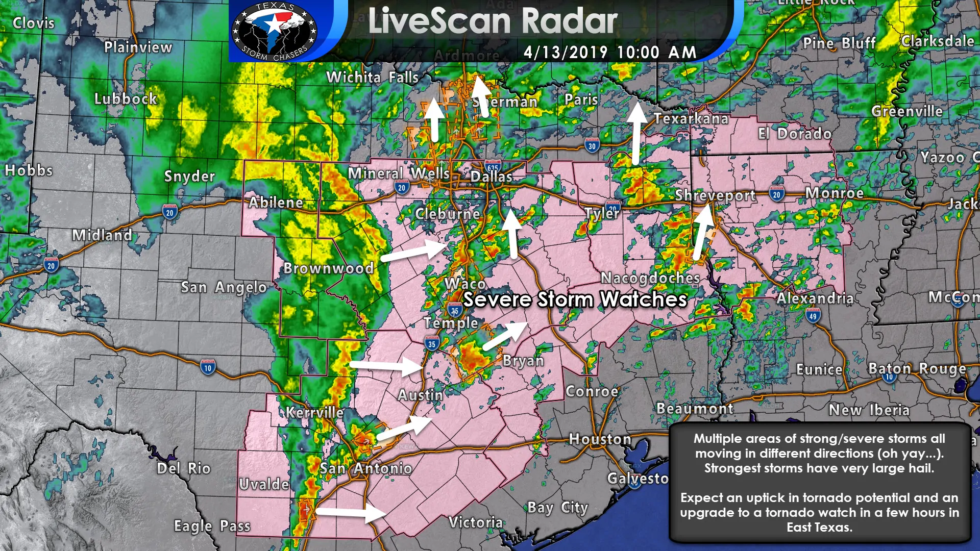
Multiple severe thunderstorm watches are in effect – including North Texas, Central Texas, South-Central Texas, the Brazos Valley, and Northeast Texas. Tornado watches will likely be issued in a few hours for some of those severe thunderstorm watch areas as we start to see an uptick in tornado potential. This uptick in tornado potential will be due to a warm front lifting north across East Texas. As that occurs we’ll see the threat for surface-based storms (and associated tornado potential) increase in a very supportive environment.
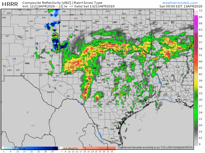
12Z HRRR simulated weather radar from 8 AM until the evening hours. This is only a simulation and should be used as such – real-life may end up looking different.


0 Comments