
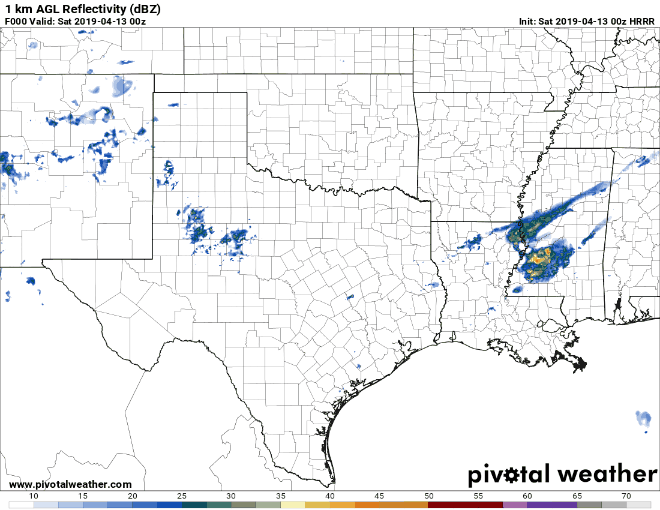
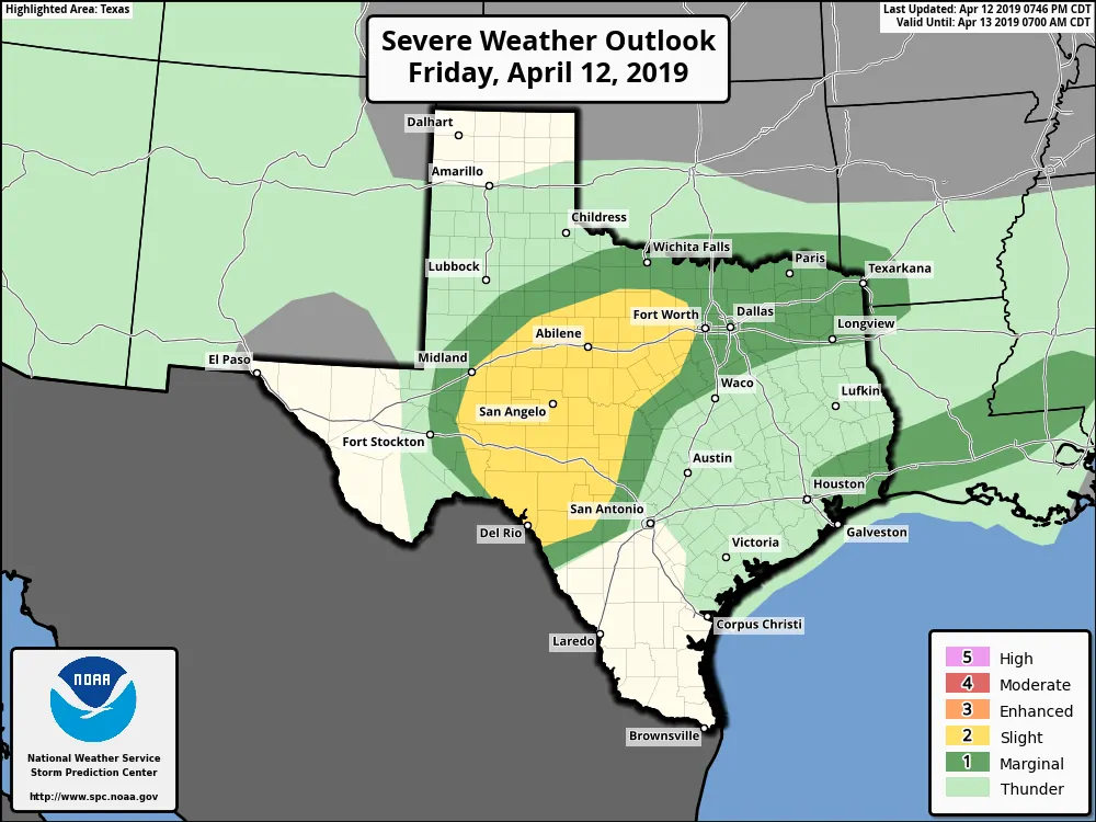
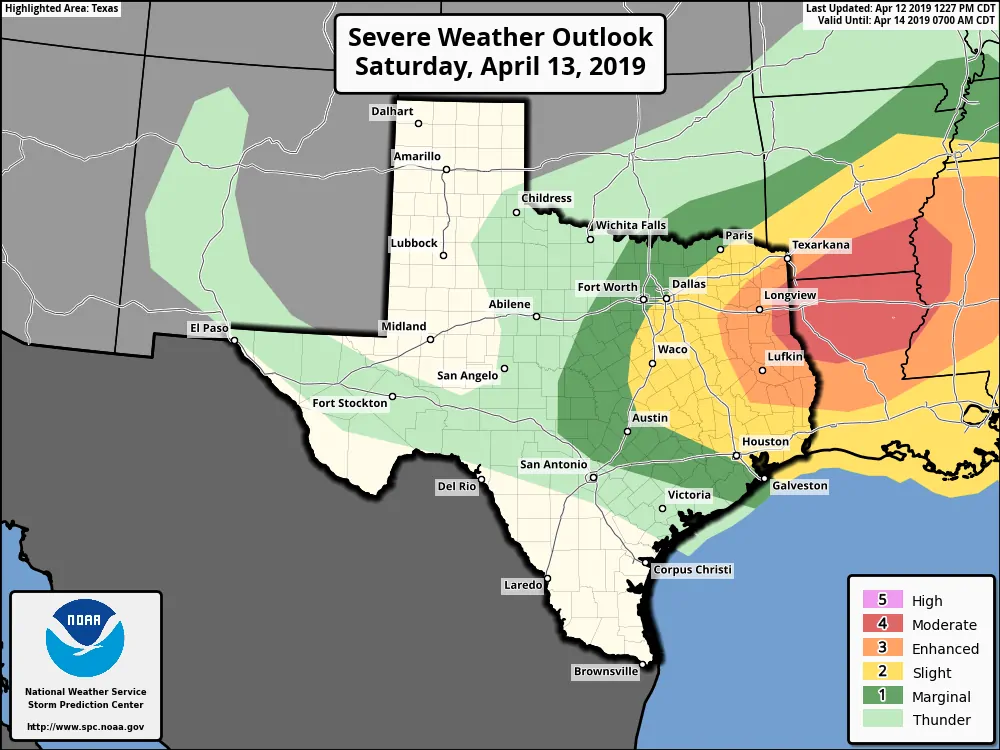
No major updates this late evening as we await the arrival of our next powerful storm system. We currently have a Slight Risk (Level 1) for strong to severe storms overnight and during the pre-dawn hours across southwest Texas up into western north Texas. For tomorrow, the Storm Prediction Center still has an Enhanced Risk (Level 3) and Moderate Risk (Level 4) in place for far eastern Texas and along the TX/LA border. Showers and storms have already begun to form across parts of southeast Texas, western north Texas and northeast Texas late this evening. So far, everything has stayed below severe limits with a warm front currently stalled out just south of Houston which leaves the current storms elevated and not likely to become surface-based…for now. But, all that will change as we get into the morning hours and the counter-clockwise motion of a surface low out west begins to lift the stalled boundary northward. For southeast Texas residents, the most likely timeframe to see severe weather ramp up will be after 8am, although we certainly cannot rule out one or two severe storms before sunrise. North of the front overnight and through noon tomorrow, we’ll have sufficient mid level instability to foster at least a few severe storms with large hail as the primary threat. Expectations as we move through the morning hours will be an increase in widespread storm coverage as the warm front continues to push north towards the I-20 and I-30 corridors. South of the front, storms will continue to form and strengthen throughout the late morning/early afternoon hours, likely peaking for northeast and eastern Texas between noon and 3pm before they begin to cross the border into Louisiana. For areas along and east of the I-45 corridor tomorrow afternoon…tornadoes, some strong, are a distinct possibility. Large hail and damaging winds are highly likely as well. While we still feel the most significant impacts from this powerful storm system will be east of us across central and northern Louisiana, we strongly urge residents across the eastern half of the state, especially deep eastern Texas, to pay close attention to the weather tomorrow. Monitor local media…especially during the afternoon hours. Review your safety plan with family…know where you need to go to seek shelter… and do not delay getting to shelter if warnings are issues for your particular location. We’ll be carefully monitoring the latest data as it rolls in overnight and will be up bright and early to provide updates.
Simulated Radar loop through 5pm Saturday
Tonight….
Tomorrow….


0 Comments