
Does anyone else miss winter yet? Spring has sprung and we’re well into our first early preview of summer. Tomorrow is going to be worse across the eastern two-thirds of Texas as we bump temperatures up a few more degrees and add a sprinkle of humidity. If that wasn’t enough tomorrow is going to be much windier. A windstorm will impact the western third of Texas. As the dryline surges east and humidity values plummet we’ll see critical to extremely critical fire weather conditions develop. A saving grace is that we’re not in extreme drought and some greenup is underway. That’ll hopefully offset what otherwise would be a major wildfire outbreak tomorrow. Nevertheless, any fires that get going could be in overdrive mode and become quite large.
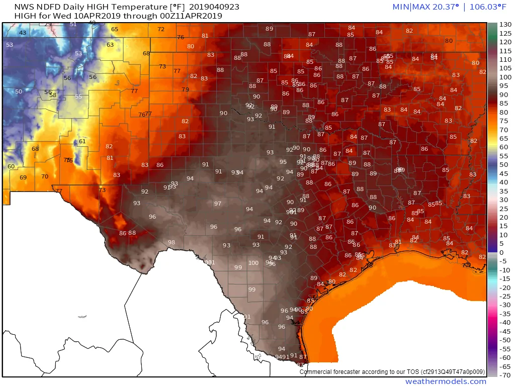
Wednesday’s high-temperature forecast
The Edwards Plateau will make it into the triple digits on Wednesday. Laredo, our typical spring hotspot across the state, may end up making it above 105 degrees. The western suburbs of San Antonio could also make a run at triple digits. Low to upper 90s are expected all the way up Interstate 35 from San Antonio to Oklahoma. East Texas south to Southeast Texas may not hit 90 tomorrow, but higher humidity values will bring along an old friend called the heat index. It’s going to be hot, windy, and all those wonderful attributes that come with Texas six to eight months out of the year. We do note that a sea breeze should bring ‘heat relief’ to the immediate coastline tomorrow, so I know where I’d wanna be.
We’re expecting another high-impact wind storm across the western third of Texas tomorrow. This one shouldn’t be ‘record-breaking’ like the one back in March, but it’s going to still be quite obnoxious. Sustained winds of 40 to 50 MPH with gusts up to 70 MPH out of the west/southwest are expected in the Borderland, Trans-Pecos, Permian Basin, West Texas, and Texas Panhandle on Wednesday. It’ll be noticeably windy across the remainder of Texas too. Widespread blowing dust is probable and we’ll have to see if we get a bonified dust storm in West Texas into Northwest Texas tomorrow afternoon. As stated in the beginning of this post the combination of these winds, hot temperatures, and low humidity will set the stage for explosive wildfire growth – so be mindful. 60-70 MPH winds can easily knock down powerlines – which could ignite wildfires.
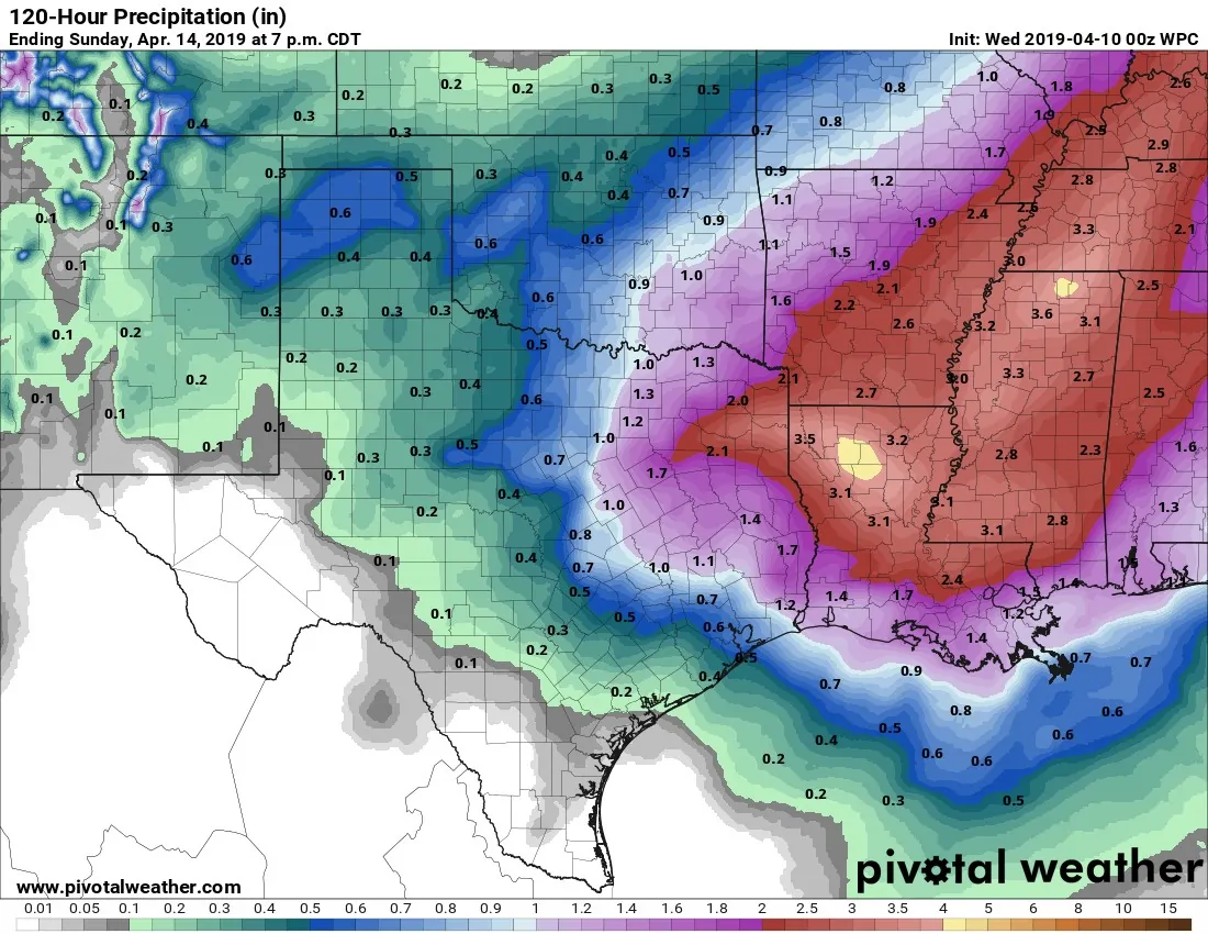
Potential rain totals with our upcoming Friday-Sunday system.
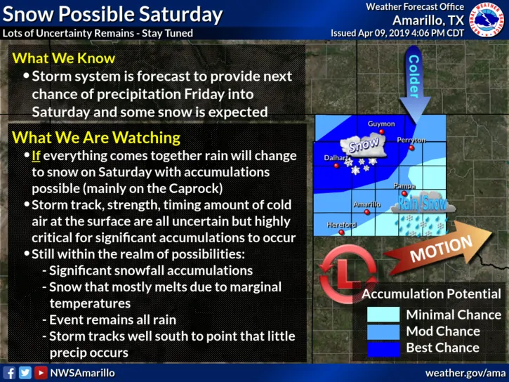
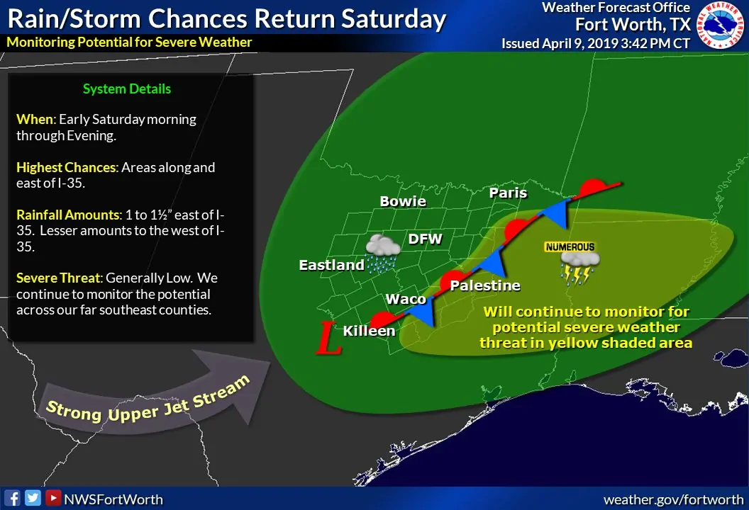
A very strong upper-level storm system will arrive Friday night and continue into Saturday. This system’s track will be unusually far south, which will result in a few notable forecast items to watch. The first is that the mid-week system will dislodge a cold airmass well to our north. That’ll be in place for the Friday night/Saturday morning system across the Texas Panhandle. Rain may change over to snow there and we’ll have to watch for the potential of accumulating winter weather. The second item is we could see a rapid influx of higher moisture values to the south and east of our Saturday system. That will have implications on the potential of severe weather Friday night into Saturday (which does seem to be on an uptick with today’s data). Finally, we’ll also have to watch for the threat of localized flooding as several inches of rain may fall across East Texas – an area already saturated.


0 Comments