
It’s been a loud morning across the eastern third of Texas. Our line of storms extends from Texarkana to Nacogdoches to Spring to Port Lavaca. At this point, most storms are below severe limits. However, we do have a segment of the lin from Henderson and Carthage south to Lufkin and Zavalla still capable of producing 60 to 70 MPH wind gusts. Trees are coming down easily this morning due to saturated soils, so we’ve heard of some power outages as well across East Texas. The strongest storms over the next few hours may produce small hail, heavy rainfall, frequent lightning, and wind gusts of 40 to 65 MPH. The squall line will continue moving east at 35 to 45 MPH through the morning hours.
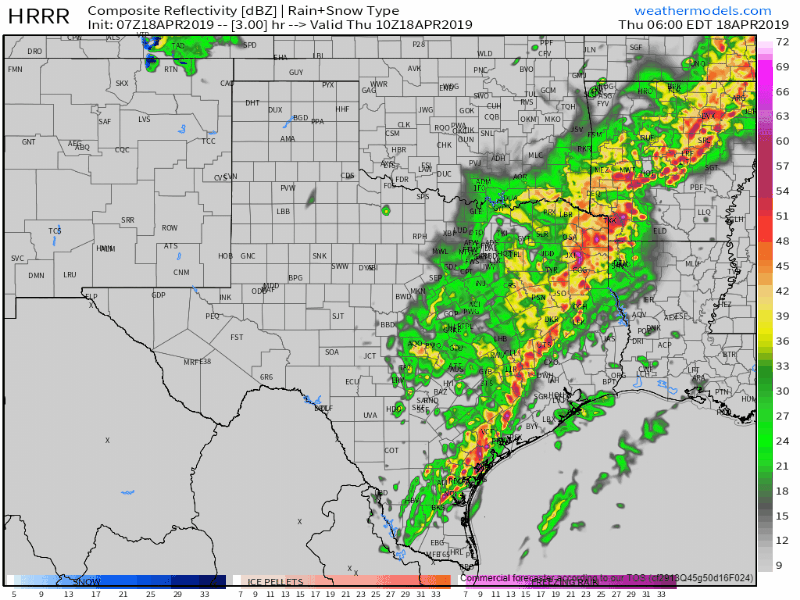
07Z HRRR: Simulated weather radar from 5 AM to 3 PM today. Click image for a full-screen version.
Thunderstorms may continue into the mid-morning hours across Southeast Texas. Storms ongoing in South Texas moving toward the Coastal Bend (Corpus Christi) will move off-shore around 6 AM. Those may actually turn more northeasterly and pass offshore, or very close to shore, in Southeast Texas toward the late morning hours. If those storms do make it back on-shore in Southeast Texas toward the late morning hours they could be strong to severe with a risk of damaging wind gusts over 70 MPH, quarter size hail, and the potential for isolated tornadoes. Low-level wind shear is going to be strong, so we’ll need to keep an eye on this scenario. The threat of severe weather wouldn’t extend more than 30-50 miles inland over far Southeast Texas, but the severe weather threat would be relatively high.
Severe storms will move out of far Southeast Texas by 2 PM with a few showers remaining possible in Texas thereafter. Otherwise, we’ll see gusty northwest winds with temperatures topping out in the 60s and 70s this afternoon (80s in South Texas).


0 Comments