
We’re blessed in this day and age that we have such well-designed and run weather models. I know I complain about them every other day, but even compared to ten years ago, they’re so much better than they used to be. I mean, my goodness, we have high-resolution weather models that are run every hour! What happens when you don’t get ‘good data’ into weather models? They pump out garbage data and predictions. That’s how models have handled tonight thanks to the storm system coming in from Mexico (where there aren’t weather balloons to collect data). So good that the United States is cutting some now in their proposed new budget. Hopefully, we haven’t reached the epitome of observational meteorology, since you can’t accurately predict the weather if you don’t have good observational data. You must first know what the weather is doing before you can try and predict what it’s going to do down the road. Anyway, that’s my annoyed digression this morning.
Since weather models are not handling storms tonight well I’m going to assume that their predictions for later today are likewise flawed. These cases are where you can really appreciate meteorologists – who can actually ‘make their own forecasts’ based on their education and experience. I’m not a meteorologist and certainly don’t pretend to be, but let’s see if we can’t put together a decent forecast update for this morning.
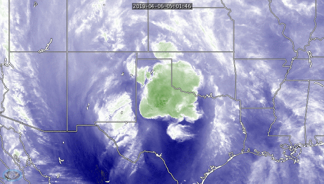
Upper-level water vapor imagery over the last few hours shows our first round of thunderstorms moving from West Texas east/northeast into Northwest Texas. Those storms have weakened over the last 45 minutes but they still contain rain and lightning. Stronger lift from an arriving upper-level storm system (which can be seen in the loop) has sparked off a new line of thunderstorms from near Lubbock to Big Spring to Rankin to not too far north of Sanderson. That line of storms is moving east.
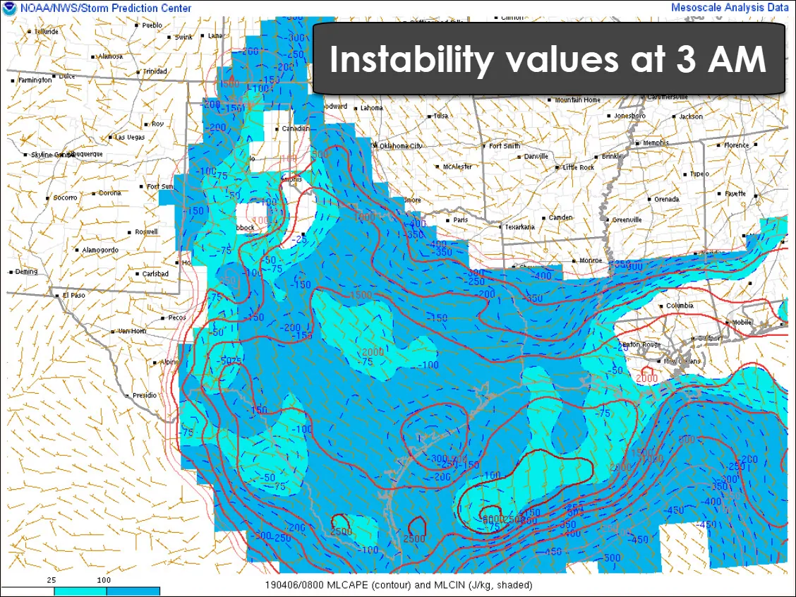
The first round of storms that have been moving toward Wichita Falls has been weakening over the last hour. That makes sense given the decrease in instability values along the Red River. As for the second round of storms now underway in the eastern Permian Basin? Those are moving east with plenty of juice. Even at 3 AM instability values over 1,000 to 1,500 J/Kg of CAPE (Convective Available Potential Energy) – which is plenty supportive of organized storms.
I won’t dive into the kinematics (wind shear/wind energy), but they’re also supportive of organized storms. Storms this morning are elevated above a low-level cap. That keeps the threat of tornadoes very low. Large hail up to the size of golfballs and localized wind gusts up to 65 MPH are possible with the strongest storms. If the squall line became organized enough to overcome that cap? The threat for brief tornadoes would increase in stronger sections of the squall line – mainly in the Concho Valley over the next several hours.
Most models don’t believe there should be a line of storms right now across the eastern Permian Basin. Obviously, they’re not correct, so that means we’ll have to do some ‘nowcasting’. No fancy model radar graphics with this update I’m afraid.
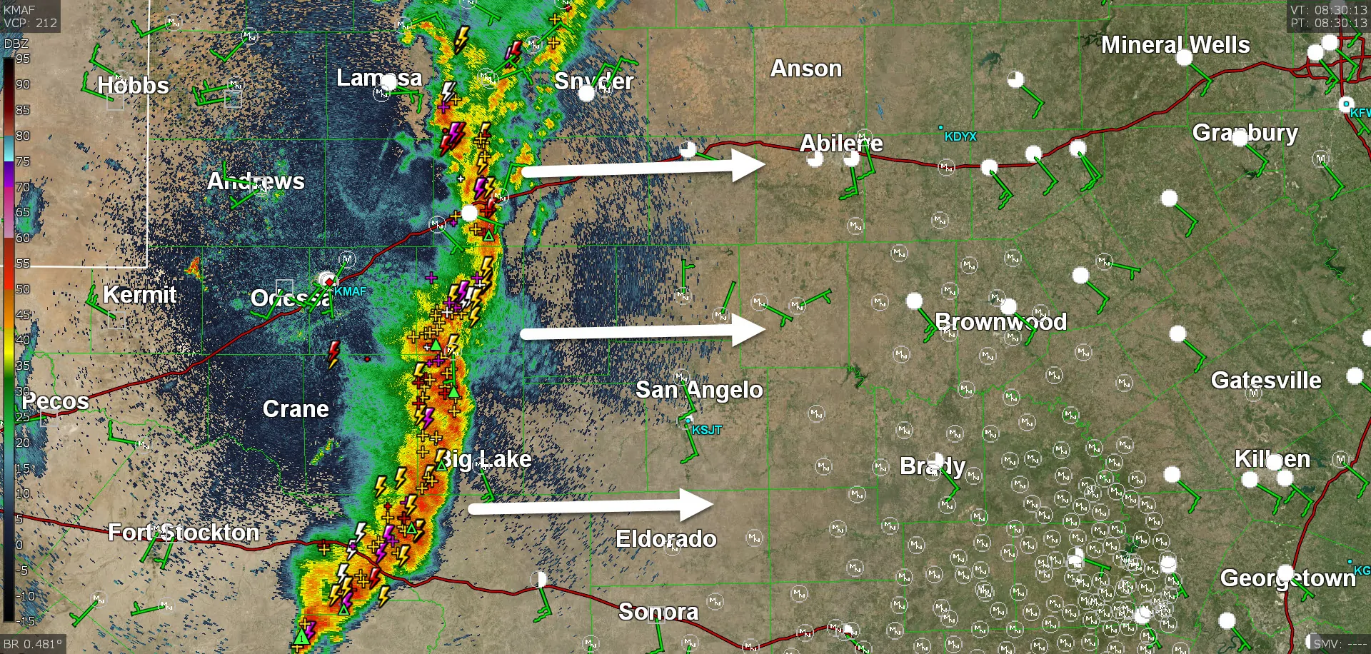
Given the storm development over the last hour, I don’t see why these storms won’t make it east into the Big Country and Concho Valley through 6 AM. Some storms may be severe with a threat of hail and localized damaging wind gusts. Heavy rainfall is also occurring. The first round of storms helped to partially stabilize the airmass across West Texas into Northwest Texas. Storm intensity/coverage up there is more uncertain, but I can’t rule out more storms later this morning.
Will the squall line make it into North Texas, Central Texas, and the Hill Country later this morning? Well, maybe. It may weaken and push out an outflow boundary to the east. The storms themselves may make decent progress toward I-35 by late morning while slowly weakening. Regardless, outflow boundaries should help spark off new storms by this afternoon across Central Texas, North Texas, the Brazos Valley, into East Texas, and Northeast Texas.
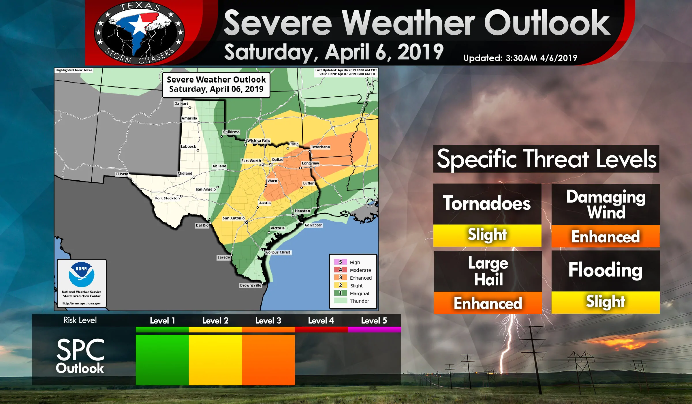
The strongest storms, regardless of if they’re from this morning or new storms this afternoon, will be capable of producing large hail up to the size of golfballs and localized damaging wind gusts up to 70 MPH. Isolated tornadoes cannot be ruled out. The threat of a tornado would be comparatively higher if any storms interacted with boundaries, or if a segment of a squall line started to ‘bow’.


0 Comments