
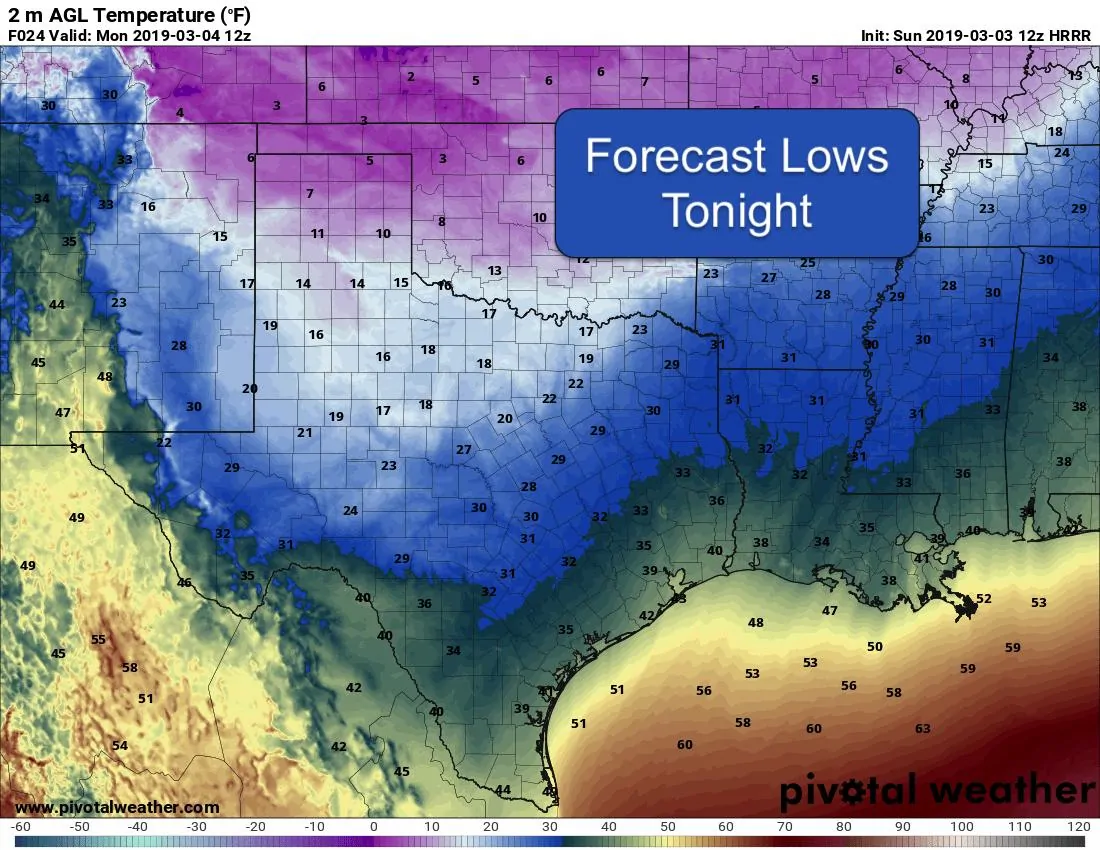
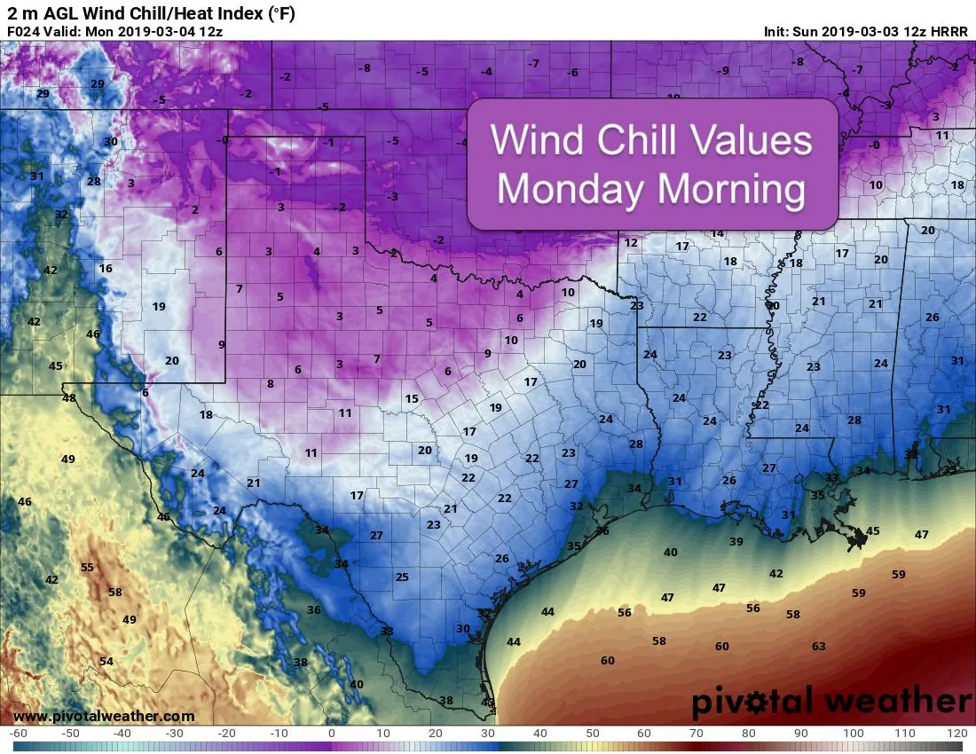
A frigid arctic airmass (aka Cold Airmass of Doom) is making quick progress towards the coast late this morning. We have quite a temperature gradient across the state with Amarillo currently at 12 degrees and Brownsville currently at 80. As of this writing, the front has cleared the central Texas counties and will likely clear the upper coast within the next hour or so, and deep south Texas by later this afternoon. Freezing drizzle was reported earlier this morning across the panhandle and into parts of north central Texas, but precipitation behind the front is quickly drying out and we expect no further issues with wintry weather during the day today. Overnight, the northern panhandle may see another quick round of snow/flurries, and parts of western north Texas and the Red River counties may see a brief window early tomorrow morning for seeing flurries, but other than that our chance for wintry weather is expected to come to an end. The main concern for the next 24-48 hours will be the unseasonably cold air and wind chills early Monday morning. Chills are expected to drop below zero by daybreak Monday across much of the panhandle region. For north Texas, we’ll see chills down in the single digits. Further south across central Texas, chills in the low teens to low 20s will be likely. All of northern Texas and down into parts of central Texas will experience hard freeze conditions Monday morning. Hard Freeze conditions will be present overnight and into early Monday across all of northern Texas and down into the central Texas counties. Hopefully no one has planted spring flowers yet. If you have, be sure to cover them and hope for the best.
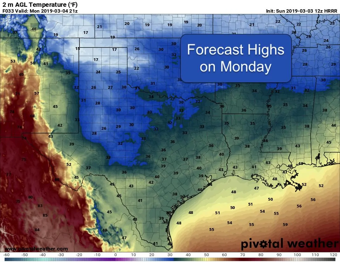
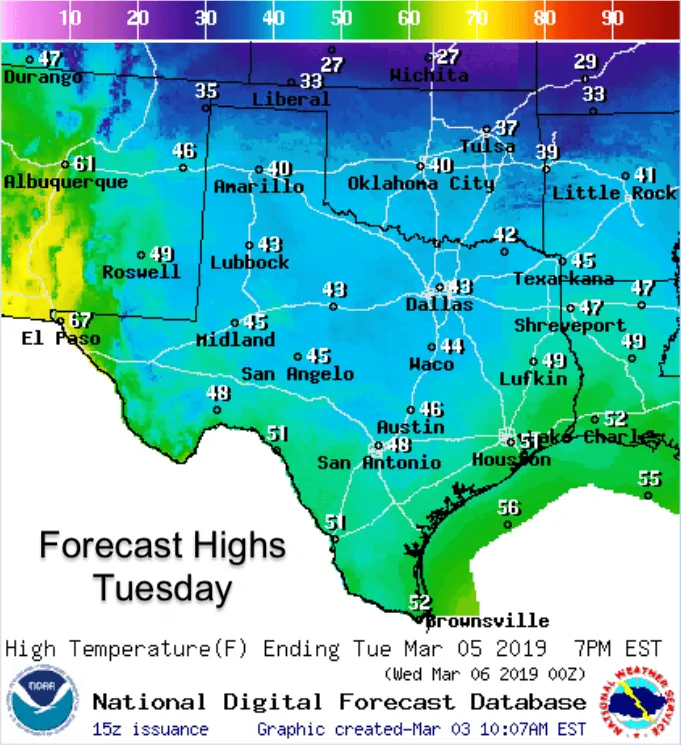
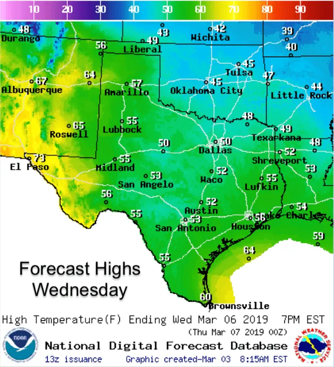
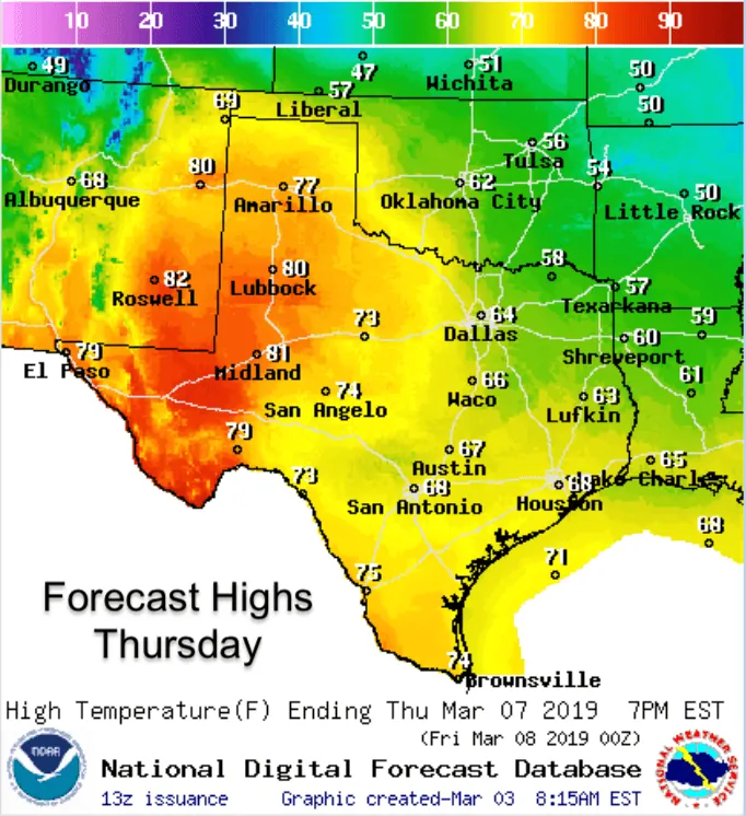
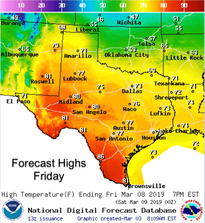
Cold arctic air will remain in place through Tuesday before we undergo a fairly rapid warmup into the latter part of the work week. By Thursday and Friday, we’ll see temps rebound into the 60s and 70s across a broad swath of the state, especially for areas west of the I-35 corridor. Rain chances will begin to return by mid-week across south, central and eastern Texas by the latter part of the week, but overall the end of the work week and into next weekend look quite mild compared to what we’ll be dealing with today, tomorrow and Tuesday. We can’t say this will be the last blast of frigid air for the season, but as we move deeper into March, the likelihood decreases…so let’s keep our fingers crossed that Winter will release its grip soon!


0 Comments