
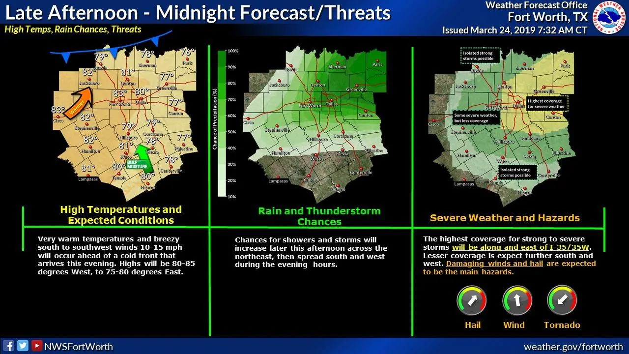
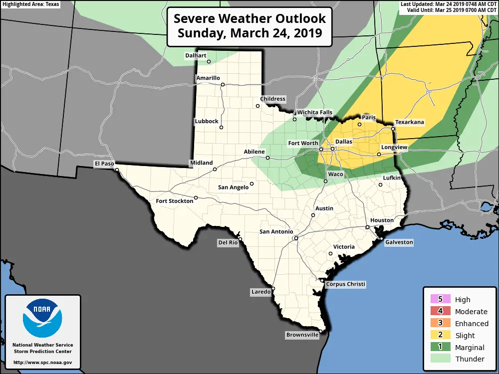
An active weather pattern continues today with another chance for strong to severe storms across portions of north central and northeast Texas. The Storm Prediction Center has outlined areas from Dallas/Ft Worth and eastward under a Slight Risk (Level 2) for severe weather later this evening and into the overnight hours. The morning and afternoon hours will be rain-free, so don’t expect any issues if you have travel or outdoor plans during the day. Storm development this go-round will not happen until late afternoon and into the evening and overnight hours as an upper level disturbance arrives coincident with a cold front. Favored areas for strong to severe storm development will be primarily along and east of the I-35 corridor and extending into northeast Texas by late afternoon. This will include portions of the DFW metroplex, so heads up if you have plans late this evening. As we get into the overnight hours, the threat for storms will shift south and east as the cold front slowly treks south into the state. The main threat any storms that develop this afternoon and during the early overnight hours will be large hail, damaging winds and frequent lightning. The tornado threat is non-zero, but very low…with better chances further northeast and into Arkansas. Unlike yesterday, forecaster confidence is higher that we will actually see more numerous and vigorous storm development. This is not a guarantee that everyone will see storms, but we will see more expanded coverage than yesterday…especially for folks northeast and east of the the immediate DFW metroplex. As we lose instability from daytime heating into the overnight hours, the severe threat will wane, but portions of eastern Texas will continue to see the threat for a few strong storms continuing overnight into early Monday.
—The main takeaways for this evening’s storm chances —-
-
Strong to severe storms are possible late this afternoon and evening for parts of the DFW metro into northeast Texas
-
Large hail, damaging winds and frequent lightning will be the main threats
-
Storm coverage is expected to be more than we saw yesterday, but not everyone will see storms
-
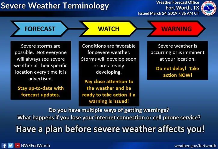
Have a way to receive weather warnings and notifications if you have outdoor plans. Monitor local media for the latest on storms that develop in your immediate area.


0 Comments