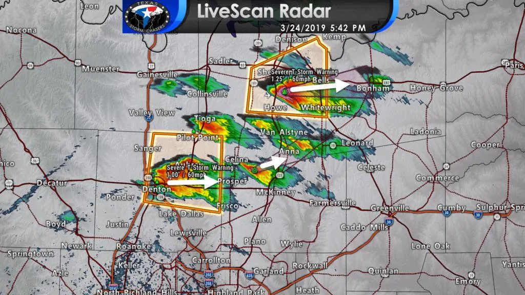
A severe thunderstorm watch is in effect until midnight for eastern North Texas and Northeast Texas. This does include the D/FW Metroplex – where severe storms have quickly erupted over the last half hour.
Storms in Denton and Grayson counties have gone supercelluar and could produce large hail as they move east around 20 MPH. The threat also exists for localized damaging wind gusts. The tornado threat is very low, but not zero this evening. Additional thunderstorms may develop over the next couple of hours across D/FW as the cool front is still to the northwest.
Additional thunderstorms are expected to fire up this evening across eastern North Texas and Northeast Texas as a cool front moves south of the Red River. Those storms will have the potential of being severe with large hail and damaging winds. With time and probably late tonight they could grow into a small cluster or small line. That line would have the potential of damaging winds and hail as it moves south/southeast. The severe weather threat may continue into the early morning hours Monday in Northeast/East Texas.
We’re now entering nowcast mode. We’ll try and post blog updates about every one hour with the next one coming around 7 PM. Much more frequent updates will be posted on social media, especially on our Twitter account (which you can follow here – no twitter account needed).


0 Comments