
A line of strong to severe storms extends from Avery to Mount Vernon to Quitman to Van to Athens to Mexia to Marlin to Rosebud. Several sections of the squall line have been put under severe thunderstorm warnings over the last several minutes. The strongest storms in the squall line are capable of producing wind gusts up to 60 MPH. Small hail is also possible. Movement with the line is to the east at around 45 MPH.
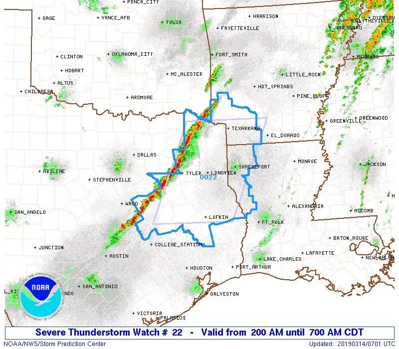
Given the increasingly organized storms over the last hour, the Storm Prediction Center has issued a severe thunderstorm watch. This watch runs through 7 AM and includes all of East Texas and the Arklatex. The primary severe weather threat with the strongest storms will continue to be damaging straight-line winds of 55 to 65 MPH. Small hail and a brief tornado cannot be ruled out.
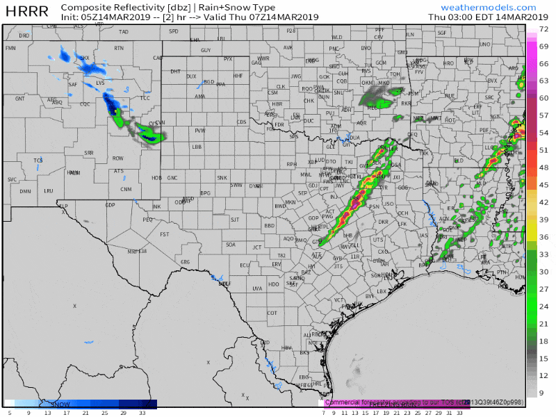
05Z HRRR: Simulated weather radar for the next several hours. This model won’t have the exact placement/timing completely right, but it gives a general idea of what to expect.
We do anticipate the squall line will continue to produce strong to damaging winds over the coming few hours as it moves east through Northeast Texas and East Texas. Small hail is also possible and I can’t rule out a very brief tornado, but that threat is very low. Heavy rain and cloud to ground lightning are occurring with all storms this morning. The squall line over Central Texas will move southeast into the Brazos Valley over the next hour or two. Those storms are also capable of producing small hail and gusty winds, but the threat for higher-end winds (55+ MPH) seems to be lower than farther northeast. Still, we’ll be watching it. You can watch it all too with our free HD interactive weather radar. Just click here or use our main menu up top.


0 Comments