
Severe thunderstorms are impacting the Trans-Pecos and will be moving into West Texas and the Permian Basin by 10 PM. These storms have a history of producing tornadoes, baseball size hail, and wind gusts over 75 MPH. Hail will become a lesser concern after midnight. There have been no substantial changes to the severe weather outlook. The main threat overnight into Wednesday morning will be localized to more widespread damaging straight-line winds. Brief tornadoes are possible in intense portions of the squall line given extreme shear values in place. The line will move east across the western half of Texas by sunrise Wednesday. The squall line will weaken as it moves east, but could still be strong to severe as it approaches Interstate 35 in North Texas around 5 AM Wednesday.
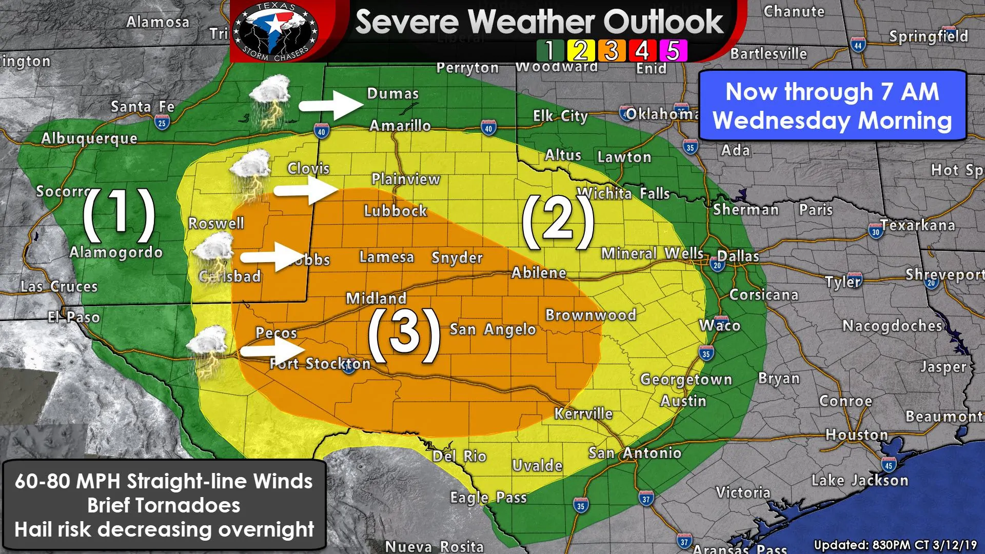
Level 3 Risk: West Texas, Permian Basin, Concho Valley, Big Country. A nearly 1/3 chance of having damaging wind gusts of 60 to 80 MPH within 25 miles of your location. Brief tornadoes and spotty hail are also possible.
Level 2 Risk: Southern half of the Texas Panhandle, Northwest Texas, western North Texas, the Hill Country, and the northern Edwards Plateau. A nearly 1 in 5 chance of damaging winds of 60 to 75 MPH within 25 miles of your location. Brief spin-up tornadoes may occur in stronger segments of the squall line.
Level 1 Risk: The northern Texas Panhandle, a small portion of North Texas, Central Texas, and South-Central Texas. The eastern delineation of the level one risk will actually expand into all of Northeast Texas, East Texas, and Southeast Texas after 7 AM Wednesday through the morning and early afternoon hours. A level one risk means there is a 5% chance of severe weather occurring within 25 miles of your location. This typically means most storms are sub-severe, but some may not be.
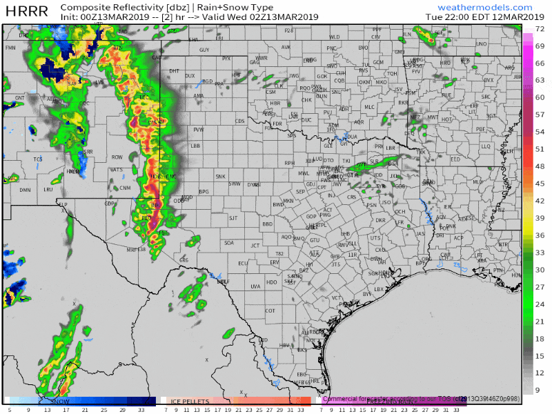
0Z HRRR: Simulated weather radar from 9 PM tonight through 12 PM Wednesday. Timing may be an hour off for storms overnight, but this provides a general guideline on highest intensities and timing. Keep in mind even weaker storms may be able to transport 40-60 MPH winds to the surface due to extremely strong winds aloft.
A nearly solid line of thunderstorms will move east and impact the western half of Texas by 7 AM Wednesday. That squall line, in a weakened state, will continue eastward and move over Northeast Texas, East Texas, and Southeast Texas after sunrise and by lunchtime be into Arkansas and Lousiana. Timing will likely vary an hour or two, but here are a few arrival times for more intense segments of the squall line…
Midland & Odessa: Now through midnight
Abilene: 1-3 AM
San Angelo: 1-3AM
Wichita Falls: 2-4AM
Denton & Fort Worth: 4-6AM
McKinney & Dallas: 5-7AM


0 Comments