
I’ve just about run out of ways to describe the cold weather we’re experiencing. Northerly winds of doom, annoying wind chills that are stupidly cold for March, colder than a well-digger’s behind, etc. Actually, I did alter that last one to make it more family friendly, but undoubtedly some of you have more descriptive methods to the cold. I’m actually a snow lover myself, but without snow, this cold is just about put me at my limit for March. I’m ready for spring and luckily it looks like I’ll be getting my wish by the end of the work week. Before that warm up? Yeah, it’s still going to be annoyingly cold for March.
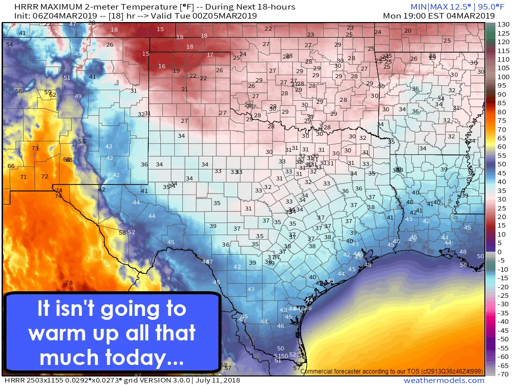
Today’s high temperature forecast
Those northerly winds are going to keep cold air advection in full force today. That means temperatures are going to struggle to climb much this afternoon. In fact, you’ll need to be south of Interstate 10 to get out of the 30s this afternoon. Well, unless you’re in the Borderland. El Paso will top out at 74 degrees or so today. Wind chill values will be 10 to 15 degrees lower than the air temperature. It’s going to be one seriously cold Texas day, whether today was in December, January, or March.
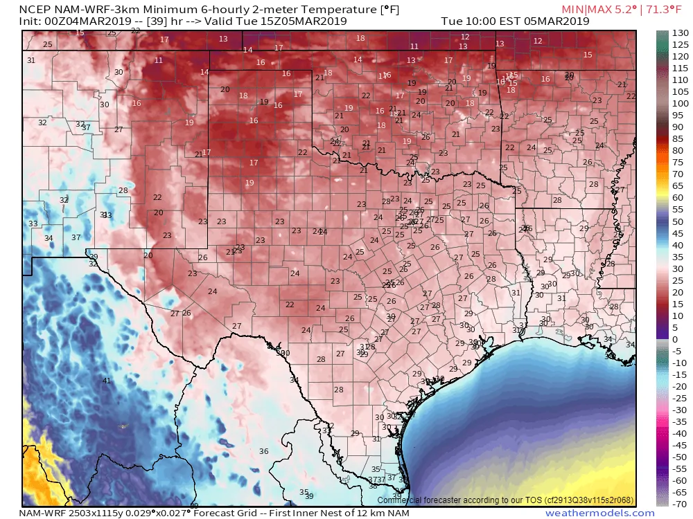
Tuesday morning is looking like a cold one!
A freeze is probable for much of Texas tonight. The only folks who may escape are in Deep South Texas and the Rio Grande Valley. The weather model I’m using for this temperature forecast may be being a bit too aggressive south of Interstate 10, while not aggressive enough across the Panhandle. Regardless, those with interests in agriculture or the growing season are not going to like tonight’s forecast. Most locations will experience a hard freeze for several hours before temperatures rise above freezing on Tuesday.
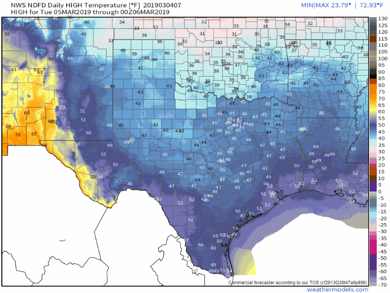
High temperature forecast from Tuesday (tomorrow) through Saturday from the National Weather Service
Temperatures on Tuesday will be a bit warmer than today, but it’ll still be chilly. We’ll start recovering on Wednesday with temperatures quickly rebounding on Thursday. By Friday it looks like we’ll have high temperatures in the 60s, 70s, and 80s across all of Texas. Heck, we may even have a couple of 90s across Deep South Texas by Saturday. We’ll be switching from a winter freeze to spring – pretty much like you’d expect in March.
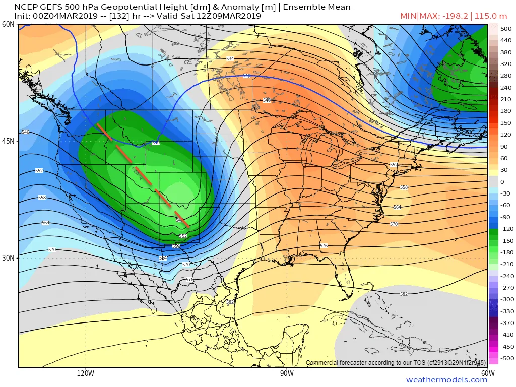
A look at the mid-levels of the atmosphere by the end of the work week. Those greens/blues mark the arrival of our next upper-level storm system.
With spring temperatures comes the potential for spring storm mischief. We’ll be watching for that possibility closely as we head into Friday night and on Saturday. While we’re not trying to get specific on something 6 days out, we are seeing signs of a potent upper-level storm system and associated surface low moving across the Plains on Saturday. That kind of system in combination with a spring-like airmass always makes us keep our eyes peeled for thunderstorm potential. Indeed, we will need to watch for the threat of strong thunderstorms, especially along and east of Interstate 35 on Saturday. Beyond that, we’re just in the waiting phase since this system is still way out in the Pacific Ocean. However, it has been showing up in model-land for a while now.


0 Comments