
March 17 4:30 PM Update: The National Weather Service in Midland has confirmed an EF-1 tornado impacted just east of Andrews, Texas during Tuesday’s evening’s severe storms. That tornado was rated EF-1 with maximum estimated winds between 80 and 100 MPH. Straight-line winds up to 100 MPH also impacted Snyder, TX. Both of those damage surveys have been added to the map below.
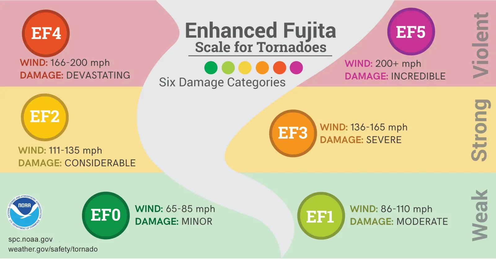
Original post from March 14 7:08 PM CT: National Weather Service meteorologists across the state have been busy conducting damage surveys from the storms experienced Tuesday night through Thursday morning. Most of the wind damage experienced across West Texas, the Permian Basin, Big Country, Concho Valley, North Texas, Central Texas, and East Texas was caused by straight-line winds. Five brief tornadoes have been confirmed after detailed damage analysis. These five tornadoes were all in the ‘weak’ category with maximum peak winds ranging from 80 to 110 MPH.
These brief tornadoes generally occurred within larger areas of damaging straight-line winds. Brief tornadoes that ‘spin up’ within squall lines are notoriously difficult to issue tornado warnings for because the develop and dissipate so quickly. That’s why you should take severe thunderstorm warnings seriously. Severe storms can and do produce tornadoes without a tornado warning, especially these brief/weak spin-up tornadoes.
Weather radar only scans about every 2-3 minutes and most of the confirmed tornadoes were only down for a few minutes. In addition, radar beams go out in straight lines. With earth’s curvature, those radar beams increase with height with distance from each weather radar. Squall line tornadoes (QLCS tornadoes) typically develop quickly and are contained within shallow circulations. Not only do they happen between radar beam scans, but they’re also sometimes ‘overshot’ by the radar beam itself!
Damaging straight-line winds of 65 to 85 MPH caused wind damage across the D/FW Metroplex Wednesday morning. Those winds were not associated with tornadic circulations, yet produced significant damage. That’s why we say it doesn’t matter if it’s straight-line winds of a brief tornado – both produce damage! I think it’s safe to say we’ve begun our spring severe weather season. It’ll continue in full force through mid to late May, although some years we keep going into June. If you haven’t put together or reviewed your family’s severe weather safety plan I encourage you to do so. We’ve got a brand new page up with safety tips and plans for you and your family.
Thus far it appears the wind damage experienced in East Texas this morning was caused by straight-line winds of 60 to 75 MPH. Those high winds can produce more widespread damage in the Arklatex and East Texas because of all the trees. Falling trees can impact structures, block roadways, knock out infrastructure, and cause a messy scene.
Some National Weather Service offices upload specific damage survey results with photos to a database. We’ve compiled those results into a Google map below. With a few of the tornadoes, we’ve manually added the start and end points, so their paths are an approximation. Below the map are the written details of each confirmed tornado from the National Weather Service offices in Lubbock, San Angelo, and Fort Worth.
Andrews, Texas Tornado

Rating:                 EF-1
Estimated peak wind:    80-100 mph
Path length (statute):  Approximately 1 mile
Path width (maximum):   Roughly 350 yards
Fatalities:             0
Injuries:               0

Start date:             03/12/2019
Start time:             9:55pm CDT

End date:               03/12/2019
End time:               10:00pm CDT

Specifics on damage and damage locations will be included
in the final storm damage write-up that will be completed shortly.
Anton, Texas Tornado
Rating: EF-1
Estimated Peak Wind: 110 MPH
Path length: 2.0 Miles
Path width: 200 Yards
Fatalities: 0
Injuries: 0
Start date: 03_12_2019
Start time: 1035 PM CDT
Start location: 1 mi SE Anton, TX
Start Lat/Lon:
End date: 03_12_2019
End time: 1043 PM CDT
End location: 1.7 mi NE Anton, TX
End_lat/lon:
Tornado embedded in rain within a line of storms, moving from
south-southwest to north northeast traveled approximately 1 mile
east of Anton, TX causing significant damage to a single family
residence, destroying a large metal building, snapping tree limbs
and powerlines and causing damage to a center pivot. The tornado
path was approximately 2 miles and was approximately 200 yards
wide. The Lubbock radar showed a TDS [Tornado Debris Signature] likely from the house and
large metal building, was lofted to around 4000 to 5000 feet
above the ground.
Zepher, Texas Tornado
RATING: EF-1
ESTIMATED PEAK WIND: 90 MPH
PATH LENGTH /STATUTE/: 1.4 MILES
PATH WIDTH /MAXIMUM/: 230 YARDS
FATALITIES: NONE
INJURIES: NONE
START DATE: MAR 13 2019
START TIME: 319 AM CDT
START LOCATION: 0.4 Miles NW of Zephyr
START LAT/LON: 31.6790/-98.8001
END DATE: MAR 13 2019
END TIME: 321 AM CDT
END LOCATION: 1 Mile E of Zephyr
END_LAT/LON: 31.6764/-98.7766
SURVEY SUMMARY: On Wednesday, a National Weather Service team
surveyed damage from Tuesday night`s storms in Zephyr and
Junction. In Zephyr, they found evidence of tornado damage
consistent with an EF1 tornado, with estimated wind speeds from 86
to 110 mph. Along its path, the tornado overturned a small
residence and threw it 50 feet from its foundation. Thankfully
the resident of the home was uninjured. The tornado tore off
several roofs. It destroyed awnings and power lines, snapped power
poles and trees and damaged a grandstand. The tornado wrapped the
metal of a roof tightly around a tree as it blew out the wall of
a store.
Junction, Texas Tornadoes
.JUNCTION TORNADO # 1…
RATING: EF-0
ESTIMATED PEAK WIND: 80 MPH
PATH LENGTH /STATUTE/: 0.20 MILES
PATH WIDTH /MAXIMUM/: 30 YARDS
FATALITIES: NONE
INJURIES: NONE
START DATE: MAR 13 2019
START TIME: 300 AM CDT
START LOCATION: 0.8 Miles WSW Junction
START LAT/LON: 30.4861/-99.7843
END DATE: MAR 13 2019
END TIME: 301 AM CDT
END LOCATION: 0.6 Miles WSW Junction
END_LAT/LON: 30.4867/-99.7812
SURVEY SUMMARY: In Junction, the NWS survey team found evidence of
two tracks from one tornado. The first touchdown was located 0.8
miles WSW of Junction in a residential neighborhood. At this
location, they found damage to storage sheds and an awning. The
tornado broke a power pole near the base and blew out windows of
a nearby residence. The tornado damage was consistent with an EF0
tornado with estimated winds ranging from 65 to 85 mph.
.JUNCTION TORNADO # 2…SECOND TOUCHDOWN
RATING: EF-1
ESTIMATED PEAK WIND: 100 MPH
PATH LENGTH /STATUTE/: 0.70 MILES
PATH WIDTH /MAXIMUM/: 140 YARDS
FATALITIES: NONE
INJURIES: NONE
START DATE: MAR 13 2019
START TIME: 303 AM CDT
START LOCATION: Junction
START LAT/LON: 30.4900/-99.7756
END DATE: MAR 13 2019
END TIME: 305 AM CDT
END LOCATION: 0.5 Miles E Junction
END_LAT/LON: 30.4894/-99.7637
SURVEY SUMMARY: The second touchdown began on Main Street in
Junction between 14th Street and 5th Street. The tornado ripped off
several roofs, blew out windows and damaged trees and power lines.
It turned a one by four piece of wood into a missile. This missile
went through a metal eave of a residence and into the exterior wall
of the residence just above the window. The damaging winds also
turned a deer feeder lid into a missile and lodged it into the side
of a business. The damaging winds blew out an overhead door at the
fire station. The second touchdown produced EF1 damage, with
estimated wind speeds between 86 to 110 mph.
Mineral Wells, Texas Tornado
..Mineral Wells Tornado…
Rating: EF1
Estimated Peak Wind: 95 mph
Path Length /statute/: 2.30 miles
Path Width /maximum/: 250.0 yards
Fatalities: 0 Injuries: 0
Start Date: 03/13/2019
Start Time: 03:25 AM CDT
Start Location: 1 E Mineral Wells / Palo Pinto County / TX
Start Lat/Lon: 32.8088 / -98.0927
End Date: 03/13/2019
End Time: 03:28 AM CDT
End Location: 3 E Mineral Wells / Parker County / TX
End Lat/Lon: 32.8117 / -98.0534
Survey Summary:
This tornado developed immediately east of downtown Mineral Wells, in
an industrial area. Initial damage was confined to some sheet metal
roofing removed from a manufacturing storage building. As the tornado
moved east, it produced EF-0 scale damage to commercial signage
and roofs along the US 180 corridor. Windspeed intensity appeared to
increase along US 180 from the Garrett Morris Parkway intersection eastward,
with enhanced signage, roof, utility pole and tree damage observed. A commercial
automotive repair center located just southeast of Mineral Wells High School
sustained significant roof and wall damage consistent with low end EF-1 intensity
tornadic winds. The tornado appeared to dissipate near the intersection of
US 180 and Washington Road.
Northwest Parker County Tornado
..Northwest Parker County Tornado…
Rating: EF1
Estimated Peak Wind: 90 mph
Path Length /statute/: 0.75 miles
Path Width /maximum/: 250.0 yards
Fatalities: 0
Injuries: 0
Start Date: 03/13/2019
Start Time: 03:37 AM CDT
Start Location: 7 NE Cool / Parker County / TX
Start Lat/Lon: 32.864 / -97.9102
End Date: 03/13/2019
End Time: 03:39 AM CDT
End Location: 8 NE Cool / Parker County / TX
End Lat/Lon: 32.8685 / -97.8989
Survey Summary:
This tornado formed along Cabaniss Lane, just south of New Authon Road, in
northwest Parker County. Minor tree trunk and branch damage was oriented in
a convergent pattern along and east of Cabaniss Lane. The tornado tracked east
northeast, seriously impacting a site-built frame home located on FM 1885
just south of New Authon/Precinct Road. Most of the home`s wood rafter roof,
clad in plywood and sheet metal, was removed from the home and deposited in
the front yard of the residence. Minor damage was observed to trees and
outbuildings in the vicinity of the home. Significant damage also occurred
to a metal-clad commercial building located approximately 200 yards southeast
of this home. Metal roof cross members were severely twisted on this building,
and most of the sheet metal roofing was removed and deposited along FM 1885.
The tornado crossed FM 1885 and continued for a short distance, producing
minor tree damage. It ultimately dissipated as it reached Precinct Road,
just east of FM 1885.


0 Comments