
At the time of this writing, a line of thunderstorms extends from Sanderson to McCamey to Big Spring to Post to Idalou to Plainview. There are embedded stronger cells within the rain-shield located over the southern Texas Panhandle. We did have a brief tornado near Anton (northwest of Lubbock) around 10:40 PM. Wind gusts over 70 MPH were recently measured by the West Texas Mesonet with the line segment approaching Post. The storms approaching Big Spring are also looking mighty strong. Thus far we haven’t seen a ‘widespread’ damaging wind threat materializes. However, that could change if we see a bow-echo begin to develop, or the process of the storms ‘bowing out’. There are some indications that could occur as the storms in the Permian Basin make their way toward Sweetwater and Abilene over the next 2-3 hours.
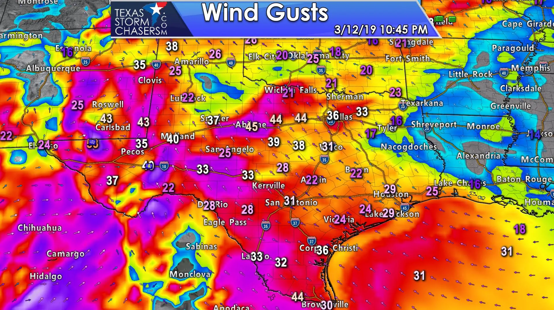
Damaging straight-line winds over 70 MPH and brief tornadoes remain possible with the strongest storms in the squall line. We continue to anticipate them moving into North Texas after 2-3AM and entering the western metroplex around 4-6AM. The line will slowly weaken as it approaches I-35 and moves east, but strong winds remain a possibility in the metroplex. Well, strong thunderstorm winds from the west. Honestly, we may end up having more issues tonight from the gradient winds ahead of the storms versus the localized wind damage from the storms themselves. Brief tornadoes are also possible as the line moves east across the Big Country, Concho Valley, and into western North Texas overnight. Small hail also cannot be ruled out, but we anticipate the damaging winds and heavy rainfall to be the primary threat.
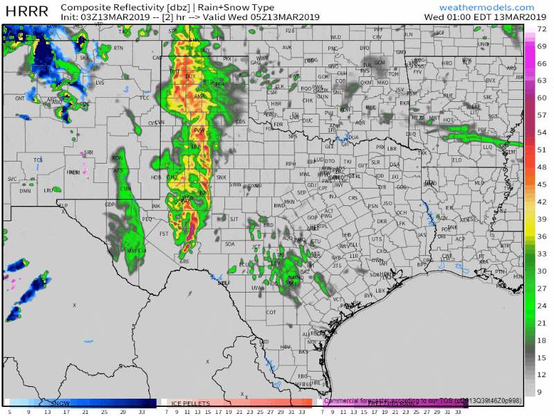
03Z HRRR Simulated weather radar from midnight through 12 PM Wednesday.


0 Comments