
It looks like we may have two ’rounds’ of showers and thunderstorms tonight. The first is more questionable as to the intensity of the storms, while the second is more likely to have the threat of strong to severe storms. The strongest storms overnight into Saturday morning may be capable of producing large hail up to the size of golfballs, localized wind gusts up to 70 MPH, and a low threat of a tornado. There may be a corridor of comparatively higher tornado potential in Northeast Texas from about 7 AM to 11 AM in Northeast Texas.
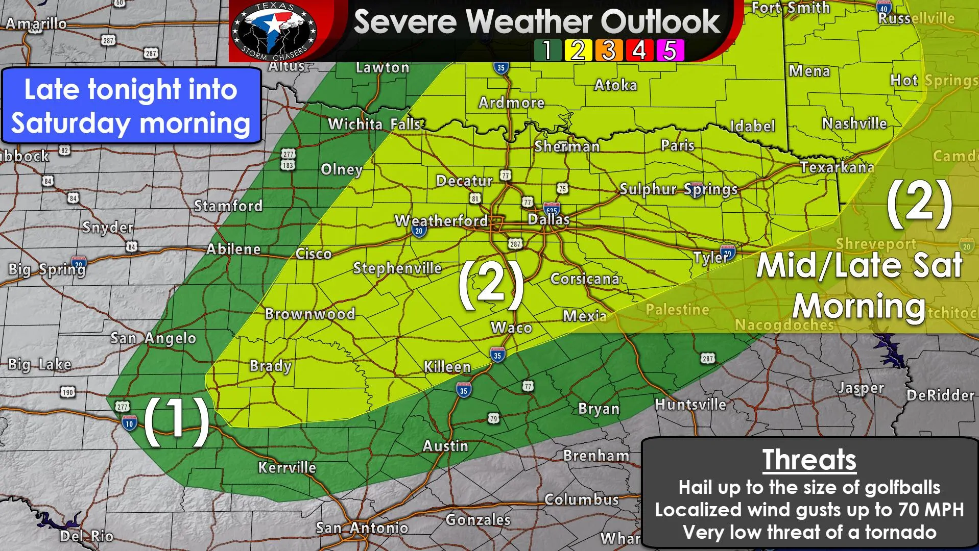
The standard level two risk of severe weather includes all of North Texas and Northeast Texas. Brady, Brownwood, Stephenville, Graham, Gainesville, the entire D/FW Metroplex, Hillsboro, Waco, Corsicana, Sherman, Paris, Canton, Palestine, Tyler, Longview, and Texarkana are a few cities included. This level two risk means those in or near it have a 15% chance of having severe weather occur within 25 miles of their location. A level one risk surrounds the higher probabilities and means there is a 5% chance of having severe weather occur within 25 miles of any given point (like your house) late tonight into Saturday morning. If you’re in either risk zone that means you should be ‘weather aware’ overnight into Saturday morning.
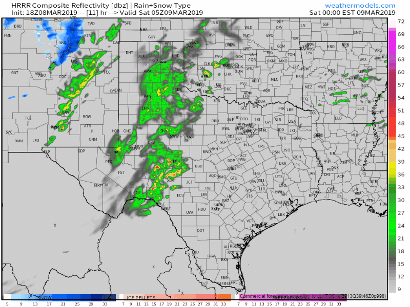
18Z HRRR: Simulated weather radar this evening through lunch-time Saturday. This is only a model simulation.
A cluster of showers and thunderstorms may be underway by 11 PM across the Concho Valley northward into Northwest Texas. We could see a few stronger storms by that time in the Concho Valley and Big Country with small hail. As storms move northeast into North Texas there are a few signals that intensities may be on the increase. It isn’t a guarantee, but if we do see the stronger solutions pan out, we could see scattered storms with large hail move northeast across the eastern Big Country into North Texas between midnight and 6 AM. Otherwise, most activity would tend to remain sub-severe with showers and storms moving across Northwest Texas and North Texas overnight.
Our ‘second-round’ of activity is more likely to produce severe weather Saturday morning. Isolated to widely scattered thunderstorms are expected to form just east of a dryline between 6 AM and 9 AM near the Interstate 35 corridor in North Texas. This may be a case where storms fire up on top of the D/FW metroplex, but move east before they have a chance to intensify. Regardless, if storms get going in a hurry, they could start producing large hail and localized damaging winds before exiting the metroplex to the east. These storms will move quickly to the northeast into and across Northeast Texas and portions of East Texas Saturday morning. The strongest storms look to move east of Texas around lunch-time.
While the time of day would typically suggest a lower severe weather potential, I am concerned that we may have a brief window of increased severe weather risk. Large hail (some potentially larger than golfballs), damaging wind gusts, and a couple of tornadoes may occur in Northeast Texas tomorrow morning. Those storms are expected to produce a higher tornado threat as they approach the Mississippi River (east of Texas) Saturday afternoon. The time window for a more substantial severe weather threat is small for Northeast Texas tomorrow morning, but we’re going to be watching it closely.
The surface dryline will continue to move east on Saturday afternoon. Folks west of the dryline will enjoy temperatures in the 70s and 80s with mostly sunny skies and gusty west winds. Once we get through tomorrow morning’s severe weather we’ll have to start focusing on the Monday-Wednesday system. That one still looks like it’ll bring a widespread precipitation event to much of Texas with a dual threat of severe thunderstorms and heavy rainfall. See our morning blog post for more on the extended forecast.


0 Comments