
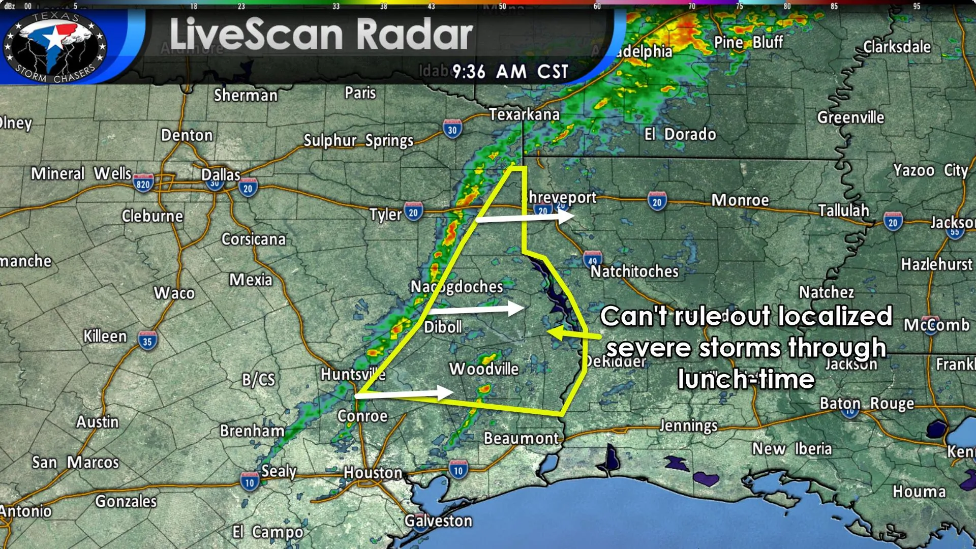
At the time of this writing, a broken line of showers with embedded thunderstorms extended from Texarkana to Longview to Wells to Huntsville to near Conroe. This line is making decent progress to the east. Thus far none of the activity has become severe with brief heavy rainfall and small hail. We can’t rule out a few episodes of larger hail up to the size of quarters and localized wind gusts of 40 to 60 MPH through the late morning hours. All thunderstorm activity will move east out of Texas by lunch-time.
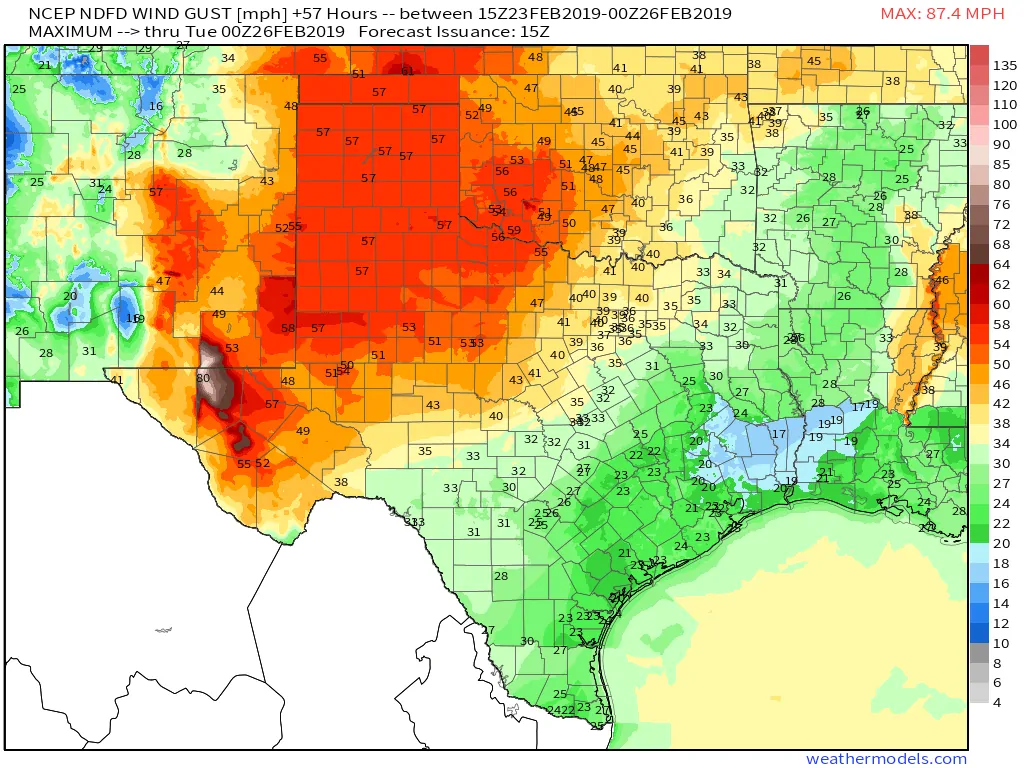
Thunderstorms aside the main weather impact for Texas today will be strong to very strong winds and critical wildfire danger. Winds gusting up to 65 MPH out of the west are possible across the Texas Panhandle, West Texas, Northwest Texas, and higher elevations of Southwest Texas through the late afternoon hours.
35 to 45 MPH wind gusts are expected this afternoon as far east as Interstate 35 from the Red River south through the D/FW Metroplex south into the Hill Country and Concho Valley. Winds will start coming down around sunset, although gusty conditions may continue into the evening across North Texas and East Texas.
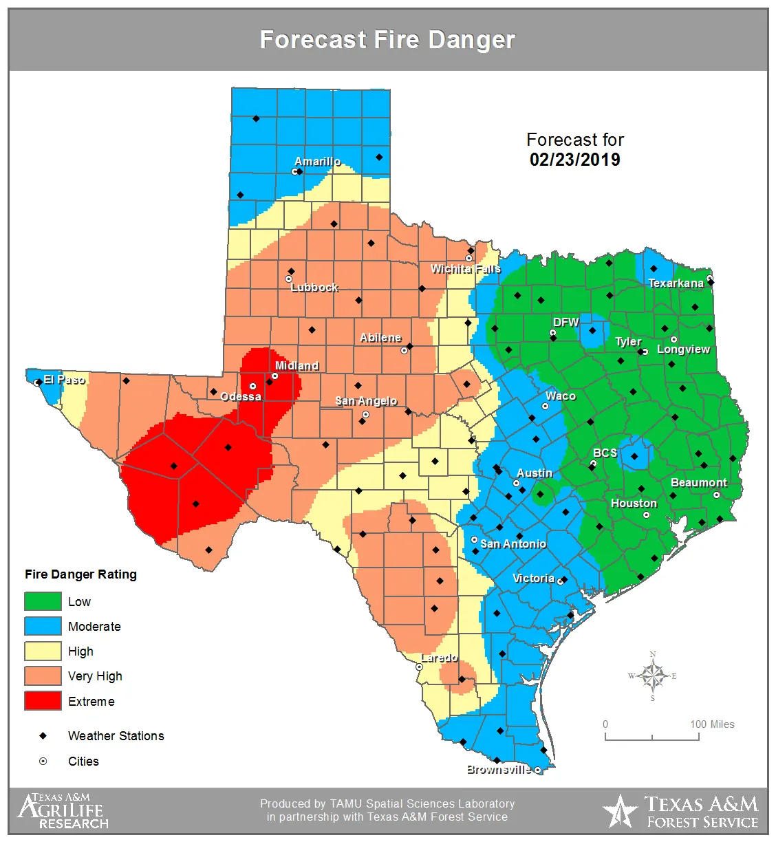
Relative humidity values will drop below 20 percent from the Borderland (El Paso region) eastward all the way to Interstate 35 this afternoon. Excluding the Texas Panhandle who saw precipitation this morning, all of that real estate will be under a very high to critical fire weather risk today. That means any grass fires that ignite have the potential to spread rapidly and exhibit significant resistance to initial attack efforts. Conditions will moderate this evening as winds decrease and humidity values recover.


0 Comments