
A potent upper-level storm system will quickly move overhead Texas on Saturday. The result will be increased fire-weather concerns and the potential of strong to severe thunderstorms. The time of day and fast-moving nature of the storm system look to keep the comparatively higher severe weather threat east of Texas. However, it is likely we’ll be dealing with thunderstorms Saturday morning along and east of the Interstate 35 corridor (Gainesville to Fort Worth to Austin line).
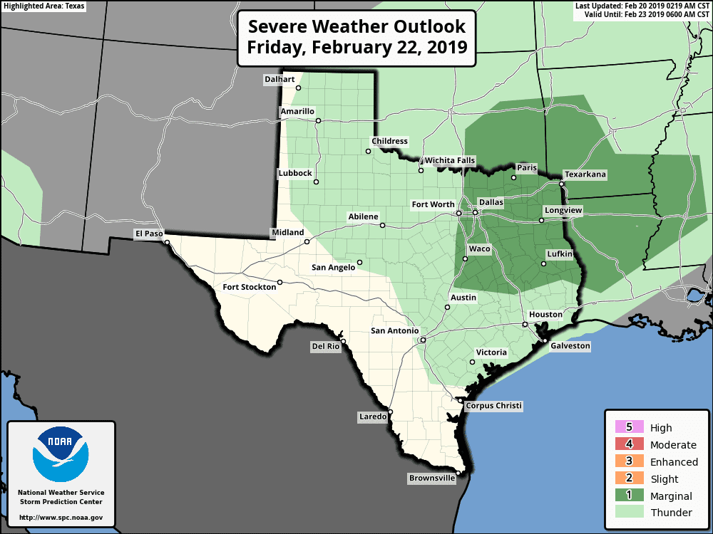
The Storm Prediction Center has highlighted a level one risk of severe weather for the eastern half of North Texas, Northeast Texas, East Texas, and portions of the Brazos Valley. While not shown on the included graphic they do have a level two risk across far Northeast Texas and far East Texas for the morning hours on Saturday. We’ll be able to provide an updated and integrated outlook tomorrow.
Drizzle, fog, and isolated thunderstorms are expected during the day and evening Friday across the eastern half of Texas. Some storms may produce small hail, but the atmosphere is expected to remain relatively stable until the late evening hours. As the upper-level storm system arrives and temperatures aloft cool we’ll see instability values increase. Instability values will still be on the modest side, but sufficient for stronger thunderstorms when combined with very strong wind shear values.
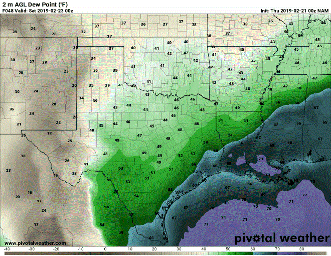
0Z NAM: Surface dewpoint temperature from 6 PM Friday through 3 PM Saturday. This animation is meant to show where moisture levels increase ahead of the dryline, and then the dryline’s quick eastward movement on Saturday. This will be known as ‘last-minute moisture’ as it quickly increases ahead of the dryline. If moisture doesn’t increase as quickly as models indicate, the atmosphere may not be as unstable (compared to model projections).
That upper-level storm system will also provide the lift necessary to ignite the dryline Saturday morning as it approaches Interstate 35. This may end up being around 5-7 AM on Saturday based on the current thinking. These storms would have the potential to be strong to marginally severe with a threat of quarter size hail and localized wind gusts of 50 to 60 MPH. An isolated tornado can’t be ruled out as storms approach the Arkansas and Lousiana borders.
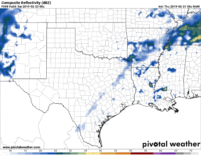
0Z NAM: Simulated weather radar from 6 PM Friday through 3 PM Saturday. This animation is meant to show a simulated radar to show precipitation locations, but should not be taken as a literal forecast, or gauge potential intensity of said precipitation. This specific weather model (0Z 12KM NAM) does not have a high enough resolution to depict specific convective elements accurately.
Storms should be in the form of a squall line as they quickly move east across Northeast Texas and East Texas during the morning hours Saturday. In fact, storms may mostly be out of Texas by the early afternoon hours on Saturday with gusty west winds left as a parting gift across a good part of Texas.
Wildfire concerns will be elevated across the western half of Texas on Saturday thanks to lower relative humidity values and those gusty west winds. Recent rains may help keep the higher-end fire threat limited to parts of the Trans-Pecos and Permian Basin, but let’s not test out that theory.
Obviously, some timing aspects could change between now and Saturday. Timing may need to be adjusted several hours slower or faster. Rainfall totals shouldn’t be high enough to pose too much of a flash flooding threat, but some localized flooding is possible in Northeast Texas on Saturday.
Another uncertainty is regarding the warm front. Specifically, how quickly will it be able to lift north Saturday morning across East Texas. A shallow, cooler airmass may inhibit that warm front from lifting north as quickly as some weather models show. If that’s the case most thunderstorms on Saturday would be ‘elevated’ above a cap. That would make it difficult for damaging winds to make it to the surface, but would still result in a risk of hail with stronger thunderstorms. We’ll also have to watch for the warm front’s position as any storms that interact with it could have a small threat of producing a brief tornado.


0 Comments