
Like a broken record we are once again starting off the day with locally dense fog across parts of Texas. This is thanks to several days of moisture return (southerly winds) resulting in dewpoint temperatures in the 50s and 60s. It doesn’t take much cooling at night in the winter to get the actual air temperature down to the 50s and 60s, so we hit the saturation point pretty quickly. Fog will be an issue again tonight and every morning through Thursday.
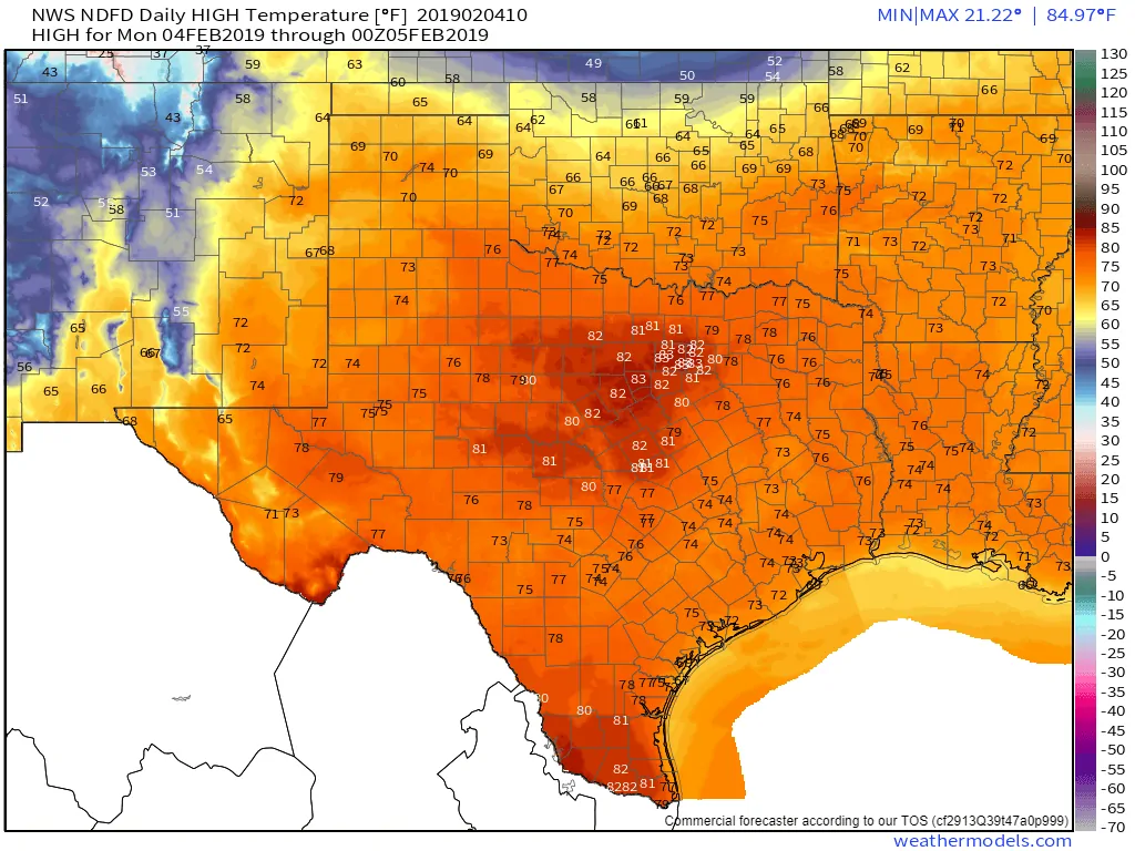
Today’s high temperature forecast
Afternoon high temperatures today will be 15 to 27 degrees above where they should be for February 4th. Temperatures could approach previous records set in North Texas, including at D/FW Airport where the forecast high temperature for today is 83 degrees. The threat of grass fires will be enhanced today due to dormant surface fuels and above-average temperatures. Although we note that some surface vegetation is beginning to awaken across the eastern half of Texas. In fact, a few bluebonnets can be found in Austin! Those plants are not going to enjoy the late week cold front and resultant freeze.
Strong storms possible Wednesday Night
A strong cold front will begin pushing into Texas during the night-time hours Wednesday and into Thursday. A few showers will be possible during the day Wednesday across the eastern half of Texas, but a capping inversion *should* prevent the development of thunderstorms for much of the daytime. We’ll have to keep an eye on that in the coming days in-case that expectation changes.
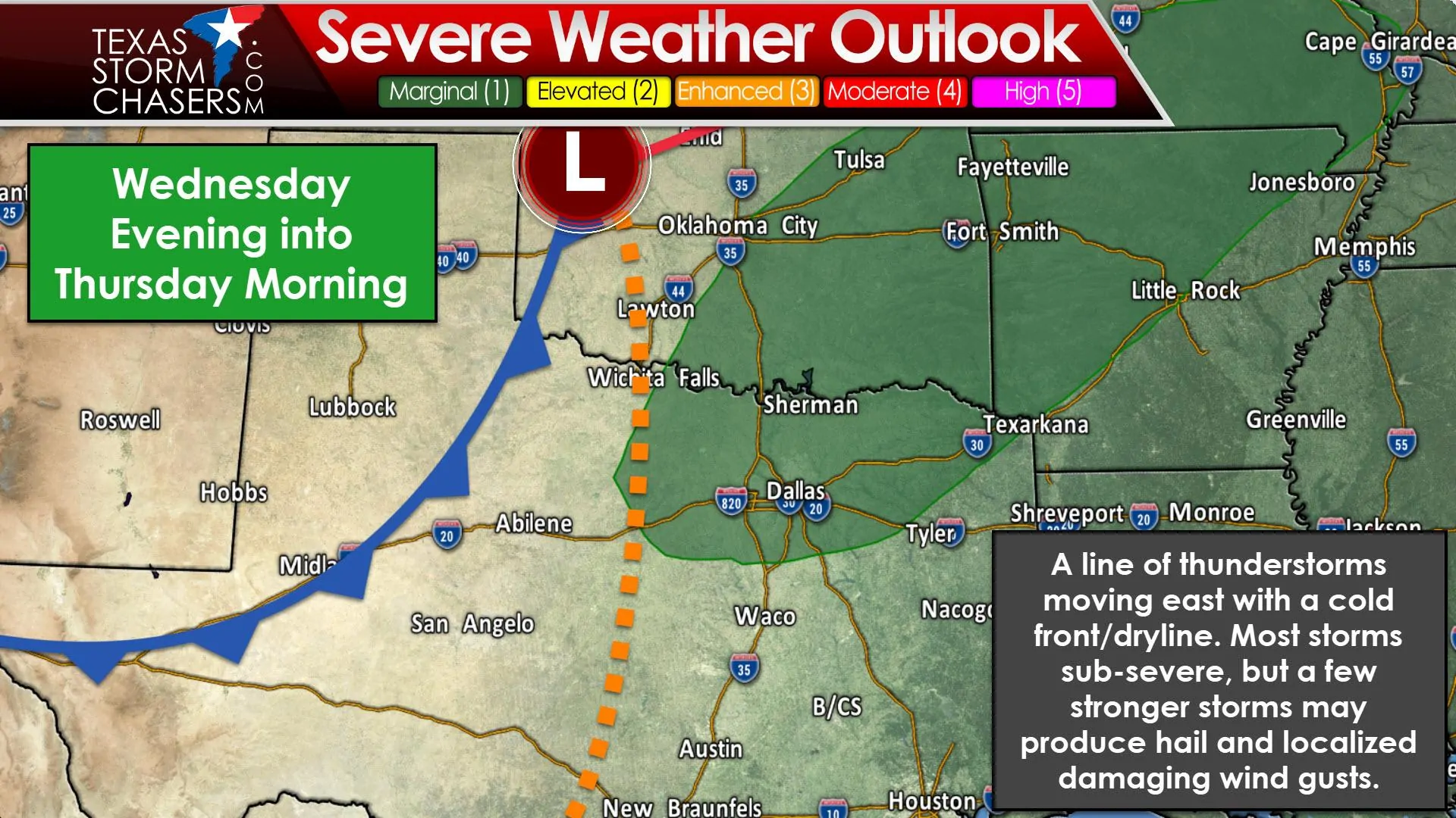
As the dryline/cold front combination move east Wednesday night a line of showers and thunderstorms is expected to develop. This could result in thunderstorm chances for the eastern two-thirds of Texas Wednesday night and on Thursday (shifting from west to east). Wind shear aloft will be strong and it does appear we will have a bit of instability along and ahead of the cold front thanks to the above-average temperatures and abundant moisture in place.
Questions remain on the timing of thunderstorm development, which at this point appears to take place after sunset and into the night-time hours. Should this end up being a nocturnal event the time of day (in February) would help keep the threat of severe weather somewhat lower. Another question is if the cold front will outrun thunderstorms – thus cutting off their supply of unstable air. That would also work against a higher severe weather threat. Hail and localized damaging wind gusts will be possible with stronger storms.
Tornadoes do not look likely at this time due to the storm mode (linear) and the possibility of storms being elevated above a cooler layer of air near the surface. We’ll refine the severe weather forecast as we get closer to Wednesday night. I encourage you to check back tomorrow and Wednesday for the latest severe weather outlooks.
Spring preview comes to an abrupt end on Thursday as winter returns
A strong cold front will push south through all of Texas on Thursday. Once the front arrives at any location temperatures will begin falling and continue to do so for the remainder of the day. That means high temperatures for some folks may occur during the early morning – with temperatures falling for the remainder of the day. Annoying north winds will make their presence known in the form of the well-known and despised wind chill. The front’s timing could still shift to become a bit slower or faster.
A few days of ‘February’ weather before a warm-up begins by Sunday
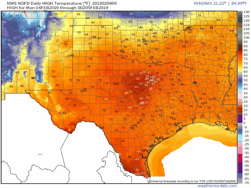
Daily high temperature forecast today through Sunday.
Temperatures will definitely feel more like February on Thursday, Friday, and Saturday. However, we’ll start to see conditions moderate across the southern half of Texas on Saturday and across more of the state by Sunday. The 70s should be back in play across South Texas, the Coastal Plains, and Southeast Texas for Sunday with 50s and 60s farther to the north. It won’t be as warm as what we’re going to experience today through Wednesday, but it’s better than wind chills in the teens and twenties.


0 Comments