
Widespread showers with embedded thunderstorms have brought small hail to portions of Northeast Texas this afternoon. All this activity is moving northeast at about 55 MPH. Most convection is producing moderate rainfall. However, we have had a few stronger storms embedded within the rain shield this afternoon. Those stronger storms have produced small hail up to the size of dimes and plenty of cloud to ground lightning.
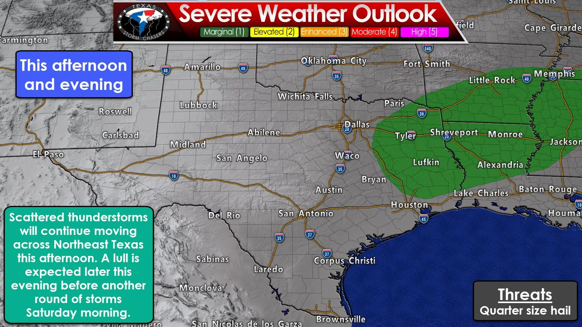
Additional showers and storms are firing up from near Buffalo to Palestine to Tyler, so we should continue seeing activity for at least the new couple of hours. We can’t rule out a borderline severe storm producing quarter size hail this afternoon, but thus far storms have mostly been behaving.
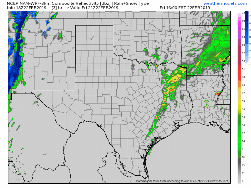
18Z HRRR simulated model radar this afternoon through early Saturday afternoon.
Short-term weather models indicate we should have a lull in storms for a time this evening. I’d expect a decent amount of mist and fog this evening across the eastern half of Texas given increasing moisture values. Spotty showers will remain possible this evening and it won’t be the most pleasant night to be outdoors. Temperatures will not drop much, if at all, tonight. In fact, temperatures may end up rising thanks to increasing dewpoint temperature values.
Data has backed off the idea of higher instability values advecting north/northwest tonight into Saturday morning. The result will be lower chances of severe thunderstorms along the Interstate 35 corridor in the morning. A dryline will quickly be moving east as a very potent upper-level storm system starts to kick in. Lift associated with that upper-level storm system and eastward-moving dryline will help a fast-moving line of storms fire up after 5-6AM.
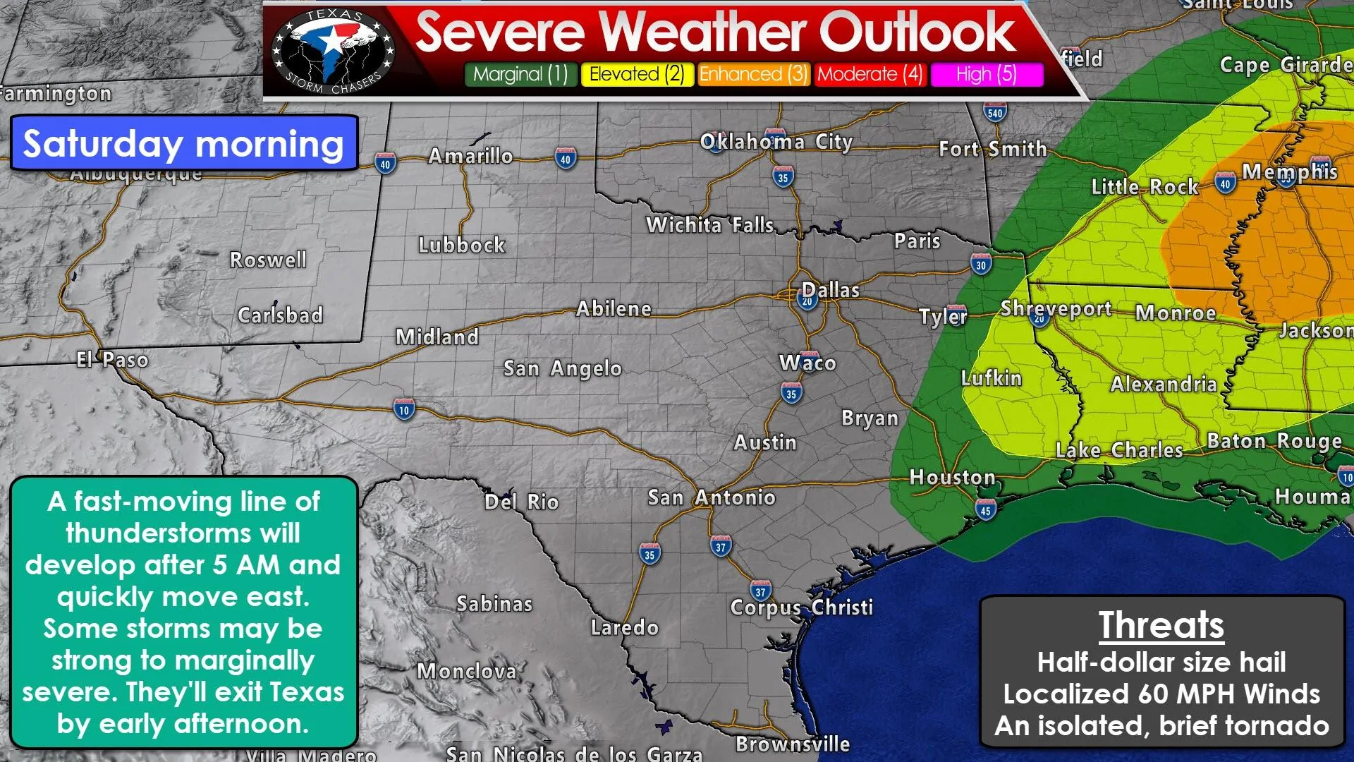
This line of storms will book it east and impact Northeast Texas, East Texas, and Southeast Texas through the mid-morning hours. Small hail is probable with stronger storms thanks to colder temperatures aloft. As thunderstorms move east and into a comparatively more unstable airmass we may start to see the stronger storms produce hail up to the size of half-dollars (about 1.25″ in diameter).
Stronger storms across the piney woods of East Texas and far Southeast Texas may also produce localized damaging wind gusts over 55 MPH. An isolated, brief tornado can’t be ruled out in far East Texas or far Southeast Texas (generally in the level 2 risk zone). Tornadoes will be a higher threat tomorrow afternoon in eastern Arkansas, Mississippi, into western Tennessee.
The line of thunderstorms should be exiting Texas to the east around lunch-time tomorrow. That’ll conclude the threat of severe thunderstorms in Texas for the weekend. Skies will quickly clear behind the squall line and temperatures will climb up into the 60s.
Strong to very strong non-thunderstorm winds are expected across the western two-thirds to the western three-quarters of Texas tomorrow. Some of these winds could exceed 60 MPH across the western third of Texas. Elevated to critical fire weather concerns will exist along and west of I-35 from the Red River to San Antonio, and then across all of South Texas. We’ll be talking more about tomorrow’s high wind and fire event in a separate discussion this evening.


0 Comments