
Good morning and welcome to the 7th week of 2019. Only 45 more weeks to go until Christmas! What? I like Christmas, okay?
Did someone forget to pay the light bill?
Low-level overcast, fog, and showers are common this morning across the eastern two-thirds of Texas. This activity is not severe and temperatures are too warm to support any winter mischief. Showers will generally become confined to the southern/eastern third of Texas beginning tonight. All activity will move off into the Gulf of Mexico and off to the east of Texas by Tuesday afternoon. That’ll conclude precipitation chances for several days. In fact, we may not see another precipitation event until Sunday or Sunday Night.
Windier than a baked-bean eating contest
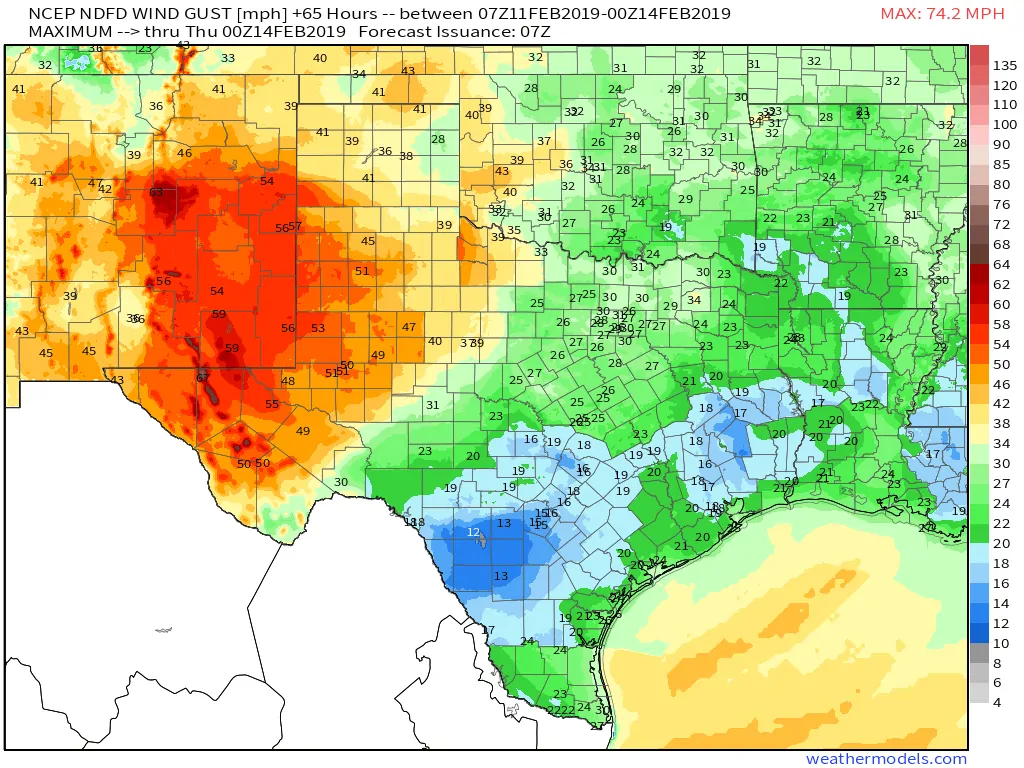
Potential maximum wind gusts in MPH for today.
While the eastern half of Texas deals with gloom today the western third of Texas will be dealing with blowing dust and enough wind to blow the cat half-way across the county. As an upper-level low takes shape over the southern United States this afternoon we’ll see west/southwest winds gusting up to 50-60 MPH across the Trans-Pecos, Permian Basin, West Texas, and in the Texas Panhandle. Generally speaking, the highest winds will be west of Interstate 27/Highway 87/Highway 349. Reduced visibility thanks to blowing dust is expected. High-profile vehicles on north/south roads are not going to have a pleasant go of it today.
The return of flaming tumbleweeds
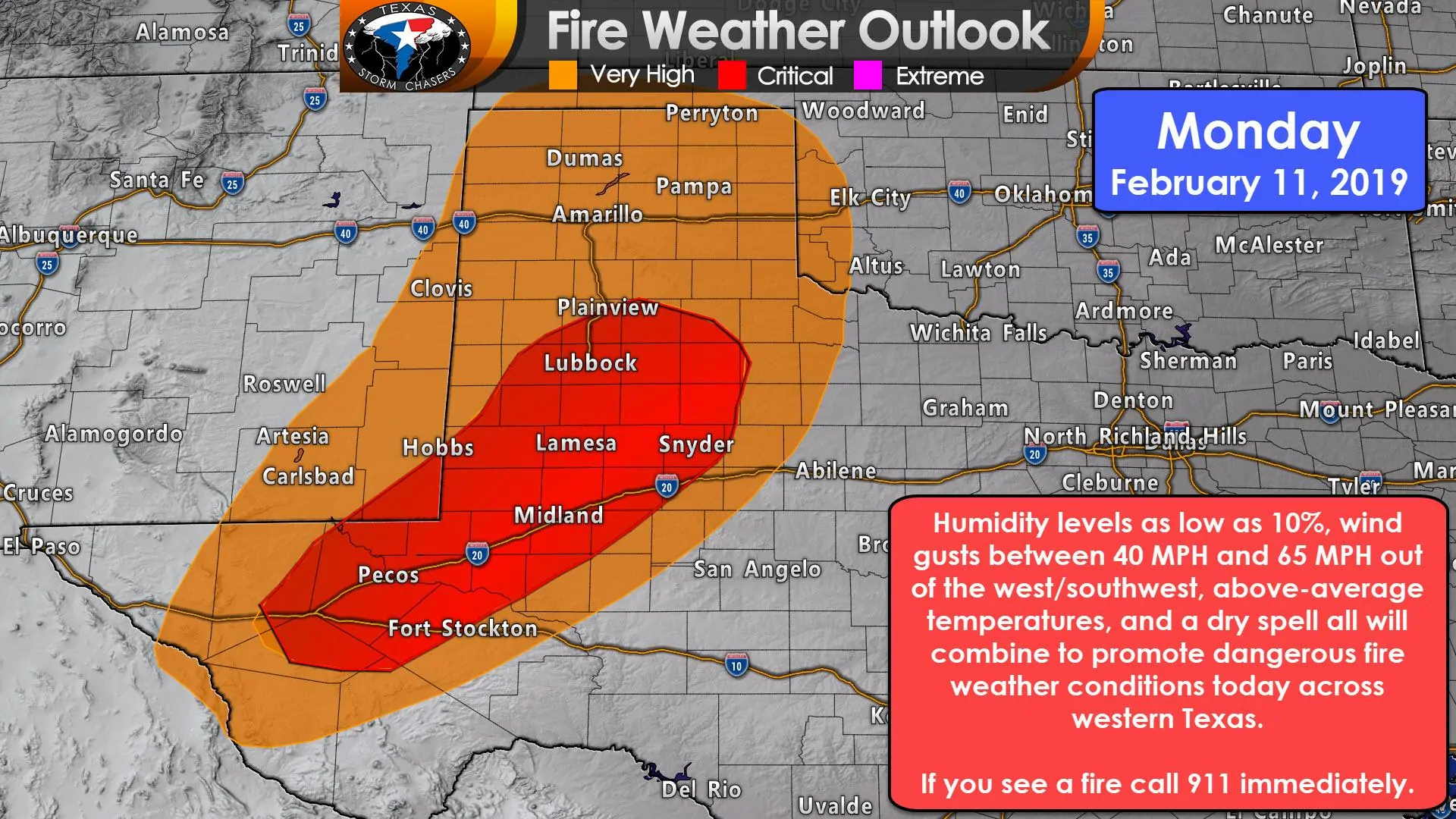
In addition to the aforementioned winds, temperatures will be above-average and humidity values will drop into the 10-20% range. Given the recent dry spell and dormant vegetation, today could mark the beginning of an active fire weather week across western Texas. Fire weather meteorologists have highlighted the Permian Basin, West Texas, and Texas Panhandle in a very high to critical risk of wildfires today. That means any wildland fire that gets started will have a heightened risk of moving at a rapid rate of spread and becoming uncontrollable.
Any fire that gets going could become large and destructive in a hurry. Conditions will moderate tonight and on Tuesday, but another higher-end wildfire threat will develop on Wednesday and on Thursday. Recent fires have started due to chains dragging behind vehicles. Please take extra care to ensure your motor vehicle is safe to operate. High winds today could also result in a few downed powerlines – which love to start brush fires.
Weather outlook for the rest of the week
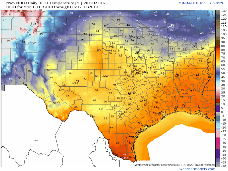
Daily high temperature forecast today through Sunday from the National Weather Service.
Wednesday and Thursday look to be active wildfire days across the western half of Texas given above-average temperatures, low humidity values, and a wind-maker (especially by Thursday). A cold front will cool temperatures down by Friday across the northern half of Texas, but that system looks mostly dry at this point. A more impressive upper-level storm system may bring our next precipitation event to parts of Texas on Sunday and Monday.


0 Comments