
The dryline is surging east early this morning as a potent upper-level storm system starts to kick in. The weather observation station on Guadalupe Mountain reported a 72 MPH wind gust shortly after 1 AM. Winds are now gusting upwards of 50 MPH across the Permian Basin and Trans-Pecos.
We’re going to see 55-65 MPH winds overspread the Texas Panhandle and West Texas later this morning as that dryline kicks off to the east. Just for fun, I’d like to point out the dryline will be in Lousiana by lunch-time today. Now that is a fast-moving dryline!
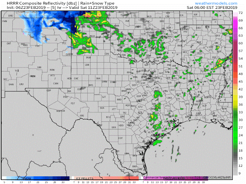
Showers and thunderstorms are moving northeast across the Texas Panhandle. We haven’t heard of any winter precipitation mixing in yet, but that is a decent bet across the northwestern and northern Texas Panhandle later this morning. Brief blizzard conditions are possible in places like Dalhart to Guymon. Snows may not last more than a few hours, but a quick couple inches with 65 MPH winds will make travel downright impossible for a time.
As for the warm-sector side: We’re already seeing a thin line of thunderstorms marching their way east into the Concho Valley. This is a bit of a surprise as models weren’t too indicative of more than just showers. These storms were probably caused by a small ripple of energy swinging through the upper-level jetstream. I don’t expect those storms will become severe this morning, but they may produce brief gusty winds and small hail. They’ll probably weaken as they move into western North Texas in a few hours.
Simulated weather radar from 5 AM through 1 PM today.
Our primary focus for stronger thunderstorms will be across East Texas and Far Southeast Texas later this morning, mainly after 6 AM. As the dryline surges east of the D/FW Metroplex to near Madisonville to Houston, we should see thunderstorms begin forming. They’ll likely grow upscale into a squall line quickly and book it off to the east.
Our squall line will fly off to the east and completely exit into Lousiana around lunch-time. Some storms within the squall line may become marginally severe with a risk of hail up to the size of half-dollars (1.25″) and the threat of localized wind gusts up to 60 MPH. After the storms move east our focus in Texas will be on the high wind event across the western two-thirds of Texas along with very high wildfire danger.


0 Comments