
Today’s severe weather outlook
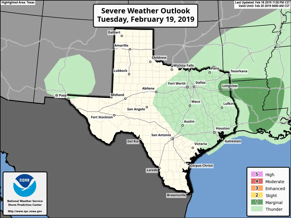
There is a low-end chance of a strong thunderstorm in far East Texas this afternoon and evening. If we did see a brief strong storm it would be capable of producing small hail. At this time the comparatively higher threat for severe weather looks to be farther east in Lousiana and southwest Mississippi early Wednesday. I honestly don’t expect much in the way of severe weather issues in Texas today or tonight. Perhaps a rogue storm with hail, but that’s about it.
Winter Weather Potential Today
Light snow or a light winter mix is possible at times today across the Texas Panhandle, West Texas, Northwest Texas, western North Texas, and portions of the Big Country. Minor, localized snow accumulations ranging from a dusting to one inch are possible across the Texas Panhandle and West Texas today. These accumulations will be localized and not widespread. Most folks may not see more than a dusting of snow.
Some folks across West Texas, Northwest Texas, and western North Texas may see a light winter mix at times this morning into the early afternoon hours before temperatures rise above freezing. Minor accumulations of ice may result in some slick travel conditions, especially on bridges. Temperatures across most of the aforementioned regions should rise above freezing by this afternoon.
Overall we’re not expecting more than a minor winter weather event today in Texas. Impacts may be higher across Oklahoma where higher accumulations totals are expected.
Rain Totals
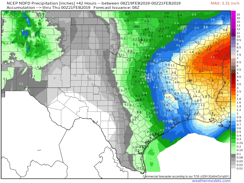
Potential rain totals through Wednesday afternoon
Rain totals may exceed one inch across Northeast Texas and East Texas. One-half inch of rainfall is possible along and east of Interstate 45 from Dallas to Houston. Localized flooding is possible in far East Texas and Northeast Texas today and tonight. This may result in some new river flooding for the remainder of the week. Additional rain is probable on Thursday through Saturday.
Timeline
Rain chances will be highest today and tonight across the eastern third to half of Texas. We’ll see precipitation chances conclude from west to east tonight into Wednesday morning. Wednesday afternoon should end up being a lull before we see rain chances begin increasing across Southeast Texas and the Coastal Plains Wednesday night. Much warmer temperatures are expected on Thursday along with more showers across East Texas and Southeast Texas.
Looking ahead to Friday Night and Saturday
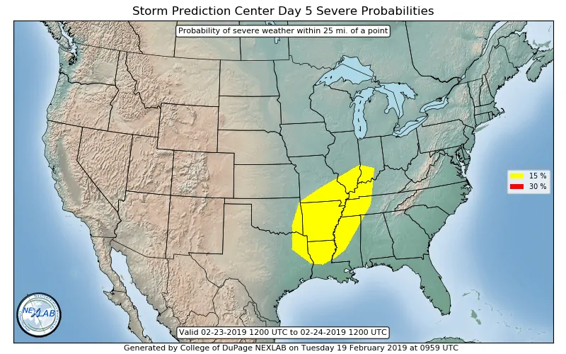
Saturday’s severe weather outlook
An impressive upper-level storm system will move across Texas on Saturday. Near critical to critical fire weather concerns will exist along and west of Interstate 35 from Laredo to Fort Worth on Saturday as a dryline surges east.
Strong to severe thunderstorms are possible Saturday across Northeast Texas and East Texas. We’ll deal with this potential once we get passed today’s storm system. We’ll need to keep an eye on this upcoming potential, however.


0 Comments