
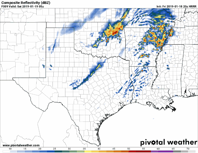
20Z HRRR Simulated Radar from 11 PM Friday through 6 AM Saturday
A broken line of thunderstorms is expected to develop along the cold front’s leading edge tonight. The most likely locations for thunderstorms overnight will be across Northeast Texas, East Texas, Southeast Texas, and the Coastal Plains. Widespread severe weather is unlikely, but there is a marginal risk that a few storms may produce quarter size hail. A non-zero risk of a brief/weak tornado and localized wind gust near 60 MPH also exists, but overall that threat is very low. Thunderstorms will move into Lousiana and out into the Gulf of Mexico by 6 AM Saturday.
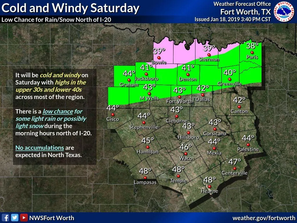
There is a chance of light snow on Saturday across Texoma and Northeast Texas. Surface temperatures will be near freezing and warm ground temperatures will both preclude much accumulation potential. However, some folks may be lucky enough to get a dusting of snow on elevated objects. No travel impacts are expected and a vast majority of folks in the aforementioned regions won’t see any snow at all.
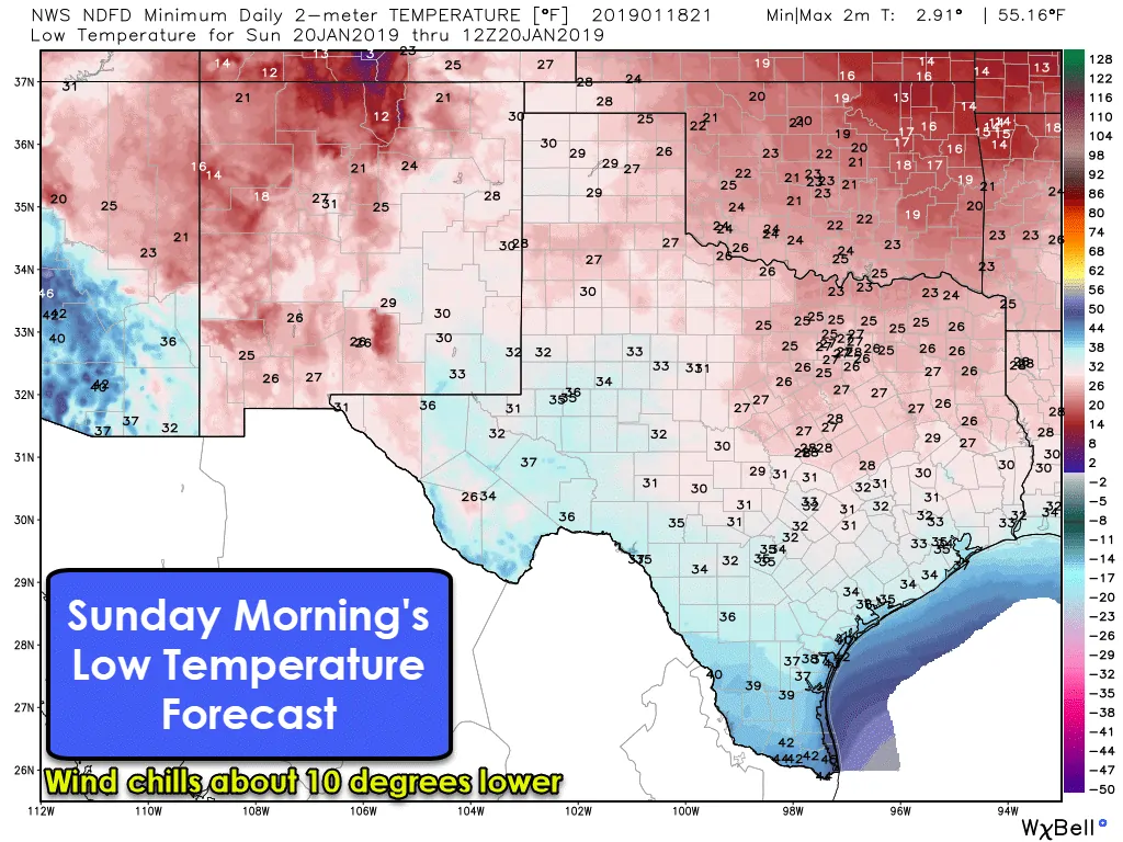
Winds behind the cold front will be quite strong tonight. Those across the northern two-thirds of Texas can expect northerly/northwesterly winds gusting up to 40-50 MPH overnight and into the morning hours Saturday. Wind chill values will be quite unpleasant. By Sunday morning temperatures will fall into the 20s, 30s, and 40s across Texas. These temperatures are certainly warmer compared to forecasts made earlier in the week, but wind chill values will still make it quite chilly. This will be the first of several cold snaps expected through the remainder of January. We’ll have at least two strong cold fronts next week – with some potential of winter mischief by mid-week.


0 Comments