
Mother nature is sending a reminder that this is January. That means those who enjoyed the 60s and 70s over the past several days are not going to be enjoying the weather tonight or tomorrow. It could be worse though. Our wind chills won’t be diving below zero, unlike the Midwest and Northeast US.
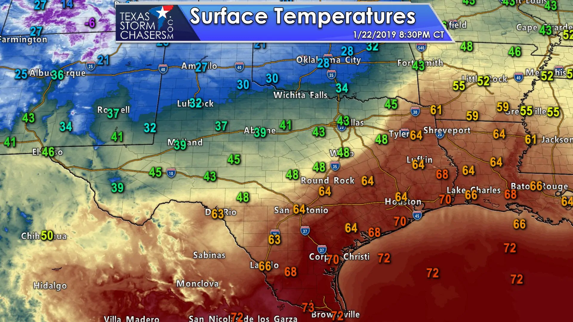
A strong cold front with a noticeable amount of northwesterly winds extends from near Laredo to San Antonio to College Station to Tyler and up to Texarkana. We have a weaker pre-frontal wind shift extending about one to two counties ahead of the actual colder air. Temperatures south of the front remain in the 60s and 70s this evening. Wind chill values along and north of Interstate 20 from the Permian Basin to the D/FW Metroplex are now falling into the 20s and 30s. Pampa has a wind chill of 8 as of 8 PM this evening. Again, those aren’t overly drastic for January, but certainly are an abrupt shift from yesterday.
The big reason why this front is so dramatic is the annoying northwesterly winds behind it. We’re seeing wind gusts of 25 to 35 MPH this evening, which results in unpleasant wind chills. These winds aren’t going to drop much overnight, and they will spread south with the cold front. Those of you in the 60s and 70s are not going to be enjoying that luxury by morning.
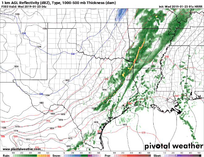
A band of showers is expected tonight into Wednesday morning across East Texas, Southeast Texas, and the Coastal Plains. Up to around one inch of rain may fall, especially across Southeast Texas and the Coastal Plains. Lighter rain totals are anticipated by the time you get southwest into the Coastal Bend. Flooding shouldn’t become too much of a problem, but saturated soils (for the last 4 months) could result in some streams running a bit high.
We have been monitoring data for the potential of a brief changeover to sleet or snow as precipitation comes to an end tomorrow morning across East Texas and the Brazos Valley. The high-resolution rapid refresh model (HRRR) is not ambitious on that idea, but it does show a brief rain/sleet/snow mix in the aforementioned areas. Any winter precipitation would be light and not last very long, so accumulations and travel impacts are unlikely. Could a spot or two get a dusting? Sure, but that’s probably the ‘best case scenario’ for winter weather fans.
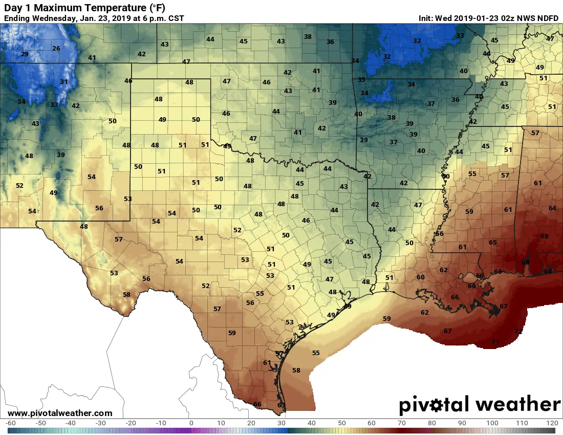
Wednesday’s high-temperature forecast
In either case, all precipitation should conclude in Texas by lunch-time Wednesday as a drier airmass filters into the state. The good news is that this drier airmass will allow temperatures to warm decently considering the front’s arrival tonight. We’re only getting a glancing blow from the arctic airmass, so we’ll be able to warm back up into the 40s, 50s, and lower 60s tomorrow with a more substantial warmup on Thursday. Tonight and tomorrow morning will be chilly with the northerly winds of doom, but tomorrow afternoon is looking pretty nice.
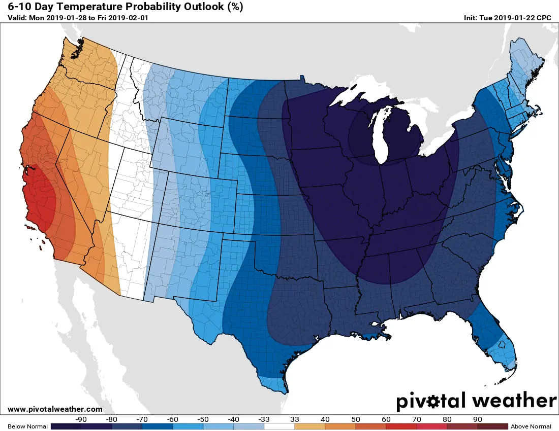
Several additional cold fronts are possible over the coming week, but questions remain over the depth/strength of the cold air. Will we get a glancing blow or a full-on arctic invasion? At this point, most of the fronts look like a glancing blow, but we’ll have to watch out for a nasty front in about 6 to 7 days. That one may actually bring a more potent batch of cold air down to Texas. The difference between us and the Midwest? The Midwest will be lucky to get above freezing in the next two weeks. Our cold snaps are much shorter lived.


0 Comments