
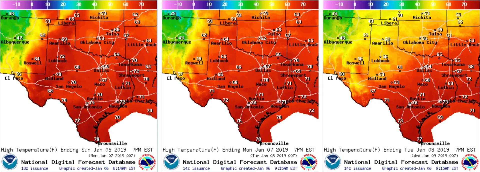
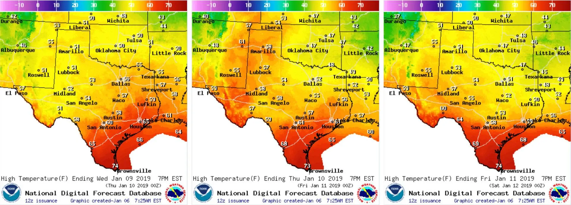
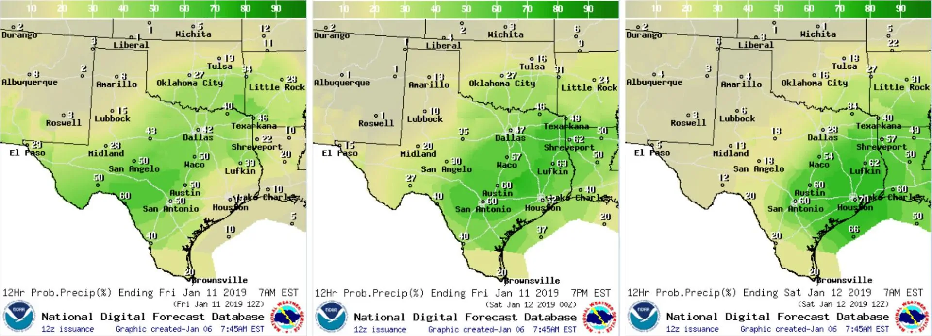
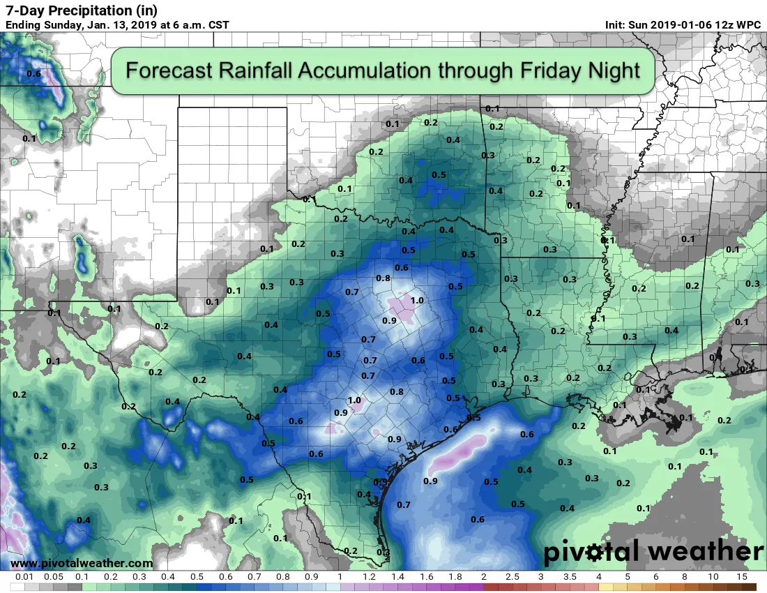
For the week ahead, many folks will see their holiday vacations ending, kids returning to school and the dreaded end to light holiday traffic during the morning and afternoon commutes. Yes, we’re now entering that dreaded wintertime lull between New Years and Spring Break…but thankfully the weather during the work week ahead looks to remain rather uneventful with mild temps and a few chances for rain. Temps for the next couple of days will run above average overall which will mean very pleasant conditions to be out and about. Today through Tuesday will be the warmest days this week with breezy conditions making it feel more like Spring than Winter. We will see a weak cold front move through early tomorrow, but it won’t be until the middle of the week before we see a secondary front drags cooler and more seasonable air south across the state. We’ll see chances for rain beginning late tonight with light showers expected mainly for areas east of the I-35 corridor through tomorrow. Later this week, a slightly stronger upper level system arrives which will bring more widespread rain chances to the state beginning late Thursday through Friday and into Saturday. Thankfully, no severe weather is expected at this time with instability levels looking rather low, and the flooding potential will be on the low side as well with only light accumulations currently expected. The main impacts will be just the typical wet roadways and hydrologically-challenged drivers. All in all, not a bad week to get back into the post-holiday groove!
Daily Forecast Highs Sunday, Monday and Tuesday
Daily Forecast Highs Wednesday, Thursday and Friday

Late Week Rainfall Chances Thursday Night, Friday and Friday Night


0 Comments