
Simulated Radar through 6pm Friday Evening

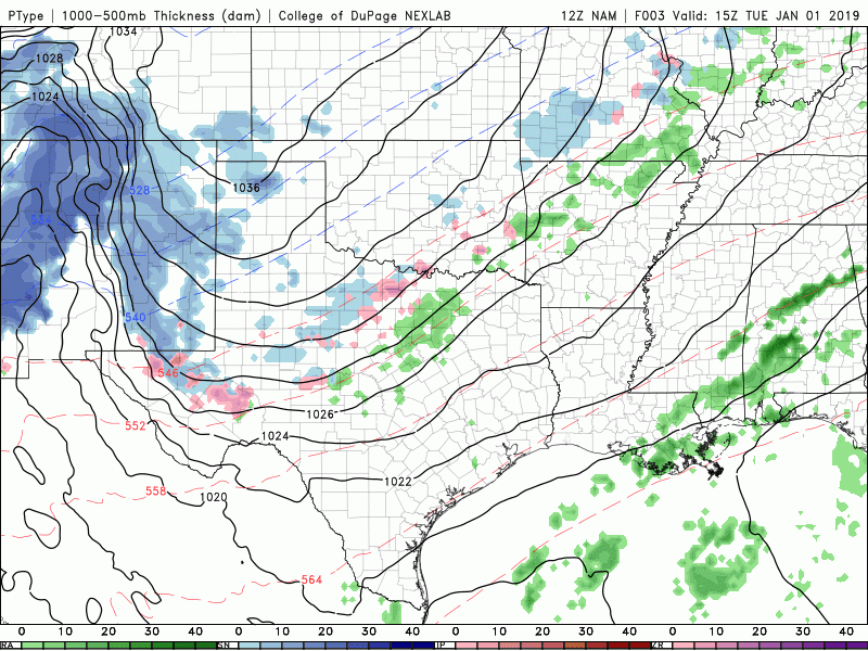
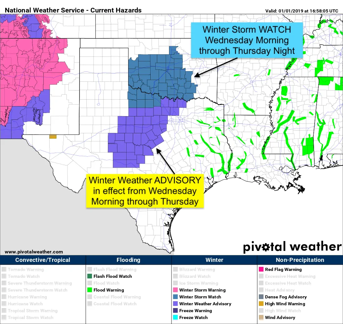
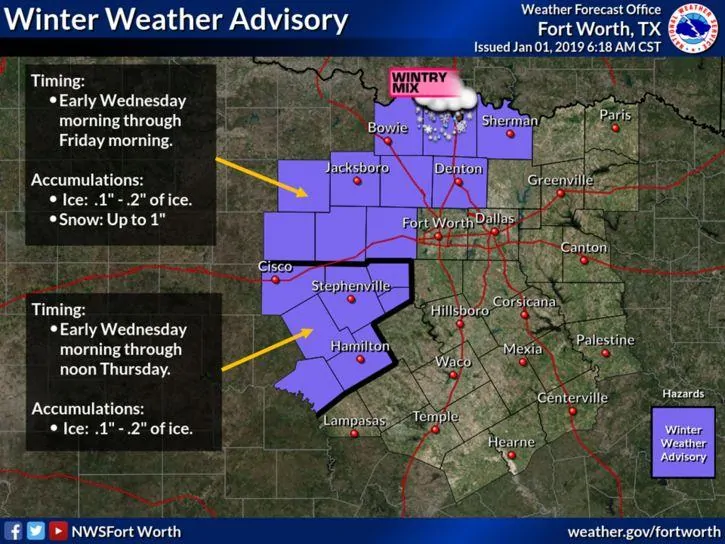
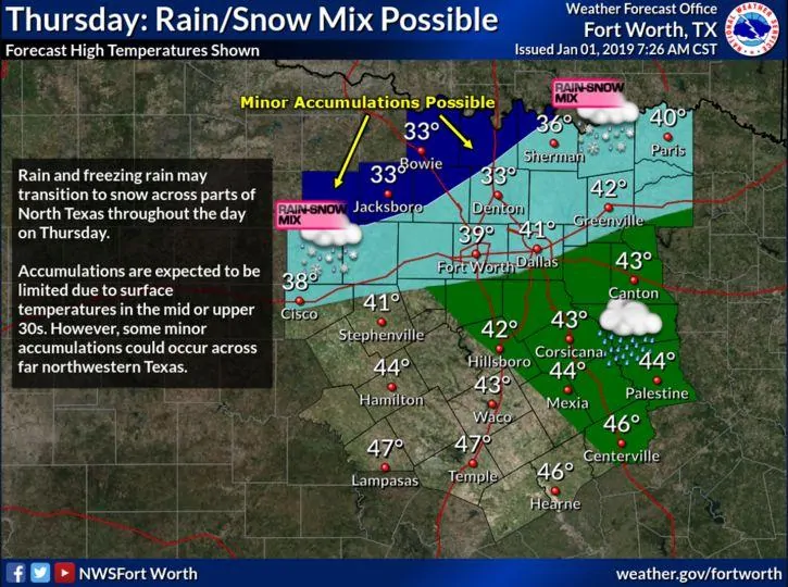
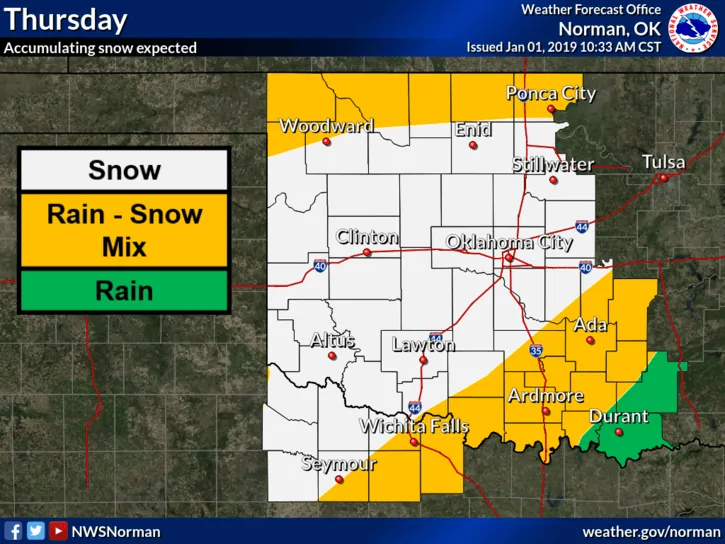
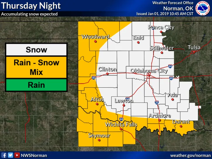
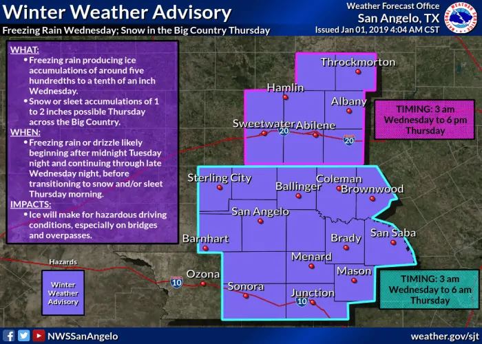
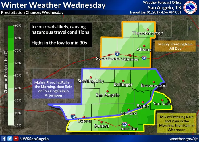
The previous Winter Storm Watch across much of western north Texas, the Big Country region and northern Hill Country region have been upgraded this morning to a Winter Weather Advisory in effect from early Wednesday through Thursday. This Advisory does NOT include Dallas or Tarrant County at this time as temps in the immediate metro area are expected to remain above freezing. Periods of freezing rain and/or sleet are expected to develop Wednesday morning across much of the current Advisory area and gradually shift north/northeast throughout the day Wednesday and into the overnight hours early Thursday morning. Ice accumulation across the Advisory region will likely vary, but overall should remain under 1/4 inch. A transition to snow is expected to occur overnight Wednesday into Thursday, especially for areas along and north of I-20 west and north of the DFW metroplex. Accumulations of snow should be light, but regardless of snow potential, the real threat with this system will be slick roadways and icy bridges and overpasses. In addition to winter weather mischief, heavy rainfall is expected to impact the eastern half of the state both Wednesday and Thursday with the potential for flooding. Folks with travel plans Wednesday and Thursday should continue to watch the forecast closely and have a plan B in place. The best source for current roadway conditions will be www.drivetexas.org. Be sure to check back with us later this evening for additional updates. We’ll have ongoing coverage through Thursday and will keep you updated if anything changes!
North Central Texas/DFW Metroplex
Western North Texas/Wichita Falls Area
Big Country/Northern Hill Country Region


0 Comments