
Unlike my last two discussions, I’m going to strive to make this one a bit less of a novel. Getting more than five hours of sleep may have a bit to do with that goal. Anyway, there have not been any major forecast adjustments overnight. We still have some uncertainty on the placement of the heaviest potential winter weather accumulations along with exactly how much snow may accumulate in those areas tonight into the morning hours on Saturday.
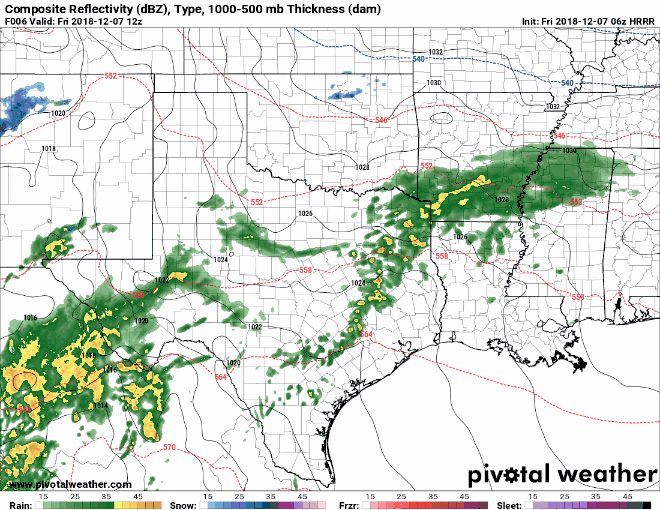
Simulated HRRR radar hourly from 6 AM this morning to 6 PM Saturday. **This is only a model simulation and may not accurately depict the evolving scenario. Use with caution and check back for updates later today**
We’ll be using the 12 AM run of the High-Resolution Rapid Refresh for images with this post. Understand that this model probably doesn’t have everything correct, so the radar may not look like this model’s depiction as we get into the day. However, I think it gives a general idea of what we’re expecting to transpire.
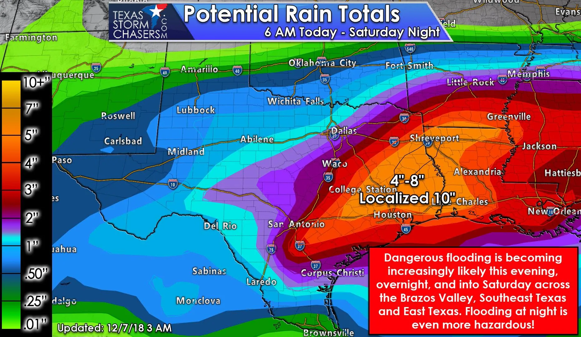
Widespread showers will continue through the day across a good portion of Texas. We’ll see an uptick in both coverage and rainfall intensity as we get toward the late afternoon and especially tonight. Training bands of heavy rain are possible this evening and tonight. Some locations could receive 2 to 3 inches of rain per hour – and storm totals could locally approach 10″ in some locations. Widespread rain totals will be closer to 3 to 7 inches of rain.
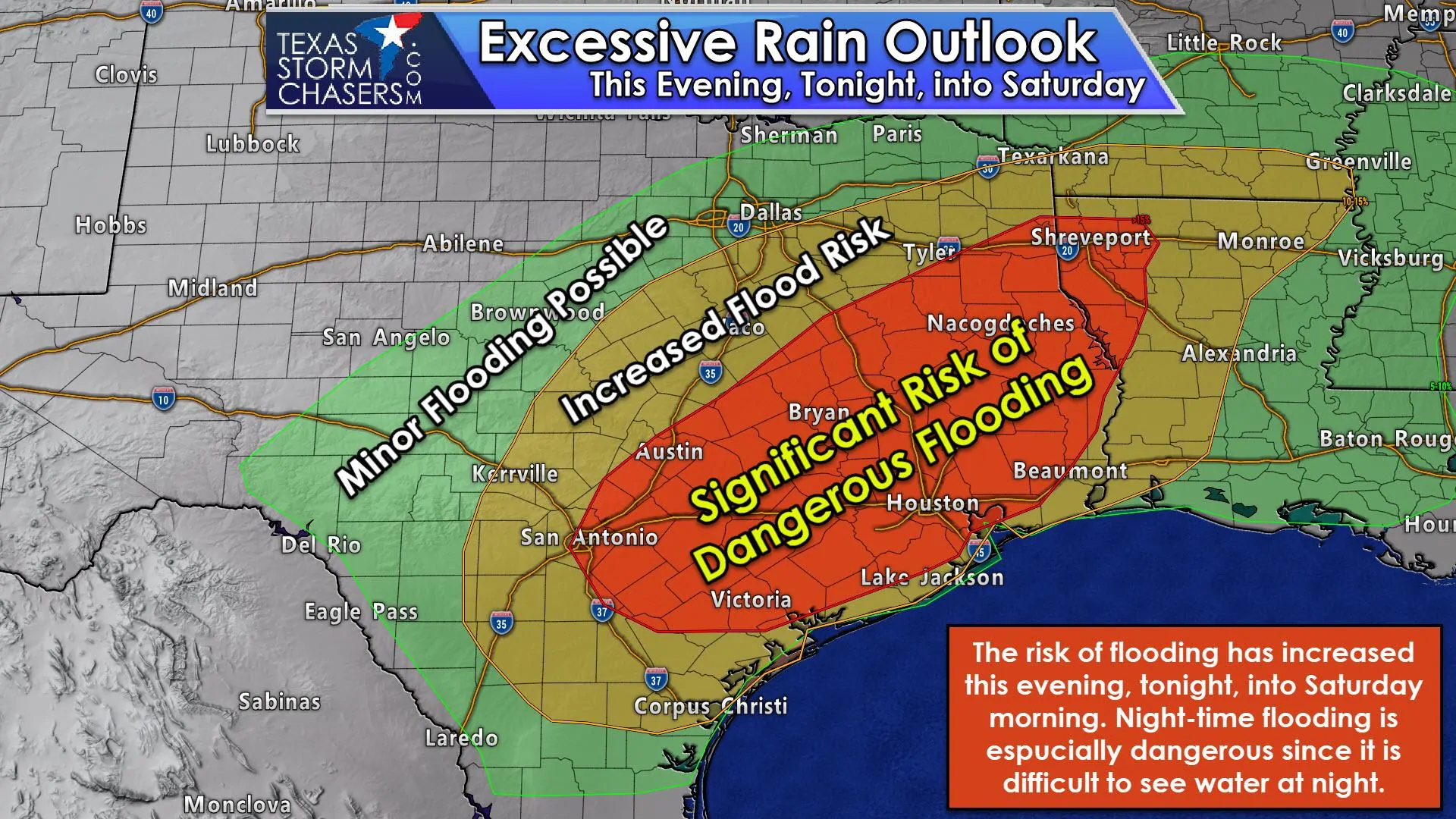
The threat of flash flooding is increasing tonight. We now have a moderate risk of flash flooding across the Coastal Plains, the Brazos Valley, Southeast Texas, and East Texas. Soils are still wet from the soaking we had back in October and they simply won’t be able to absorb much rainfall. That means most rains that fall will quickly run-off into drainage systems, which in turn go into streams, rivers, and lakes. Those who receive heavy rain (1″+ an hour) may see flooding rapidly develop due to the aforementioned conditions.
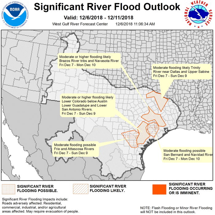
Unusually rapid rises on streams (bayous), rivers, and watersheds will also occur in regions (within and downstream) who receive very heavy rainfall tonight. I would not be surprised if we had a small ‘high risk’ area introduced in later updates. Regardless of slight, moderate, or high – the risk of flooding tonight is quite real – and that flooding could develop quite quickly. For those wondering – today is the anniversary of Pearl Harbor – which I expect might also be known as the ‘Peak Harbor Day Flood’ if tonight unfolds badly.
Rainfall will continue into the day Saturday, but we’ll see it begin ending from west to east as our upper-level storm system ejects to the northeast of Texas. We note some wrap-around moisture on the back-side of the low may produce additional rainfall Saturday afternoon and evening, but that precipitation would be much lighter than tonight’s round.
Winter Weather Forecast
The winter weather forecast for tonight into Saturday remains quite difficult, even though we are within 24 hours. That means whatever I type here in terms of any accumulation expectation will probably find a way to bust. However, it still looks possible that we’ll see 4-6 inches of snow across the eastern Texas Panhandle back into parts of West Texas. Some will see lower, and if this system actually ends up verifying potential-wise, we could see localized higher amounts up toward 8 inches.
I’m not confident in that solution and that wouldn’t be something I could ‘pin down’ until we get into the afternoon hours. This winter weather setup truly has been a pain in the behind of every meteorologist having to deal with it. Even by the usual ‘Texas’ standards for winter weather, this system has been a real butthead. Yes, that’s my technical term and I’m sticking with it.
Most of the daytime hours will be quiet, but some freezing drizzle and/or light sleet may begin falling across the Central/Eastern Texas Panhandle south into West Texas after 4 PM. We anticipate precipitation to increase in coverage around or a bit after 6 PM as upper-level lift enters the region. We may have some freezing rain/sleet initially, but a changeover to all snow is expected by midnight. Locally heavy snow may occur at times Saturday morning. Snow chances will end from west to east Saturday morning into the afternoon hours. Hazardous road conditions would begin late tonight and continue through all of Saturday and into the morning hours Sunday.
There still is a change of a rain/snow mix across the Big Country, Northwest Texas, and parts of North Texas during the afternoon and evening hours Saturday as the system moves east. Snowfall accumulations would be light to minimal, especially across North Texas where temperatures should be above freezing at the surface. We’ll refine this aspect of the forecast in later updates today.
Summary
This remains an evolving forecast and one reason why I’m getting this blog out earlier than I typically would for a morning update. I’m going to get some beauty rest with the expectation that I’ll be posting several forecast updates this afternoon and this evening. Your local National Weather Service office, broadcast meteorologist, and trusted digital weather information sites are all great sources for weather information.


0 Comments