
As mentioned in yesterday evening’s blog update, we’re keeping a close eye on the severe weather potential across portions of north central, northeast and east Texas for the late Friday afternoon/evening timeframe. Today’s forecast model runs have shifted the threat for severe storms a bit further west which now includes the eastern half of the DFW metroplex within the Slight Risk (Level 2) area. A potent upper level system is forecast to arrive across the northern half of the state by Friday afternoon. Accompanying the system will be a pacific front/dryline setup which is expected to push east towards the I-35 corridor by late Friday afternoon. While much of north central Texas is expected to miss out on the development of storms, if we can get sufficient moisture return and atmospheric destabilization over the area, we could see the development of a few strong to severe storms. Also keep in mind that if the upper level system slows a bit between now and then, the threat area could shift a bit further west as well encompassing a larger portion of the DFW metro area. We’ll be keeping an eye on that possibility. The window for the development of storms in general over the DFW metroplex will be small…but should something develop, it will have the capability of producing damaging winds and small hail before being quickly swept east by the front/dryline.
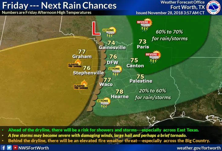
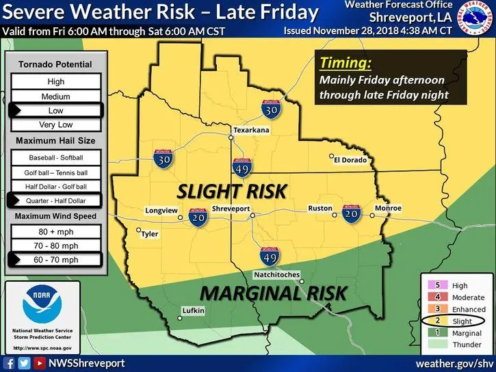
As the line of storms is swept east, they will encounter higher moisture which will continue to feed their development into the late evening and overnight hours across east and northeast Texas. There are still a few mitigating factors to widespread severe storms…one of which will be a limited amount of atmospheric destabilization. Abundant cloud cover and spotty rain and storms are expected across much of the eastern half of the state during the early part of the day on Friday and this will keep surface temps on the cool side which is not conducive to much destabilization. Should we see less coverage of clouds and showers during the day on Friday, the atmosphere will have a better chance at becoming moderately unstable. This of course would result in better chances for seeing more widespread strong to severe storms. Currently forecasted low level wind shear will also be supportive for a few tornadoes depending on the development of severe storms. So while the threat for tornadoes is currently low due to the anticipation of only meager instability, a couple of tornadoes is certainly possible if the atmosphere can become more unstable. Unfortunately, that’s one of those things we really won’t know for sure until the day of as it will be totally dependent on the amount of cloud cover and rainfall during the day and their impacts on surface heating and instability levels. We’ll continue to monitor this and provide updates as the forecast continues to refine over the next 48 hours.


0 Comments