
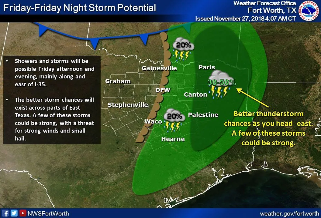
Just a brief update to let you know we are continuing the monitor the latest model data and forecast for the return of strong to severe storms this Friday. The latest model data has pushed the threat for severe storms a bit further east…mainly into far east and northeast Texas and into Louisiana and portions of central and southern Arkansas. Prior runs had shown the possibility of severe storms developing Friday afternoon long and east of the I-35 corridor, but at this time, it appears we’ll have a couple of factors working against that happening. One is the lack of sufficient moisture the further west into the DFW area. We will have some moisture with dewpoints ranging from the upper 50s to low 60s along and east of I-35….but not to the degree that points further east will see by Friday afternoon. Another factor is evidence of a capping inversion across much of north central Texas that will not really erode in time for the arrival of the best mid to upper level forcing. Ongoing showers and a few general thunderstorms during the day across the region and eastward could also slow daytime heating and impact the atmosphere’s ability to destabilize. We could certainly see a few showers and general thunderstorms develop over north central Texas in and around the DFW metroplex…but at this time, the expectation remains that the greatest threat for severe storms including hail, high winds and a few tornadoes will be well east of the metroplex and into parts of Louisiana and central and southern Arkansas after nightfall. At any rate, this will be a potent little upper level system, so we’ll continue to keep our eyes on it and update you again as the forecast refines, so be sure to check back!


0 Comments