
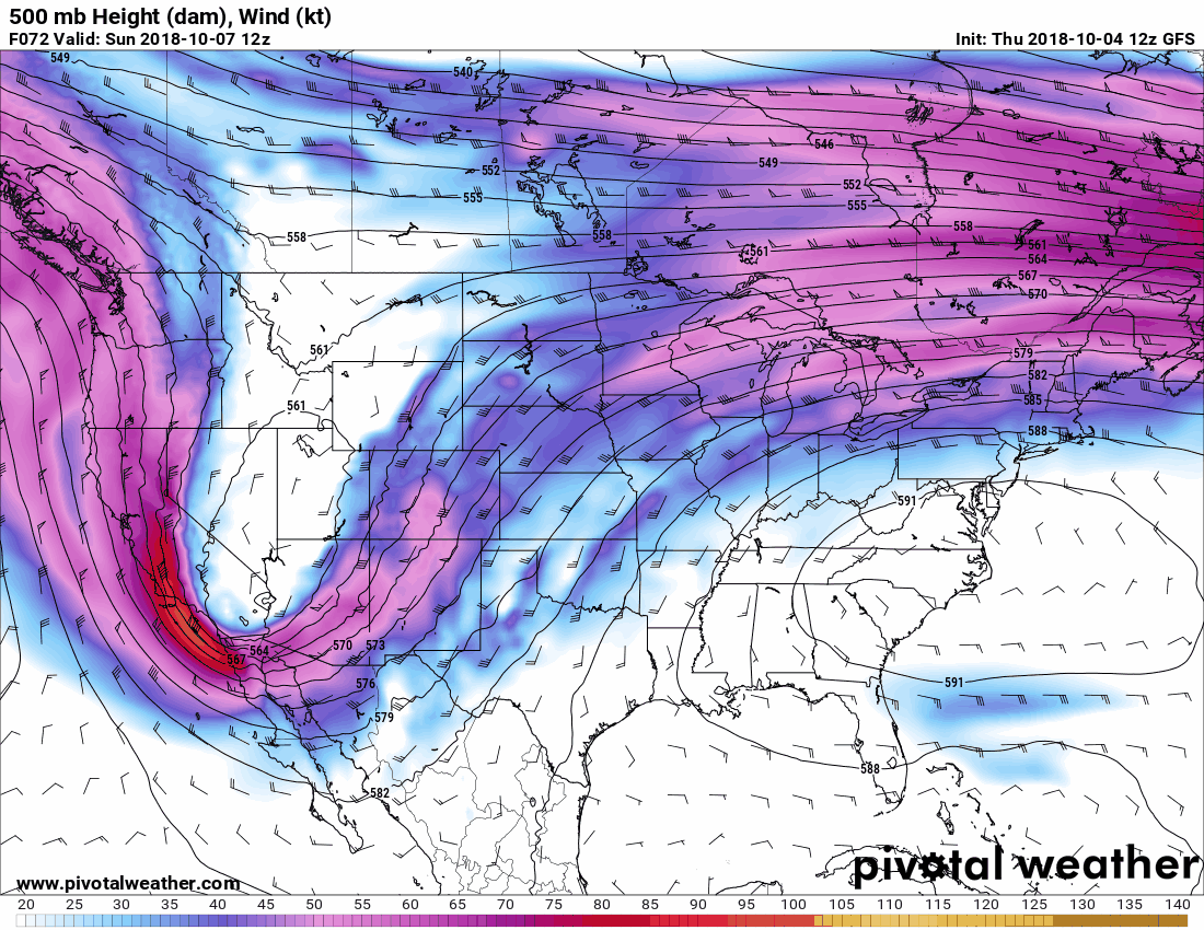
Animation from Sunday through Wednesday showing the slow-progression of a strong upper-level storm system across the Plains.
Our upcoming stretch of active weather can be attributed to a slow-moving upper level low. This system will take about three to four days to actually exit the region. The entrance region of the upper-level jet will provide strong lift – hence showers and thunderstorms. With the slow movement of the system, you can see why we have several days of rain possibilities.
Latest Rain Total Forecast & Flooding Outlook
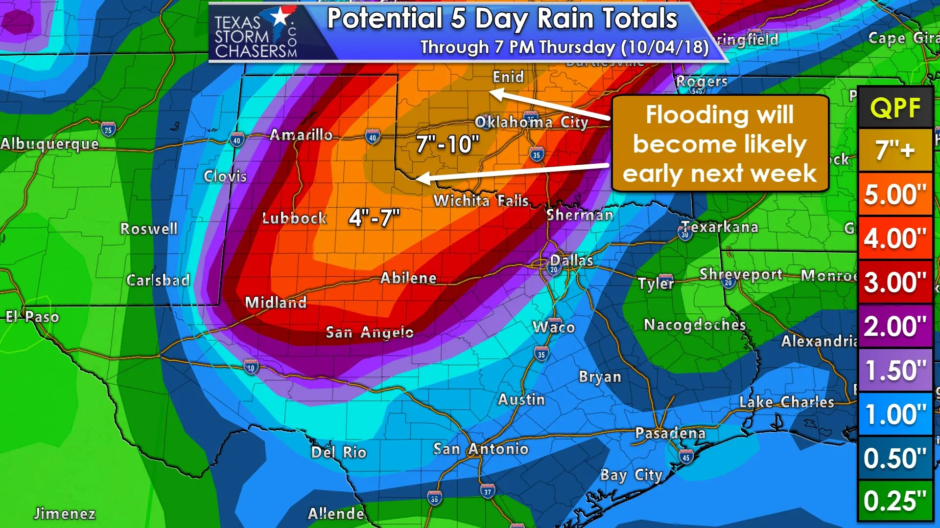
The highest rain totals over the next several days look to be across West-Central Texas north through the eastern Texas Panhandle into western and northern Oklahoma. The Weather Prediction Center (WPC/NOAA) continue to indicate a large area of impressive rain accumulations with 4-6+ inches of rain expected. Even higher totals are expected with localized amounts approaching 10 inches possible in Southwest Oklahoma and Northwest Texas. As you might expect, there will likely be some flooding. The extent of flash flooding will depend on how quickly that rain falls and where, but on a longer-term scale, we’ll likely see significant rises on rivers and lakes. Rain totals are comparatively lower to the south and east, but this forecast will be refined as future data arrives. I wouldn’t be too surprised to see some increase in rain totals closer to Interstate 35, but that would be in the Monday-Wednesday timeframe. Saturday’s OU/TX game will probably be okay.
Severe Thunderstorm Threat
There is a marginal threat of strong to severe thunderstorms for the next several days, including this afternoon. A couple stronger storms impacted West Texas this afternoon with a measured wind gust of 71 MPH near Plains (west/southwest of Lubbock). That threat will continue through the early evening as storms progress to the east/northeast. Widespread severe weather is not expected. The strongest storms may produce wind gusts over 70 MPH and quarter size hail.
Tomorrow looks like it’ll likely be quiet with a strong capping inversion keeping thunderstorm chances low. In yesterday’s blog post I explained that there were two model camps for Sunday. The first showed widespread rain/clouds keeping the threat of severe storms more localized with the second solution showing a more potent setup. Today’s model data has become keener on the first solution, which would result in plenty of showers and storms in association with a cold front from West Texas east into Texoma That’s actually good news as it would lessen the risk of a more widespread/significant severe weather threat. A localized threat may still develop, but details on that will have to wait until we get closer to Sunday. Localized damaging wind gusts and perhaps a brief tornado appear to be the primary threats at this point. A few strong storms may be possible on Monday and Tuesday across Texoma and North Texas.


0 Comments