
Good morning and welcome to the first of October! I don’t know about y’all, but I’m a big fall weather fan. We certainly aren’t experiencing any of that fall weather today, but who knows, we may get a preview by the end of the week.
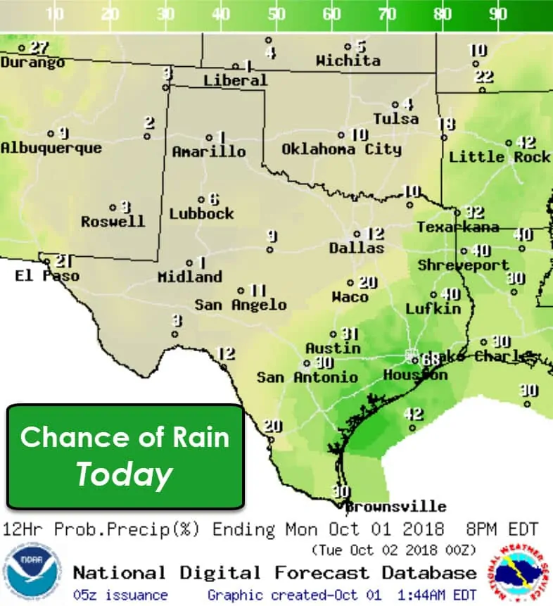
Scattered showers and thunderstorms will likely begin popping up by toward the 11 AM and lunch-time hour across East Texas, Southeast Texas, through the Coastal Plains, across South-Central Texas and all the way down into the Rio Grande Valley. Rain coverage could be fairly high during the afternoon hours.
This activity will be diurnally driven in a moisture-rich, weakly capped environment. Severe thunderstorms and widespread flooding are not expected. As usual, any downpours could cause brief ponding on roadways and in low-water crossings. In terms of flash flooding, the risk is expected to remain very low, limited, and brief – nothing to write home about.
Showers and storms should be dwindling by dinner time, and tonight should be mostly dry across the aforementioned regions. More low clouds, mist, and some fog can be expected as soils remain saturated – including farther north and west. Some rain may impact far West Texas and the Borderland tonight into Tuesday thanks to remnant moisture from ‘Rosa’.
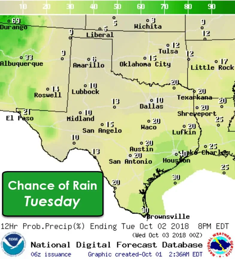
Isolated to widely scattered showers and storms are expected again on Tuesday – this time across the eastern half of Texas. It doesn’t look like we’ll see as many showers/storms as today, but low-end chances could extend north into Texoma and west into the Concho Valley. The highest chance for a downpour will be in Southeast Texas. We do note rain chances in the Borderland and the Trans-Pecos with moisture from ‘Rosa’. The highest rain chances from Rosa will be across Arizona and New Mexico (extending north from there).
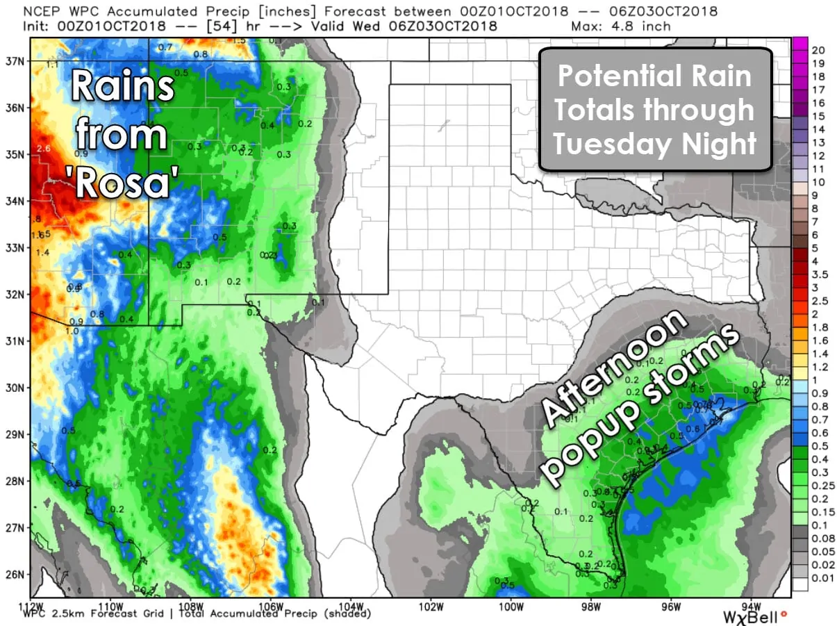
Two-day rain totals could amount up to around an inch across parts of Southeast Texas – especially along the coast. Most locations will receive lighter amounts from a tenth of an inch up toward a quarter of an inch. Not everyone will even see measurable rains. The Borderland could pick up a couple tenths of an inch of rain by Tuesday Night with amounts decreasing farther east into the Trans-Pecos.
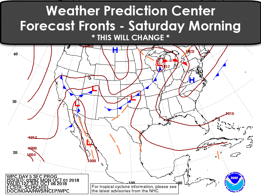
While I hate having to use a rudimentary graphic it does a decent job. A pattern shift by the end of the work-week will allow a cold front to progress south into the Texas Panhandle on Friday into Friday Night. An associated low pressure along with upper-level support should bring rain and thunderstorm chances to western parts of Texas by Friday and Saturday. The front will likely stall this weekend across the Texas Panhandle eastward into Texoma. Rain chances will be highest in the proximity of the front. Hopefully, future data will trend farther south with the front. We’ll just have to wait and see.


0 Comments