
It has been an active last few hours across the Brazos Valley, Southeast Texas, and in Northeast Texas with several tornado warnings. We’ve heard of at least two confirmed tornadoes, but they either didn’t cause damage (which is what we hope for) or we haven’t heard of the reports yet (also possible). Either way, we anticipate several more hours of potential severe weather threat as a cold front continues to push south across the state.
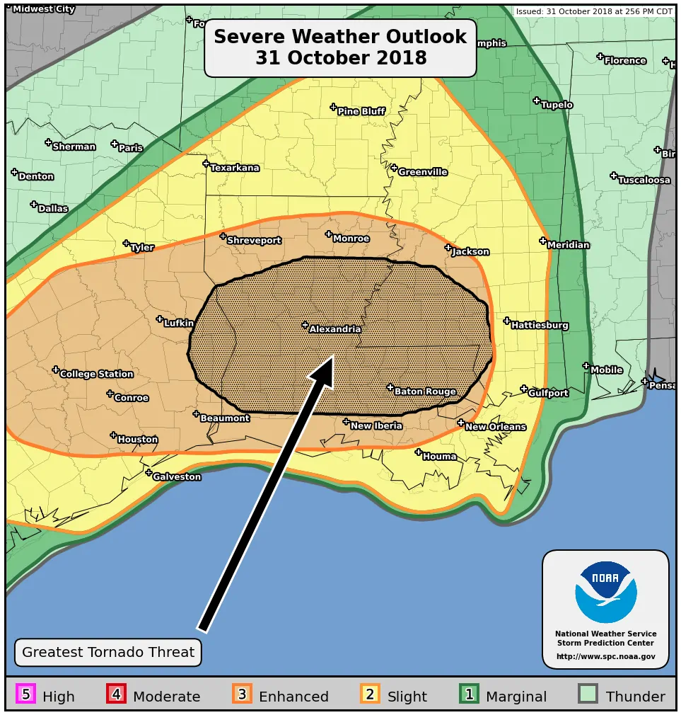
We’ll continue to watch for a few different severe weather hazards over the next several hours. The first is the potential of semi-discrete thunderstorms ahead of the cold front. These storms would be supercelluar in nature are similar to those that have produced tornadoes this afternoon. Low-level wind shear will increase across East Texas in the next two hours. Any discrete storms that do evolve in that environment could have an enhanced risk of producing tornadoes. The tornado threat is expected to ramp up overnight as storms make it into Lousiana and Mississippi after 10 PM.
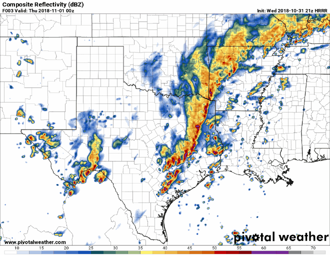
21Z HRRR simulated weather radar from 7 PM this evening to 1 AM Thursday (tonight).
Our second severe weather threat will come from thunderstorms developing along the cold front itself. The strongest storms along the front may produce damaging straight-line winds over 60 MPH, dime to quarter size hail, and a brief tornado or two. The threat of tornadoes will be lower with the squall line than discrete storms ahead of the squall line. Heavy rain is also occurring and a quick inch to inch and a half of rain may cause localized flooding.
Our cold front and squall line should be moving off into the Gulf of Mexico from Southeast Texas around midnight or so. A few storms may impact South Texas as the cold front arrives, but a stronger cap and weaker low-level wind fields may actually keep things quiet. Showers and storms may continue behind the squall line for a few hours, but those are unlikely to produce severe weather. Gusty northwest winds of 30 to 40 MPH are possible behind the front as temperatures drop from the 70s and 80s down into the 40s and 50s.
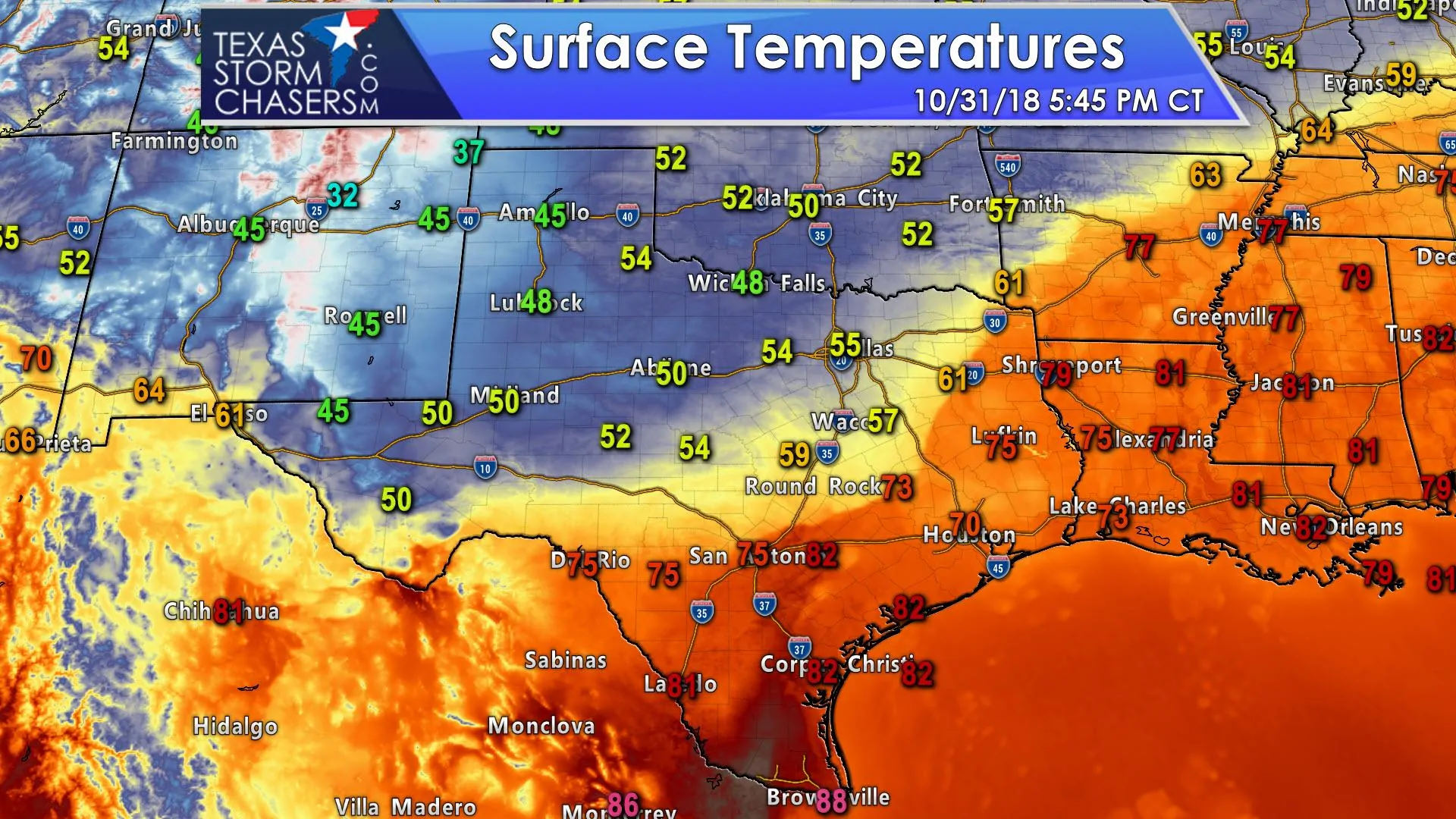
Speaking of the cold front – check out temperatures behind the front! It’ll be a chilly Halloween for the northwest half of Texas with temperatures in the 40s and 50s. Gusty north/northwest winds will make it feel even cooler. Don’t forget to bundle up the kids if you’re heading out.


0 Comments