
Severe weather outlooks from the Storm Prediction Center are based on probabilities of severe weather occurring. These probabilities are converted to a five-level risk scale. A level three risk means there is a thirty percent chance of severe weather occurring within 25 miles of a given point. The standard level two risk means a fifteen percent chance of severe weather occurring within 25 miles of a given point. Finally, a level one risk means a five percent chance of severe weather occurring within twenty-five miles of a given point.
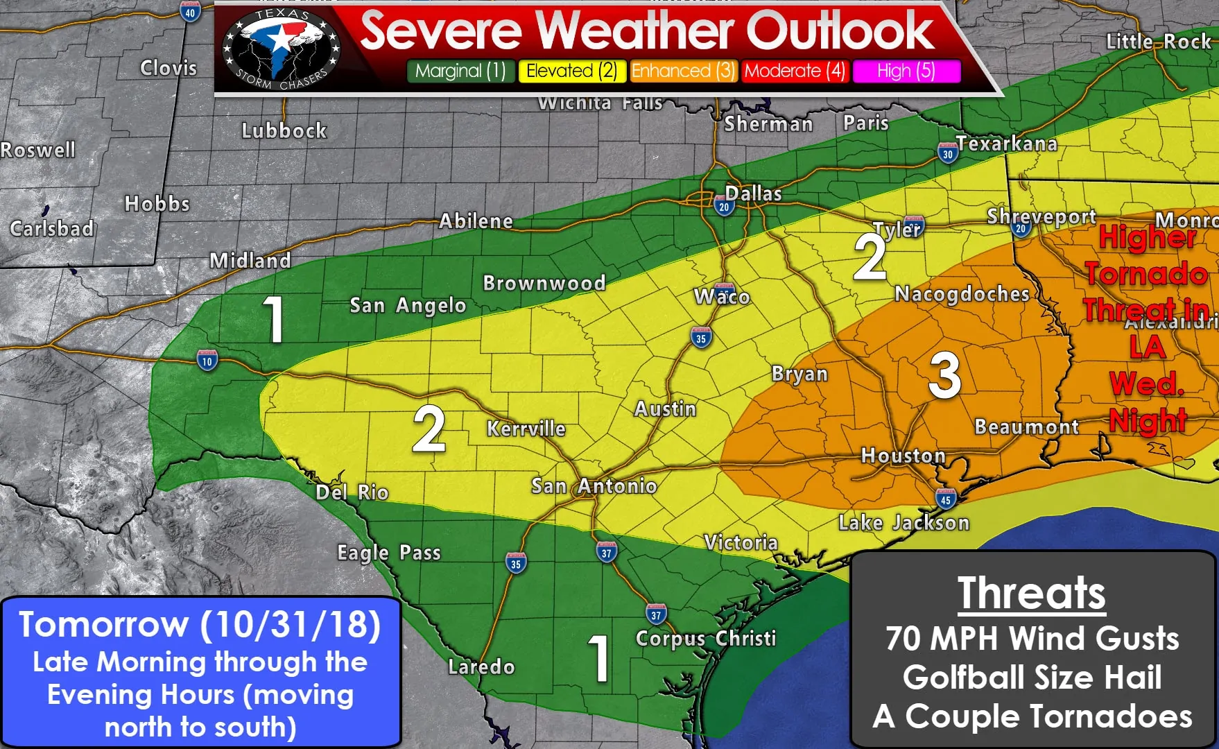
A level three risk of severe weather is in place tomorrow and tomorrow evening across portions of the Brazos Valley, Southeast Texas, and East Texas. A level two risk of severe weather includes the Edwards Plateau, the Hill Country, Central Texas, extending through the Coastal Plains. Finally, we have a level one risk of severe weather across South Texas, the Concho Valley, and a small portion of North Texas. As explained in the first paragraph these outlooks are based on the probability of severe weather occurring within twenty-five miles of a given point.
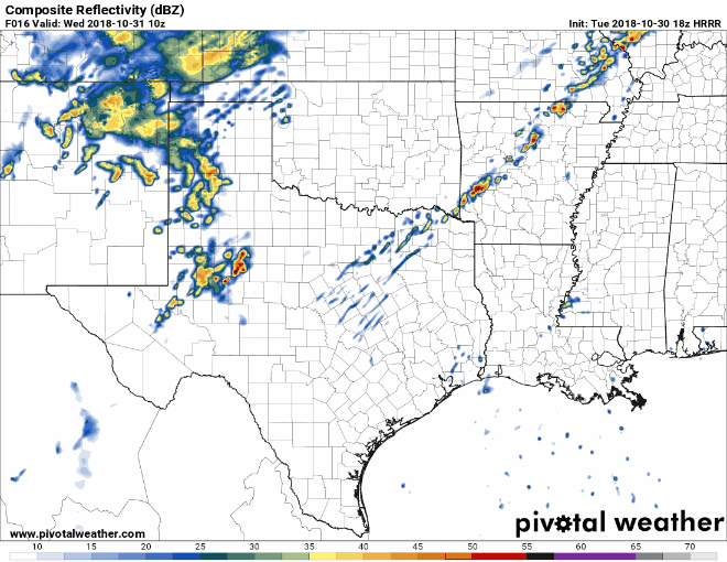
Our primary mechanism for tomorrow’s event will be a southward moving cold front. We anticipate thunderstorms will be most numerous along the leading edge of the cold front and in the wake of the front. I cannot rule out a couple discrete thunderstorms ahead of the front across Southeast Texas. However, the probability of more discrete storms will be tomorrow night in Lousiana. The animation above begins at 5 AM Wednesday and runs every three hours through 11 PM Wednesday. Please understand that this one model probably doesn’t have everything right, so don’t expect the ‘real life’ radar to play out as this one model depicts.
Thunderstorms along the leading edge of the cold front will have the highest probability of producing severe weather tomorrow. The strongest storms in that squall line may produce damaging wind gusts up to 70 MPH. Secondary threats include hail up to the size of golf balls and the possibility of isolated brief tornadoes. Thunderstorms behind the cold front will be elevated above the cool layer near the surface. However, instability in the mid-levels of the atmosphere will still support organized storms. Some of those storms could produce large hail. Finally, a conditional threat does exist for a few discrete thunderstorms ahead of the cold front late tomorrow afternoon and tomorrow evening in Southeast Texas. If this discrete development were to occur we would have to watch for an increased tornado threat. However, that possibility looks like it’ll be more likely in Lousiana tomorrow night.
You can get your local forecast anytime from the National Weather Service along with your local broadcast and digital meteorologists.


0 Comments